
Historic bridges · East Midlands
Crosskeys Bridge
In or near Terrington St Clement.
Crosskeys Bridge — Grade II* listed building-listed bridge in england-east-midlands, United Kingdom.

Pauline E — CC BY-SA 2.0 via Wikimedia Commons licence

Plan your visit
- Typical visit
- 15 min–30 min
- Free entry
- Dog-friendly
About
Crosskeys Bridge is a Grade II* listed building-listed bridge in england-east-midlands, United Kingdom, registered on the National Heritage List for England (NHLE entry 1064536). Listed status protects buildings and structures of special architectural or historic interest. See the linked Wikipedia article for further details.
Photo gallery
Heritage listing
Cross Keys Bridge is a swing bridge that carries the busy single carriageway A17 road which runs from Newark in Nottinghamshire to King's Lynn in Norfolk over the tidal River Nene in Sutton Bridge in the extreme south east of Lincolnshire close to the borders of both Norfolk and Cambridgeshire and is a major landmark on the route particularly for holiday traffic heading into and out of Norfolk during the summer months. It is the only crossing point for both traffic and pedestrians over the river north of the Cambridgeshire town of Wisbech some nine miles to the south of the bridge and provides the only direct link between Lincolnshire and Norfolk. When it was built in 1897, it was the third bridge to cross the Nene in Sutton Bridge.
From the Historic England List Entry under OGL v3.
From the Wikipedia article
Cross Keys Bridge is a swing bridge that carries the busy single carriageway A17 road which runs from Newark in Nottinghamshire to King's Lynn in Norfolk over the tidal River Nene in Sutton Bridge in the extreme south east of Lincolnshire close to the borders of both Norfolk and Cambridgeshire and is a major landmark on the route particularly for holiday traffic heading into and out of Norfolk during the summer months. It is the only crossing point for both traffic and pedestrians over the river north of the Cambridgeshire town of Wisbech some nine miles to the south of the bridge and provides the only direct link between Lincolnshire and Norfolk. When it was built in 1897, it was the third bridge to cross the Nene in Sutton Bridge. It was originally a dual-purpose bridge serving the Midland and Great Northern Joint Railway on what is now the westbound carriageway and the road was on the eastbound side. The railway line was closed in 1965 and the bridge took on its present-day use as a road bridge with one single lane for eastbound traffic and a single lane for westbound traffic. It is a Grade II* listed structure.
Excerpt from Wikipedia under CC BY-SA 4.0. See the source article linked in Sources below.
Background
History
The Borough of Wisbech was the port authority for this part of the River Nene. The emblem of Wisbech is the cross keys of St Peter. The first bridge, opened in 1831, was designed by John Rennie the Younger and Thomas Telford as part of the Wash Embankment works. It was of timber and cast iron construction and opened up rather like London's famous Tower Bridge. However it was found to be awkwardly sited and in 1850, its replacement designed by Robert Stephenson was opened. | type = Act | parliament = Parliament of the United Kingdom | long_title = An Act to regulate the Use by the Lynn and Sutton Bridge Railway Company of the Cross Keys Bridge over the River Nene. | year = 1864 | citation =…
Sourced from Wikipedia under CC BY-SA 4.0.
- Coordinates
- 52.7664, 0.1956
- County
- Lincolnshire
- District
- South Holland
- Parish
- Sutton Bridge
- Postcode
- PE12 9YN
- Parliamentary constituency
- South Holland and The Deepings
Sources
- wikidata: Q5188700 (CC0)
- wikipedia: Cross Keys Bridge (CC BY-SA 4.0)
Other places nearby

Hydraulic Engine House
Historic houses · 0.3 km

Sutton Bridge
Villages · 0.8 km

Little Sutton, Lincolnshire
Historic churches · 3.1 km

Walpole Saint Andrew
Villages · 3.9 km

Walpole Saint Andrew Village Sign
Public art & sculpture · 3.9 km
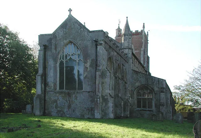
St Andrew's Church, Walpole
Historic churches · 4.0 km

Walpole Cross Keys Village Sign
Public art & sculpture · 4.0 km

Tysdale Manor
Manor houses · 4.5 km

Walpole
Villages · 4.5 km

Sutton Road
Historic bridges · 4.5 km

Walpole Saint Peter
Villages · 4.5 km
Tydd St Mary
Historic churches · 4.5 km
Nearby
📷 3Historic houses · East Midlands
Hydraulic Engine House
Hydraulic Engine House — house in Sutton Bridge, South Holland, England, UK.
📷 5📷 5Historic churches · East Midlands
Little Sutton, Lincolnshire
Little Sutton, Lincolnshire — a church in england-east-midlands, United Kingdom.
📷 5Villages · East Midlands
Walpole Saint Andrew
Walpole Saint Andrew — a village in england east midlands.
📷 3Public art & sculpture · East Midlands
Walpole Saint Andrew Village Sign
Walpole Saint Andrew Village Sign — a public art in england-east-midlands, United Kingdom.
📷 3Historic churches · East Midlands
St Andrew's Church, Walpole
St Andrew's Church, Walpole — Grade I listed church in Walpole, King's Lynn and West Norfolk, Norfolk, England, UK.
Where to eat & stay near Crosskeys Bridge
Places to stay
 📷 5
📷 5Caravan parks · East Midlands
Eau Dyke Bank Caravan Park
Eau Dyke Bank Caravan Park — a caravan park in england east midlands.
 📷 5
📷 5 📷 5
📷 5Campsites · East Midlands
Laurel Park Caravan & Camp Site
Laurel Park Caravan & Camp Site — a campsite in england east midlands.
 📷 3
📷 3Campsites · East Midlands
Hawthorne Farm Wisbech
Hawthorne Farm Wisbech — a campsite in england east midlands.
 📷 5
📷 5Caravan parks · East Midlands
Dougie's Caravan and Camping
Dougie's Caravan and Camping — a caravan park in england east midlands.
 📷 5
📷 5Places to eat & drink
 📷 5
📷 5Historic pubs · East Midlands
Number 18, Formerly The Cock And Magpie Public House
Number 18, Formerly The Cock And Magpie Public House in England East, United Kingdom.
 📷 5
📷 5 📷 5
📷 5 📷 5
📷 5 📷 5
📷 5Historic pubs · East of England
Crown And Mitre Public House
Crown And Mitre Public House in England East, United Kingdom.
 📷 5
📷 5Historic pubs · East of England
Globe Hotel
Globe Hotel in England East, United Kingdom.
More bridges in this region
 📷 5
📷 5Historic bridges · East Midlands
Mill Race Bridge To Market Deeping Mill
Mill Race Bridge To Market Deeping Mill — Grade II listed building-listed bridge in england-london, United Kingdom.
 📷 5
📷 5Historic bridges · East Midlands
Bridge Over West Glen River
Bridge Over West Glen River — Grade II listed building-listed bridge in england-london, United Kingdom.
 📷 5
📷 5Historic bridges · East Midlands
Bridge And Sluices
Bridge And Sluices — Grade II listed building-listed bridge in england-london, United Kingdom.
 📷 5
📷 5Historic bridges · East Midlands
Bridge Over River Gwash
Bridge Over River Gwash — Grade II listed building-listed bridge in england-london, United Kingdom.
Frequently asked questions
- Where is Crosskeys Bridge?
- Crosskeys Bridge is in Lincolnshire, the East Midlands, United Kingdom (postcode PE12 9YN), in the parish of Sutton Bridge.
- What is Crosskeys Bridge?
- Crosskeys Bridge — Grade II* listed building-listed bridge in england-east-midlands, United Kingdom.
- How do I get to Crosskeys Bridge?
- Drivers can use postcode PE12 9YN.
- Is Crosskeys Bridge a listed building?
- Crosskeys Bridge is officially recognised as Grade II* listed building listed.
- Is Crosskeys Bridge free to visit?
- Yes, Crosskeys Bridge is free to enter.
- How do I get to Crosskeys Bridge?
- Drivers can navigate to postcode PE12 9YN. It sits within the South Holland and The Deepings parliamentary constituency.