Country parks · North West England
Tegg's Nose
In or near Rainow.
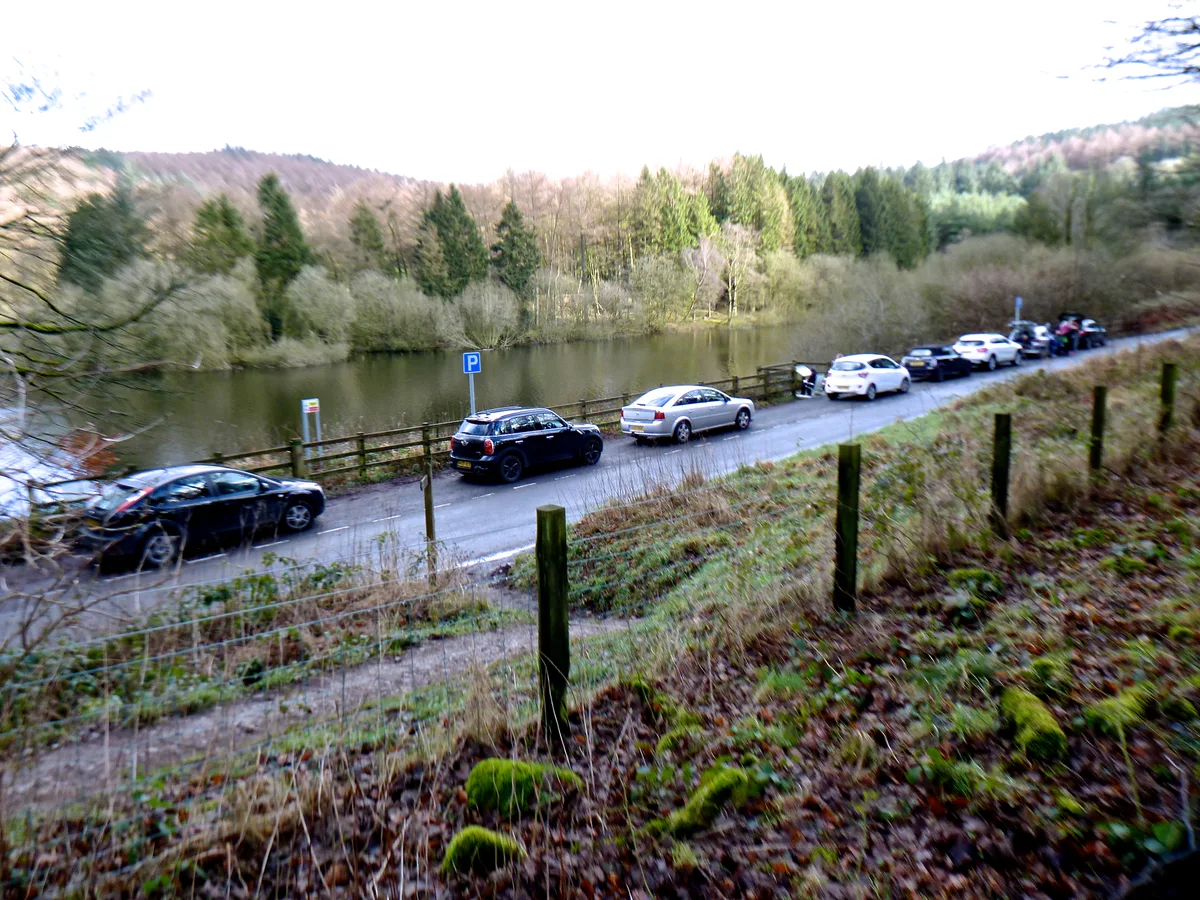
Tegg's Nose is a hill east of Macclesfield in Cheshire, England. It has a short ridge with a high point of 380 metres (1,250 ft) at SJ947725, terminating in a promontory at the southern end. It lies o

David Robinson — CC BY-SA 2.0 via Wikimedia Commons licence
Plan your visit
- Typical visit
- 1.5 h–3 h
- Nearest railway station
- Macclesfield · 2.9 km
- Free entry
- Family-friendly
- Dog-friendly
Getting there & planning your visit
To visit Tegg's Nose, the nearest railway station is Macclesfield, located 2.9 km away. Entry to the park is free.
About
Tegg's Nose is a hill east of Macclesfield in Cheshire, England. It has a short ridge with a high point of 380 metres (1,250 ft) at SJ947725, terminating in a promontory at the southern end. It lies on the western edge of the Peak District, although outside the boundary of the national park. Much of the hill's area falls within the Tegg's Nose Country Park, managed by Cheshire East Council Countryside Management Service; Tegg's Nose is also part of the Environmentally Sensitive Area Scheme. Historically quarried for millstone grit, Tegg's Nose now includes a range of environments including moorland, meadow, farmland, broadleaved woodland and is rich in wildlife. Recreational uses of the area include walking, orienteering, horse riding, fell running, cycling, mountain biking, rock climbing, sledging and fishing.
Photo gallery
From the Wikipedia article
Tegg's Nose is a hill east of Macclesfield in Cheshire, England. It has a short ridge with a high point of 380 metres (1,250 ft) at SJ947725, terminating in a promontory at the southern end. It lies on the western edge of the Peak District, although outside the boundary of the national park. Much of the hill's area falls within the Tegg's Nose Country Park, managed by Cheshire East Council Countryside Management Service; Tegg's Nose is also part of the Environmentally Sensitive Area Scheme. Historically quarried for millstone grit, Tegg's Nose now includes a range of environments including moorland, meadow, farmland, broadleaved woodland and is rich in wildlife. Recreational uses of the area include walking, orienteering, horse riding, fell running, cycling, mountain biking, rock climbing, sledging and fishing.
Excerpt from Wikipedia under CC BY-SA 4.0. See the source article linked in Sources below.
Background
History
Originally called "Tegge's Naze", "Tegge" might have been the name of an early Norse settler or might refer to a sheep ("teg"), while "nose" probably refers to the southern promontory. Blasting was introduced in the 1930s, producing crushed stone for roads and airfields, and during the Second World War, rock for runways was extracted using pneumatic drills. The nearby Ridgegate Reservoir to the east was constructed at a similar time to provide drinking water for Macclesfield, with Trentabank Reservoir following in the 1920s.
Sourced from Wikipedia under CC BY-SA 4.0.
- Coordinates
- 53.2495, -2.0809
- District
- Cheshire East
- Parish
- Macclesfield
- Postcode
- SK11 0AQ
- Parliamentary constituency
- Macclesfield
- Nearest railway station
- Macclesfield — 2.9 km
Sources
- wikipedia: Tegg's Nose (CC BY-SA 4.0)
Other places nearby

Tegg's Nose South Peak
Mountains & hills · 0.1 km

Tegg's Nose
Mountains & hills · 0.1 km

Tegg's Nose Quarry
Historic houses · 0.2 km

Ridgegate Reservoir
Reservoirs & lochs · 1.4 km

Brink
Mountains & hills · 1.5 km

Walter Whiston Bullock
Memorials & monuments · 1.5 km

Grit and Gears II
Mountain bike trails · 1.5 km

Langley
Villages · 1.8 km

Forest Bridleway
Mountain bike trails · 1.9 km

Trentabank Reservoir
Reservoirs & lochs · 2.0 km
Trentabank Reservoir Nature Reserve
Wildlife reserves · 2.0 km

Whitehills
Mountains & hills · 2.1 km
Nearby
📷 5Mountains & hills · West Midlands
Tegg's Nose South Peak
Tegg's Nose South Peak — mountain in england west midlands.
📷 5Mountains & hills · West Midlands
Tegg's Nose
Tegg's Nose — mountain in england west midlands. Elevation: 380 m.
📷 3Historic houses · West Midlands
Tegg's Nose Quarry
Tegg's Nose Quarry — a historic house in england-west-midlands, United Kingdom.
📷 3Reservoirs & lochs · West Midlands
Ridgegate Reservoir
Ridgegate Reservoir — reservoir in Cheshire, England, UK.
📷 5📷 3Memorials & monuments · West Midlands
Walter Whiston Bullock
Walter Whiston Bullock — a memorial in england-west-midlands, United Kingdom.
Where to eat & stay near Tegg's Nose
Places to stay
 📷 5
📷 5Hotels · West Midlands
Hollin House Hotel
Hollin House Hotel — a hotel in england west midlands.
 📷 5
📷 5Caravan parks · West Midlands
Stoneyfold Caravan Park
Stoneyfold Caravan Park — a caravan park in england west midlands.
 📷 5
📷 5Campsites · West Midlands
Gradbach Scout Camp
Gradbach Scout Camp — a campsite in england west midlands.
📷 5📷 5 📷 5
📷 5Caravan parks · Yorkshire & the Humber
Eastwood End Holiday Park
Eastwood End Holiday Park — a caravan park in england west midlands.
Places to eat & drink
 📷 5
📷 5Restaurants · West Midlands
Sutton Hall
Sutton Hall — a restaurant in england west midlands.
 📷 5
📷 5Historic pubs · North West England
Lord Byron Public House
Lord Byron Public House in England North West, United Kingdom.
 📷 5
📷 5Historic pubs · North West England
The Castle, Macclesfield
The Castle, Macclesfield in England North West, United Kingdom.
 📷 5
📷 5Historic pubs · North West England
2 and 4, Market Place
2 and 4, Market Place in England North West, United Kingdom.
 📷 7
📷 7Historic pubs · North West England
George Hotel Public House
George Hotel Public House in England North West, United Kingdom.
 📷 5
📷 5Historic pubs · North West England
Bate Hall Public House
Bate Hall Public House in England North West, United Kingdom.
More places in this region
 Flagship📷 3
Country parks · North West England
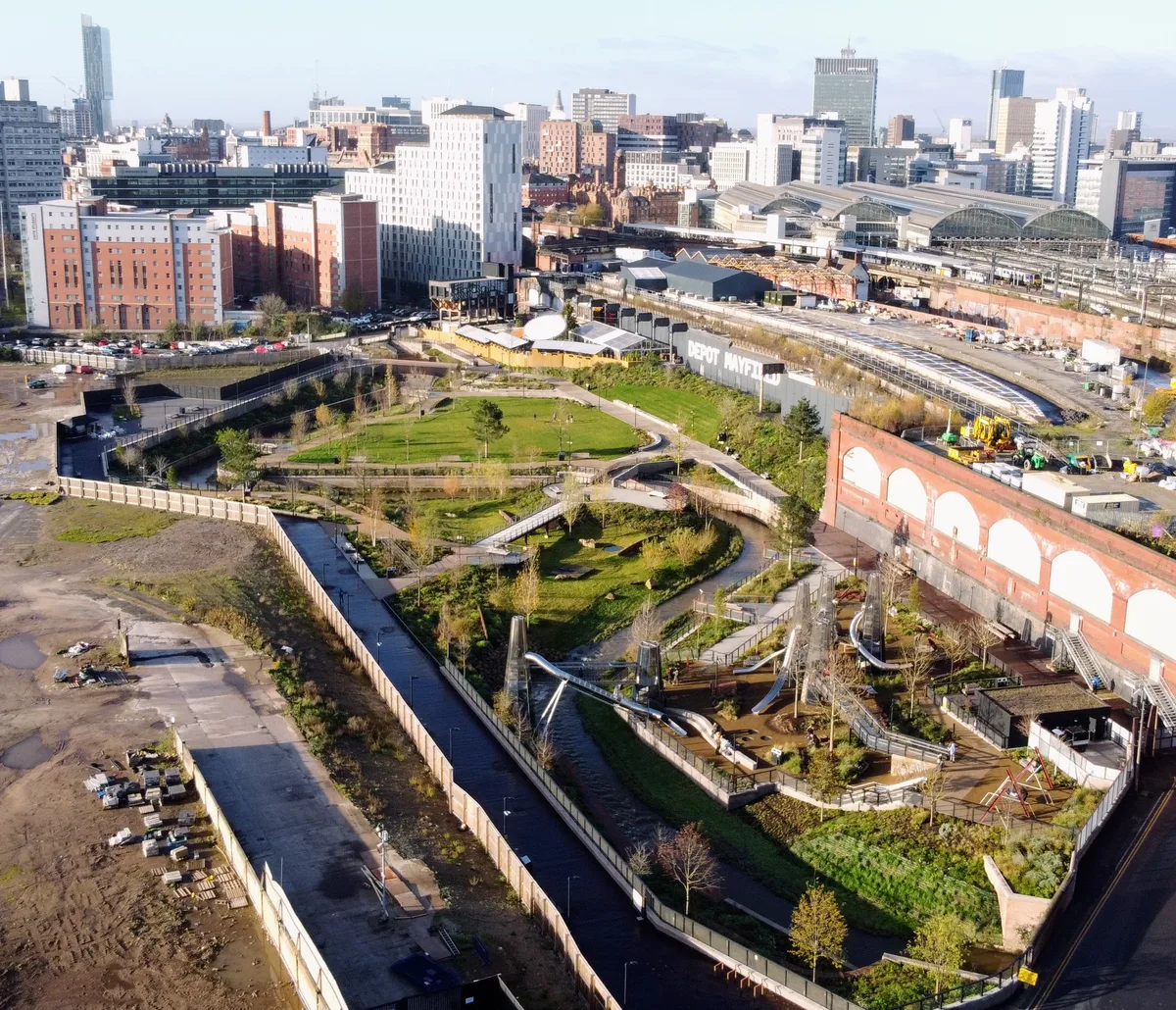
Mayfield Park
Mayfield Park — park in Manchester, United Kingdom.
 📷 3
📷 3Country parks · North West England
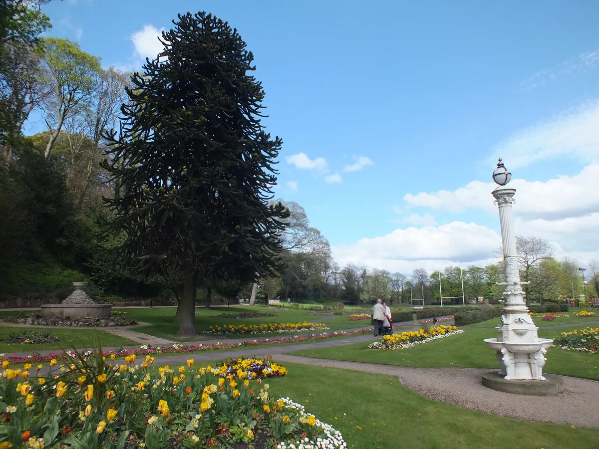
Congleton Park
Congleton Park — park in Congleton, Cheshire, England, UK.
 📷 3
📷 3Country parks · North West England
Didsbury Park
Didsbury Park — park in Didsbury, Manchester, England, UK.
 📷 3
📷 3Country parks · North West England
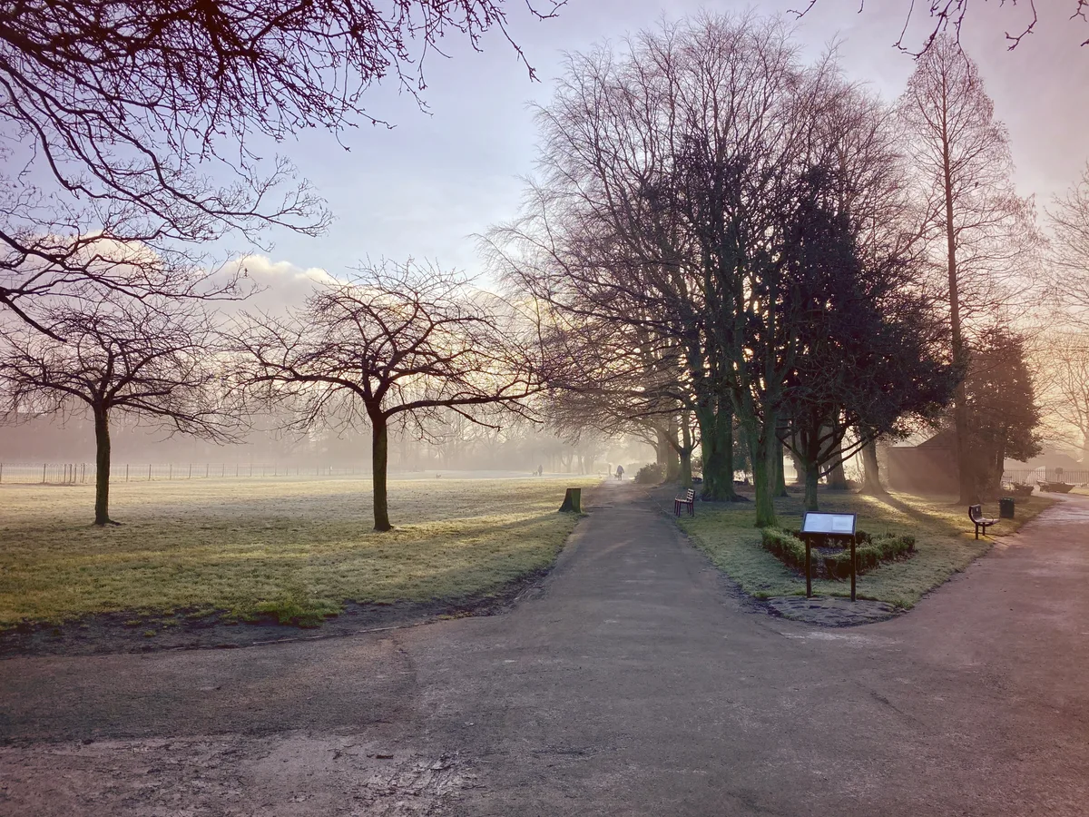
Ladybarn Park
Ladybarn Park — urban park in Withington, Manchester, England, United Kingdom.
Frequently asked questions
- Where is Tegg's Nose?
- Tegg's Nose is in North-West England, United Kingdom (postcode SK11 0AQ), in the parish of Macclesfield.
- What is Tegg's Nose?
- Tegg's Nose is a hill east of Macclesfield in Cheshire, England. It has a short ridge with a high point of 380 metres (1,250 ft) at SJ947725, terminating in a promontory at the southern end. It lies o
- How do I get to Tegg's Nose?
- The nearest railway station is Macclesfield, about 2.9 km away. Drivers can use postcode SK11 0AQ.
- Is Tegg's Nose free to visit?
- Yes, Tegg's Nose is free to enter.
- How do I get to Tegg's Nose?
- The nearest railway station is Macclesfield, about 2.9 km away. Drivers can navigate to postcode SK11 0AQ.