
Mountains & hills · South West England
Swyre Head
In or near Kimmeridge.
Swyre Head — Named summit at 203 m.

Wikimedia Commons contributors — see linked file page for photographer and licence licence

Plan your visit
- Typical visit
- 3 h–8 h
- Best time of year
- Late spring – early autumn (May–Oct)
- Nearest railway station
- Corfe Castle · 4.5 km
- Free entry
- Dog-friendly
Getting there & planning your visit
To visit Swyre Head, the nearest railway station is Corfe Castle, located 4.5 km away. Entry is free, and the postcode for sat-nav is BH20 5PD.
About
Swyre Head is a named summit in the United Kingdom. Wikidata describes it as: "Named summit at 203 m.". Coordinates: 50.6060°, -2.0940°.
Photo gallery
Protected designations
- Site of Special Scientific Interest: South Dorset Coast SSSI
- Area of Outstanding Natural Beauty: Dorset
Designations sourced from Natural England open data under OGL v3.
From the Wikipedia article
Swyre Head is the highest point of the Isle of Purbeck in Dorset, on the south coast of England. The hill Swyre Head lies about 2 kilometres (1 mi) southwest of the village Kingston, about 5 kilometres (3 mi) south of Corfe Castle and 8 kilometres (5 mi) west of Swanage. Although not very high, its relative height is such that it just misses qualification as a Marilyn. The hill consists of Jurassic Formations and is not part of the extensive Southern England Chalk Formation. Swyre Head by Kingston should not be confused with another Dorset hill called Swyre Head, at an elevation of 98 metres (322 ft), on the coast, located at grid reference SY799805, to the west of Durdle Door. The two Swyre Heads are about four hours walk apart from each other; that is, 18 kilometres (11 mi). The hill commands extensive views, including west past the Isle of Portland to Dartmoor, and east to the Isle of Wight, as well as north across the Purbeck Hills to Poole Harbour and the other Purbeck Marilyn, Nine Barrow Down. To the west, the folly of Clavell Tower can also be seen. Set back about 800 metres (half a mile) from the coast, the hill is not on the South West Coast Path, but can be reached easily from the villages of Kingston or Kimmeridge. The hill has a trig point marked as 203 metres on Ordnance Survey maps, but a tumulus, now fully grassed over, forms the highest point, 208 metres (682 ft) above sea level.
Excerpt from Wikipedia under CC BY-SA 4.0. See the source article linked in Sources below.
- Coordinates
- 50.6060, -2.0940
- District
- Dorset
- Parish
- Kimmeridge
- Postcode
- BH20 5PD
- Parliamentary constituency
- South Dorset
- Nearest railway station
- Corfe Castle — 4.5 km
Sources
- osm: n29718234 (ODbL)
- wikipedia: Swyre Head (CC BY-SA 4.0)
- commons: Swyre Head - geograph.org.uk - 86081.jpg (CC BY-SA 4.0)
Other places nearby

Encombe House
Manor houses · 1.0 km

Smedmore House
Historic houses · 1.1 km

Obelisk 500 Metres North East Of Encombe House
Forts · 1.4 km

Smedmore Hill
Mountains & hills · 1.5 km

Freshwater Steps
Waterfalls · 1.5 km
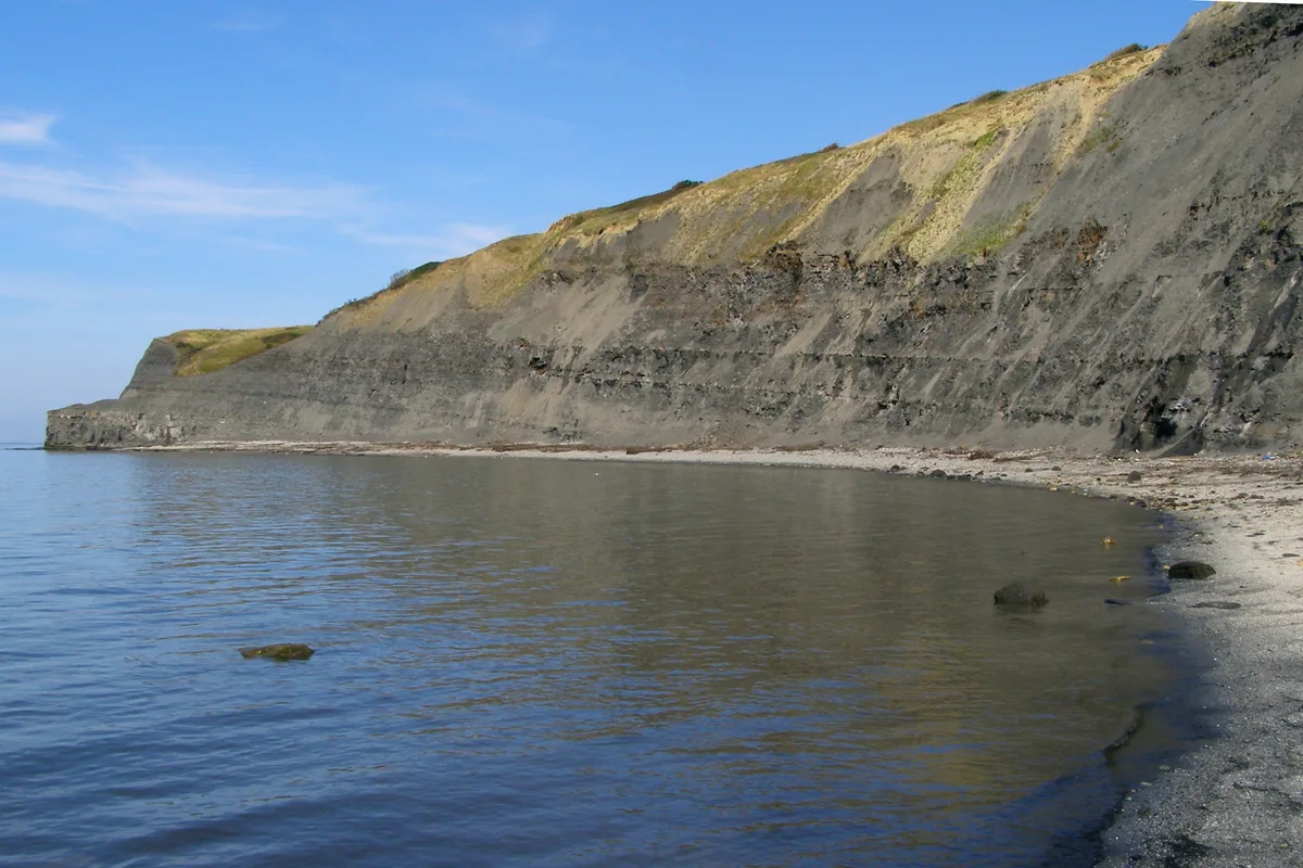
Egmont Bight
Mountains & hills · 1.7 km

Houns-tout Cliff
Mountains & hills · 1.9 km

Kimmeridge
Towns & cities · 2.1 km
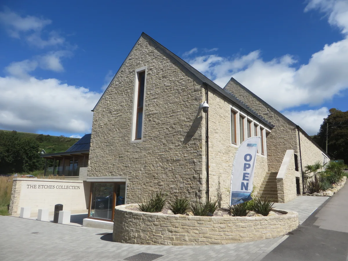
The Etches Collection
Museums · 2.3 km

Museum of Jurassic Marine Life
Museums · 2.3 km
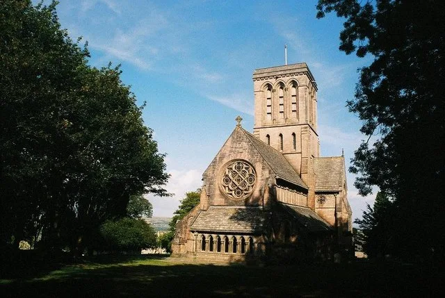
St James's Church, Kingston (Isle of Purbeck)
Historic churches · 2.4 km

Clavell Tower
Follies · 2.5 km
Nearby
📷 5Manor houses · South West England
Encombe House
Encombe House — a manor in england-south-east, United Kingdom.
📷 5Historic houses · South West England
Smedmore House
Smedmore House — a other in england-south-east, United Kingdom.
📷 5Forts · South West England
Obelisk 500 Metres North East Of Encombe House
Obelisk 500 Metres North East Of Encombe House — a martello broad in england-south-east, United Kingdom.
📷 5Mountains & hills · South West England
Smedmore Hill
Smedmore Hill — mountain in england south east. Elevation: 184 m.
📷 5📷 5Where to eat & stay near Swyre Head
Places to stay
 📷 7
📷 7Hotels · South West England
Kingston Country Courtyard
Kingston Country Courtyard — a hotel in england south east.
 📷 5
📷 5Campsites · South West England
Bucknowle Farm campsite
Bucknowle Farm campsite — a campsite in england south east.
 📷 5
📷 5Campsites · South West England
Steaple Leaze Farm Campsite.
Steaple Leaze Farm Campsite. — a campsite in england south east.
 📷 5
📷 5Campsites · South West England
Church Farm Campsite
Church Farm Campsite — a campsite in england south east.
 📷 5
📷 5Campsites · South West England
Corfe Castle Camping and Caravanning Club Site
Corfe Castle Camping and Caravanning Club Site — a campsite in england south east.
 📷 5
📷 5Campsites · South West England
East Creech Farm Campsite
East Creech Farm Campsite — a campsite in england south east.
Places to eat & drink
 📷 7
📷 7Historic pubs · South West England
The Scott Arms, Including Outbuilding On Left
The Scott Arms, Including Outbuilding On Left in England South West, United Kingdom.
 📷 7
📷 7Historic pubs · South West England
Square and Compass
Square and Compass in England South West, United Kingdom.
 ★ Iconic📷 3
Historic pubs · South West England
The Square and Compass
Dorset's served-through-a-hatch family pub since 1907 — fossils, cider, pumpkin festival.
 📷 7
📷 7Historic pubs · South West England
The Old Granary
The Old Granary in England South West, United Kingdom.
 📷 7
📷 7Historic pubs · South West England
Black Bear Hotel
Black Bear Hotel in England South West, United Kingdom.
 📷 7
📷 7Historic pubs · South West England
No 46 (The Pure Drop Public House)
No 46 (The Pure Drop Public House) in England South West, United Kingdom.
More mountains in this region
 📷 5
📷 5 📷 5
📷 5 📷 5
📷 5 📷 5
📷 5Frequently asked questions
- Where is Swyre Head?
- Swyre Head is in South-East England, United Kingdom (postcode BH20 5PD), in the parish of Kimmeridge.
- What is Swyre Head?
- Swyre Head — Named summit at 203 m.
- How do I get to Swyre Head?
- The nearest railway station is Corfe Castle, about 4.5 km away. Drivers can use postcode BH20 5PD.
- Is Swyre Head a protected site?
- Yes — Swyre Head is part of the South Dorset Coast SSSI Site of Special Scientific Interest and the Dorset National Landscape (AONB).
- Is Swyre Head free to visit?
- Yes, Swyre Head is free to enter.
- How do I get to Swyre Head?
- The nearest railway station is Corfe Castle, about 4.5 km away. Drivers can navigate to postcode BH20 5PD.