
Towns & cities · South West England
Kimmeridge
Kimmeridge — village and civil parish in Dorset, England, UK.

Wikimedia Commons contributors — see linked file page for photographer and licence licence

Plan your visit
- Typical visit
- 3 h–6 h
- Nearest railway station
- Norden · 5.0 km
- Paid entry
- Family-friendly
- Dog-friendly
Getting there & planning your visit
Kimmeridge is located in Dorset, with the postcode BH20 5PH. The nearest railway station is Norden, which is 5 km away. Entry to Kimmeridge is free.
About
Kimmeridge is a town, city, village or settlement in the United Kingdom. Recent population estimates put it at around 70 people. Wikidata describes it as: "village and civil parish in Dorset, England, UK". Coordinates: 50.6170°, -2.1180°.
Photo gallery
Official information
The Etches Collection is a modern museum showcasing fossils from the Jurassic marine life of Dorset. Visitors can explore exhibits that highlight the life and death in the Kimmeridgian Seas, dating back 157 million years.
Protected designations
- Site of Special Scientific Interest: South Dorset Coast SSSI
- Area of Outstanding Natural Beauty: Dorset
Designations sourced from Natural England open data under OGL v3.
From the Wikipedia article
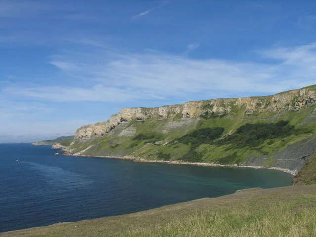
Kimmeridge ( ) is a small village and civil parish on the Isle of Purbeck, a peninsula on the English Channel coast in Dorset, England. It is situated about 4.5 miles (7.2 km) south of Wareham and 7 miles (11 km) west of Swanage. In 2013 the estimated population of the civil parish was 90. Kimmeridge is a coastal parish and its coastline forms part of the Jurassic Coast, a World Heritage Site. The coast is also part of a Site of Special Scientific Interest, and the whole parish is in the Dorset National Landscape area. Kimmeridge is the type locality for Kimmeridge Clay, the geological formation that covers most of the parish. Within the clay are bands of bituminous shale, which in the history of the village have been the focus of several attempts to create an industrial centre. An oil well has operated on the shore of Kimmeridge Bay since 1959. The village is the origin of the name of the Kimmeridgian stage of the Late Jurassic. The roughly semi-circular Kimmeridge Bay is southwest of Kimmeridge village. It is backed by low cliffs of Kimmeridge clay, and beneath the cliffs is a large wave-cut platform and a rocky shore with rock pools and attendant ecology. Kimmeridge Bay is a surfer and diver area.
Excerpt from Wikipedia under CC BY-SA 4.0. See the source article linked in Sources below.
Background
History
In the Iron Age and during the Roman occupation, ornaments and other objects were made from the black bituminous shale—known as blackstone or 'Kimmeridge coal'—that occurs in layers within the Kimmeridge clay that covers most of Kimmeridge parish. Armlets were manufactured from the shale using a lathe, which produced waste in the form of hard black discs; these have been discovered at several sites, and were thought by 18th-century antiquaries to be coins and therefore called 'coal money'. The Romans also used the shale as fuel for boiling sea water to produce salt. the pier which Clavell built for the port became ruinous and was destroyed by a storm in 1745. Clavell had Smedmore House…
Description
In 2014 £2.7 million was secured from the Heritage Lottery Fund for the purpose of creating a new museum in Kimmeridge, on the site of the old village hall. The project cost a total of £5 million and also houses conservation workshops and a new village hall and community space with a capacity for 120 people. The museum, called the Museum of Jurassic Marine Life, displays the Etches Collection of over 2,000 fossils collected over 30 years by village resident Steve Etches. The museum opened in October 2016.
Sourced from Wikipedia under CC BY-SA 4.0.
- Coordinates
- 50.6170, -2.1180
- District
- Dorset
- Parish
- Kimmeridge
- Postcode
- BH20 5PH
- Parliamentary constituency
- South Dorset
- Phone
- 01929 270000
- Population
- 70
- Nearest railway station
- Norden — 5 km
- Opening
- Daily 10am–5pm; closed 24–26 Dec
- Official site
- www.theetchescollection.org
Sources
- wikidata: Q597734 (CC0)
- wikipedia: Kimmeridge (CC BY-SA 4.0)
- commons: Kimmeridge main street - geograph.org.uk - 251704.jpg (CC BY-SA 4.0)
Other places nearby
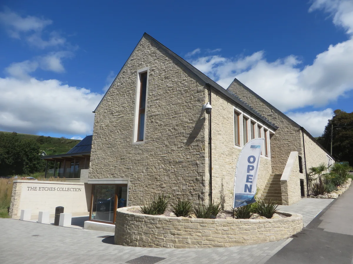
The Etches Collection
Museums · 0.2 km

Museum of Jurassic Marine Life
Museums · 0.2 km

Smedmore Hill
Mountains & hills · 0.7 km

Smedmore House
Historic houses · 1.1 km

Fine Foundation Marine Centre
Natural landmarks · 1.2 km

Hen Cliff
Natural landmarks · 1.3 km

Clavell Tower
Follies · 1.3 km

Old Site of Clavel Tower
Archaeological sites · 1.4 km

Steaple Leaze Farm Campsite.
Campsites · 1.4 km
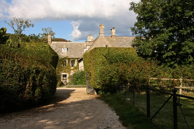
The Manor House
Stately homes · 1.5 km
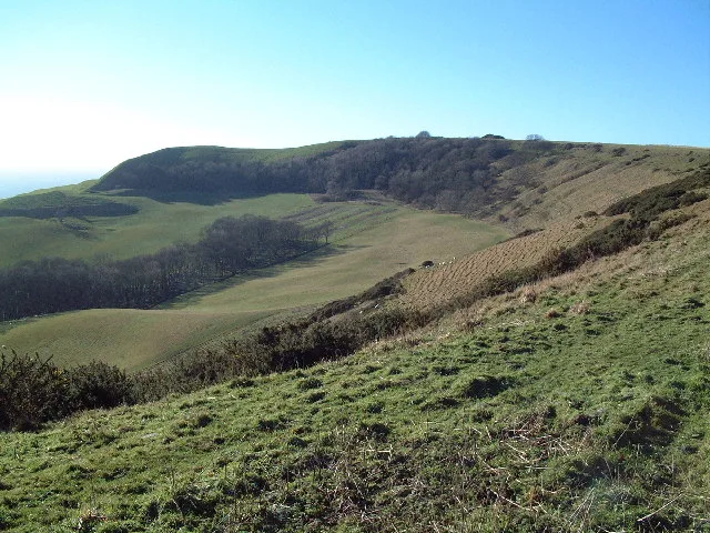
Swyre Head
Mountains & hills · 2.1 km

Ridgeway Hill
Mountains & hills · 2.1 km
Kimmeridge is a small village located in South East England with a population of 70. Our guide lists N attractions within reach.
At a glance
- Population
- 70
- Constituency
- South Dorset
- Top categories near here
Things to see in Kimmeridge
32 attractions within 12 km — showing the 24 most editorially-significant. Full guide: things to do in Kimmeridge →
 📷 5📷 5
 📷 5
📷 5Memorials & monuments · South West England
Grange Arch
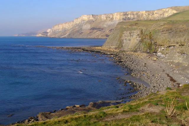
Grange Arch is a memorial in the United Kingdom.
 📷 5
📷 5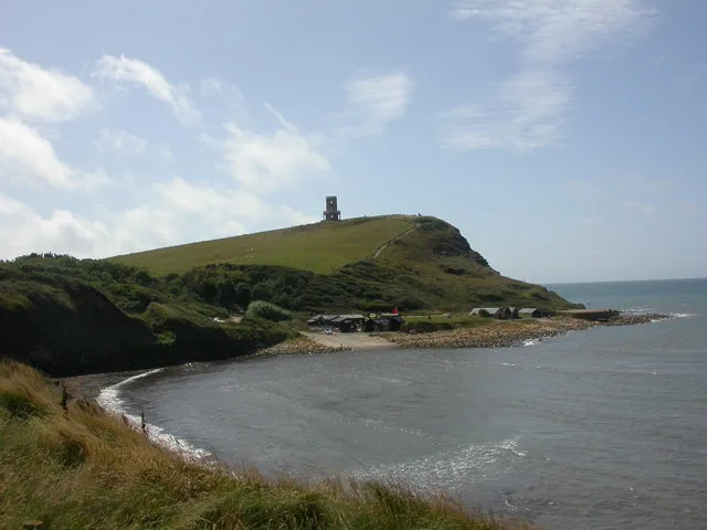 📷 3
📷 3Mountains & hills · South West England
Kimmeridge Bay
Kimmeridge Bay — bay in Dorset, England, UK.
 📷 5
📷 5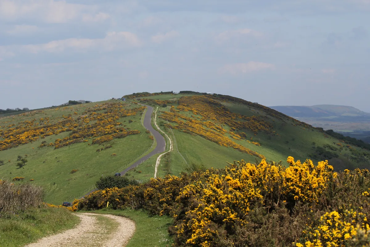 📷 5📷 5📷 5
Museums · South West England
The Etches Collection
The Etches Collection — museum in Dorset, United Kingdom.
📷 5Stately homes · South West England
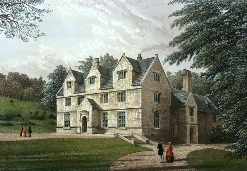
The Manor House
The Manor House — manor house in Steeple, Dorset, England, UK.
 📷 5
📷 5Stately homes · South West England
Tyneham House
Tyneham House — house in Tyneham, Dorset, England, UK.
📷 5Natural landmarks · South West England
Fine Foundation Marine Centre
Fine Foundation Marine Centre — a other in england-south-east, United Kingdom.
📷 5Historic houses · South West England
Smedmore House
Smedmore House — a other in england-south-east, United Kingdom.
📷 5Archaeological sites · South West England
Old Site of Clavel Tower
Old Site of Clavel Tower — a archaeological in england-south-east, United Kingdom.
 📷 5
📷 5Historic houses · South West England
Gwyle Cottages
Gwyle Cottages — a historic house in england-south-east, United Kingdom.
 📷 5
📷 5Historic houses · South West England
Tyneham Post Office
Tyneham Post Office — a historic house in england-south-east, United Kingdom.
 📷 5
📷 5Historic houses · South West England
Rectory
Rectory — a historic house in england-south-east, United Kingdom.
 📷 5
📷 5Historic houses · South West England
Laundry Cottages
Laundry Cottages — a historic house in england-south-east, United Kingdom.
📷 5Museums · South West England
Tyneham
Tyneham — a museum in england-south-east, United Kingdom.
 📷 5
📷 5Museums · South West England
Tyneham School
Tyneham School — a museum in england-south-east, United Kingdom.
📷 5Museums · South West England
Museum of Jurassic Marine Life
Museum of Jurassic Marine Life — a museum in england-south-east, United Kingdom.
📷 5Campsites · South West England
Steaple Leaze Farm Campsite.
Steaple Leaze Farm Campsite. — a campsite in england south east.
 📷 5
📷 5Vineyards · South West England
Tyneham
Tyneham — a UK vineyard in england south east, producing English or Welsh wine from cool-climate grape varieties.
📷 5Mountains & hills · South West England
Ridgeway Hill
Ridgeway Hill — a hill or mountain in england south east.
Nearby
📷 5Museums · South West England
The Etches Collection
The Etches Collection — museum in Dorset, United Kingdom.
📷 5Museums · South West England
Museum of Jurassic Marine Life
Museum of Jurassic Marine Life — a museum in england-south-east, United Kingdom.
📷 5Mountains & hills · South West England
Smedmore Hill
Smedmore Hill — mountain in england south east. Elevation: 184 m.
📷 5Historic houses · South West England
Smedmore House
Smedmore House — a other in england-south-east, United Kingdom.
📷 5Natural landmarks · South West England
Fine Foundation Marine Centre
Fine Foundation Marine Centre — a other in england-south-east, United Kingdom.
📷 5Where to eat & stay near Kimmeridge
Places to stay
📷 5Campsites · South West England
Steaple Leaze Farm Campsite.
Steaple Leaze Farm Campsite. — a campsite in england south east.
 📷 5
📷 5Campsites · South West England
East Creech Farm Campsite
East Creech Farm Campsite — a campsite in england south east.
 📷 5
📷 5Campsites · South West England
Church Farm Campsite
Church Farm Campsite — a campsite in england south east.
 📷 5
📷 5Campsites · South West England
Bucknowle Farm campsite
Bucknowle Farm campsite — a campsite in england south east.
 📷 5
📷 5Campsites · South West England
Corfe Castle Camping and Caravanning Club Site
Corfe Castle Camping and Caravanning Club Site — a campsite in england south east.
 📷 5
📷 5Campsites · South West England
Norden Farm
Norden Farm — a campsite in england south east.
Places to eat & drink
 📷 7
📷 7Historic pubs · South West England
The Scott Arms, Including Outbuilding On Left
The Scott Arms, Including Outbuilding On Left in England South West, United Kingdom.
 📷 7
📷 7Historic pubs · South West England
Square and Compass
Square and Compass in England South West, United Kingdom.
 ★ Iconic📷 3
Historic pubs · South West England
The Square and Compass
Dorset's served-through-a-hatch family pub since 1907 — fossils, cider, pumpkin festival.
 📷 7
📷 7Historic pubs · South West England
The Old Granary
The Old Granary in England South West, United Kingdom.
 📷 7
📷 7Historic pubs · South West England
Black Bear Hotel
Black Bear Hotel in England South West, United Kingdom.
 📷 7
📷 7Historic pubs · South West England
No 46 (The Pure Drop Public House)
No 46 (The Pure Drop Public House) in England South West, United Kingdom.
More towns in this region
 Flagship📷 10
Towns & cities · South West England
Shoscombe
Shoscombe — village and civil parish in Somerset, UK.
 Flagship📷 10
Towns & cities · South West England
Tarrant Keyneston
Tarrant Keyneston — village and civil parish in Dorset, United Kingdom.
 📷 5
📷 5 📷 5
📷 5Towns & cities · South West England
Arne
Arne — village in Purbeck, Dorset, United Kingdom.
Frequently asked questions
- Where is Kimmeridge?
- Kimmeridge is in South-East England, United Kingdom (postcode BH20 5PH), in the parish of Kimmeridge.
- What is Kimmeridge?
- Kimmeridge — village and civil parish in Dorset, England, UK.
- How do I get to Kimmeridge?
- The nearest railway station is Norden, about 5.0 km away. Drivers can use postcode BH20 5PH.
- Is Kimmeridge a protected site?
- Yes — Kimmeridge is part of the South Dorset Coast SSSI Site of Special Scientific Interest and the Dorset National Landscape (AONB).
- Is Kimmeridge free to visit?
- Yes, Kimmeridge is free to enter.
- How do I get to Kimmeridge?
- The nearest railway station is Norden, about 5.0 km away. Drivers can navigate to postcode BH20 5PH.