
Chapels · North West England
St Catherine's Chapel, Lydiate
In or near Haskayne.
St Catherine's Chapel, Lydiate — ruined chapel in Merseyside.

Wikimedia Commons contributors — see linked file page for photographer and licence licence

Plan your visit
- Typical visit
- 20 min–45 min
- Nearest railway station
- Maghull North · 3.5 km
- Free entry
Getting there & planning your visit
To visit St Catherine's Chapel in Lydiate, the nearest railway station is Maghull North, located 3.5 km away. The postcode for sat-nav is L31 4HD. Entry to the chapel is free.
About
St Catherine's Chapel, Lydiate is a chapel in the United Kingdom. Heritage designation: scheduled monument. Wikidata describes it as: "ruined chapel in Merseyside". Coordinates: 53.5368°, -2.9612°.
Photo gallery
Protected designations
- Ramsar wetland: Ribble & Alt Estuaries
Designations sourced from Natural England open data under OGL v3.
From the Wikipedia article
St Catherine's Chapel, known locally as Lydiate Abbey, is a ruined chapel located in Lydiate, Merseyside, England. The Chapel is situated on the A5147, adjacent to the Scotch Piper Inn. It is a Grade II* listed building, and a Scheduled Monument. Although the precise years of construction are unknown, it is likely that the chapel was built in the late 15th or early 16th century by the Ireland family. It was primarily used for private worship, and stopped being used during the 16th century dissolution of the monasteries. Since then, it—along with the nearby Lydiate Hall—have gradually fallen into ruin, with only the outer structure remaining. The chapel grounds are now used to host local community events.
Excerpt from Wikipedia under CC BY-SA 4.0. See the source article linked in Sources below.
Background
History
The chapel was built some time in the late 15th or early 16th century, primarily for the private worship of the Ireland family, who held the Lydiate lordship at the time. The parish church was located in Halsall, over 3 mi away from Lydiate Hall, making a local chapel considerably more convenient. Although no definitive records are available, it is believed that construction of the chapel was initiated by Laurence Ireland, who named it in honour of his wife, Catherine Blundell. Catherine's initials ("C. I.", following her marriage), along with those of Laurence, were engraved on the church. Although Laurence may have started the chapel's construction, it is possible that it was only…
Architecture
The chapel is built of sandstone in a perpendicular style, with buttresses and battlements on the north and south walls. The building had no windows on the northern wall—the reason is unknown—though it did have exterior doors on both north and south walls, with the southern door covered by a porch. The square tower had three stories. The east window was stained glass, but the colour had been lost from glass remains found nearby, so the pattern or image is unknown.
Sourced from Wikipedia under CC BY-SA 4.0.
- Coordinates
- 53.5368, -2.9612
- District
- Sefton
- Parish
- Lydiate
- Postcode
- L31 4HD
- Parliamentary constituency
- Sefton Central
- Nearest railway station
- Maghull North — 3.5 km
Sources
- wikidata: Q7592749 (CC0)
- wikipedia: St Catherine's Chapel, Lydiate (CC BY-SA 4.0)
- commons: Lydiate Abbey 1a.jpg (CC BY-SA 4.0)
Other places nearby

Lydiate Hall
Historic houses · 0.3 km

Lydiate Hill Bridge
Historic bridges · 0.6 km

Lydiate
Villages · 0.8 km
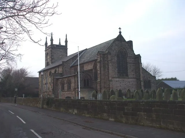
St Thomas' Church, Lydiate
Historic churches · 0.8 km

Lydiate Bridge
Historic bridges · 0.9 km

Farmer Ted's Farm Park
Theme parks · 1.7 km

Maghull
Museums · 2.4 km
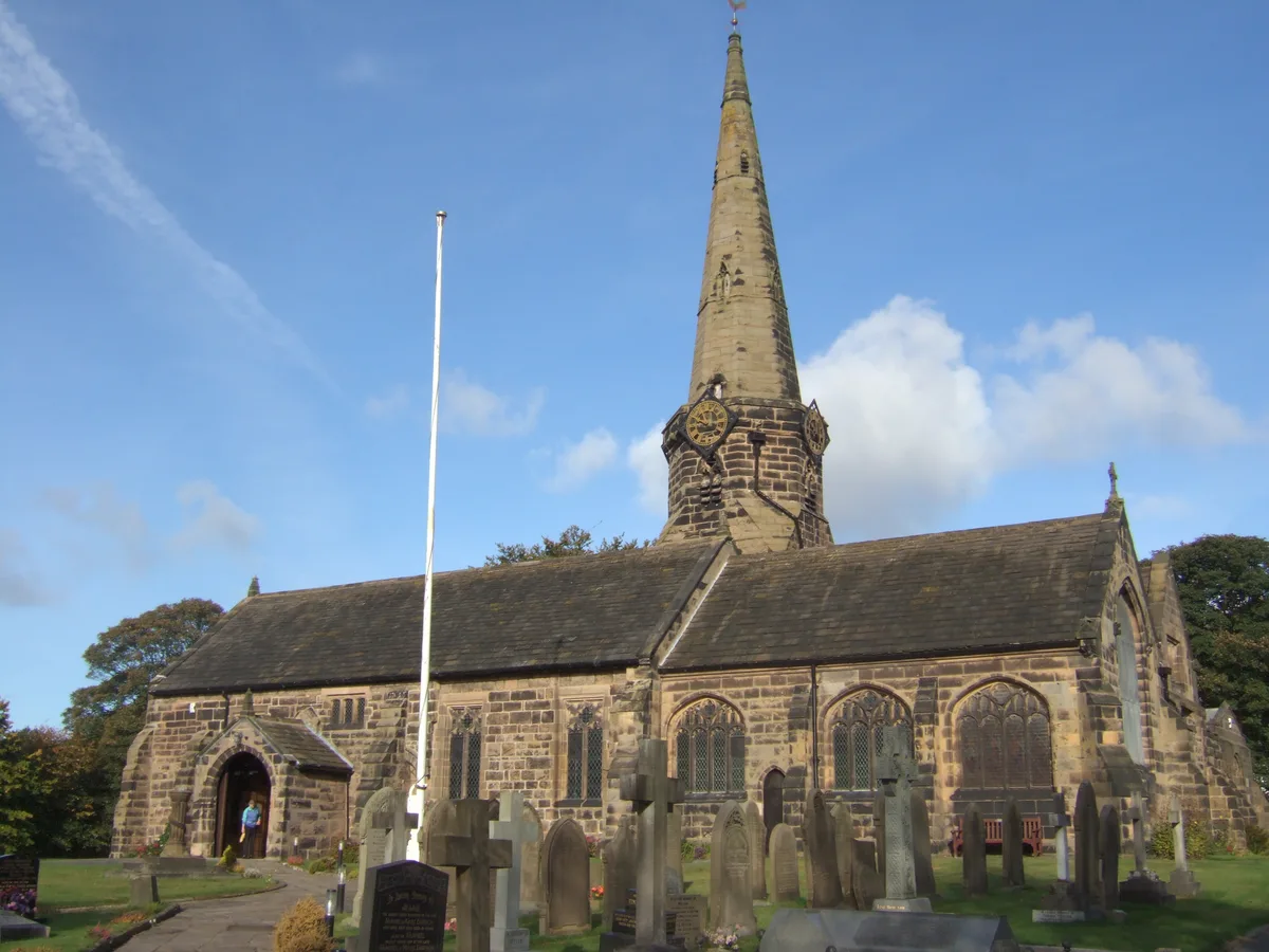
St Michael's Church, Aughton
Historic churches · 2.8 km

Astra Entertainment Centre
Theatres · 2.8 km

Hidden Corner Camp Site
Campsites · 2.9 km

Haskayne
Towns & cities · 3.2 km

Maghull Chapel
Chapels · 3.2 km
Nearby
📷 5Historic houses · North West England
Lydiate Hall
Lydiate Hall — building in Lydiate, Sefton, Merseyside, England, UK.
📷 3Historic bridges · North West England
Lydiate Hill Bridge
Lydiate Hill Bridge — Grade II listed building-listed bridge in england-north-west, United Kingdom.
📷 5📷 5Historic churches · North West England
St Thomas' Church, Lydiate
St Thomas' Church, Lydiate — grade II listed church in Lydiate, Sefton, Merseyside, England, UK.
📷 3Historic bridges · North West England
Lydiate Bridge
Lydiate Bridge — Grade II listed building-listed bridge in england-north-west, United Kingdom.
📷 3Theme parks · North West England
Farmer Ted's Farm Park
Farmer Ted's Farm Park — a theme park in North West England, United Kingdom.
Where to eat & stay near St Catherine's Chapel, Lydiate
Places to stay
📷 5Campsites · North West England
Hidden Corner Camp Site
Hidden Corner Camp Site — a campsite in england north west.
 📷 5
📷 5Caravan parks · North West England
Tristram's Farmhouse
Tristram's Farmhouse — a caravan park in england north west.
 📷 5
📷 5Caravan parks · North West England
Plex Moss Caravan Park
Plex Moss Caravan Park — a caravan park in england north west.
 📷 5
📷 5 📷 5
📷 5Caravan parks · North West England
Willowbank Caravan Park
Willowbank Caravan Park — a caravan park in england north west.
 📷 5
📷 5Caravan parks · North West England
Abbey Farm Holiday Park
Abbey Farm Holiday Park — a caravan park in england north west.
Places to eat & drink
 📷 7
📷 7Historic pubs · North West England
Buck I' Th' Vine Inn
Buck I' Th' Vine Inn in England North West, United Kingdom.
 📷 7
📷 7Historic pubs · North West England
The Windmill Public House
The Windmill Public House in England North West, United Kingdom.
 📷 5
📷 5Historic pubs · North West England
The Hare And Hounds Public House
The Hare And Hounds Public House in Wales North, United Kingdom.
 📷 5
📷 5Historic pubs · North West England
Former bank and residence
Former bank and residence in Wales North, United Kingdom.
 📷 5
📷 5Historic pubs · North West England
The Old Toby Public House
The Old Toby Public House in England North West, United Kingdom.
 📷 5
📷 5Historic pubs · North West England
Throstles Nest Hotel, Scotland Road
Throstles Nest Hotel, Scotland Road in Wales North, United Kingdom.
More places in this region
 📷 3
📷 3Chapels · North West England
Central Synagogue
Central Synagogue — former synagogue in Manchester, Greater Manchester, England, UK.
 📷 3
📷 3Chapels · North West England
Chapel Street And Hope United Reformed Church
Chapel Street And Hope United Reformed Church — chapel in Salford, Greater Manchester, England, UK.
 📷 3
📷 3Chapels · North West England
Church of England Chapel In Manchester Southern Cemetery
Church of England Chapel In Manchester Southern Cemetery — chapel in Manchester, Greater Manchester, England, UK.
 📷 3
📷 3Chapels · North West England
Hale Chapel
Hale Chapel — building in Greater Manchester, England, UK.
Frequently asked questions
- Where is St Catherine's Chapel, Lydiate?
- St Catherine's Chapel, Lydiate is in North-West England, United Kingdom (postcode L31 4HD), in the parish of Lydiate.
- What is St Catherine's Chapel, Lydiate?
- St Catherine's Chapel, Lydiate — ruined chapel in Merseyside.
- How do I get to St Catherine's Chapel, Lydiate?
- The nearest railway station is Maghull North, about 3.5 km away. The nearest town is Haskayne. Drivers can use postcode L31 4HD.
- Is St Catherine's Chapel, Lydiate a listed building?
- St Catherine's Chapel, Lydiate is officially recognised as scheduled monument listed.
- Is St Catherine's Chapel, Lydiate a protected site?
- Yes — St Catherine's Chapel, Lydiate is part of the Ribble & Alt Estuaries Ramsar wetland.
- Is St Catherine's Chapel, Lydiate free to visit?
- Yes, St Catherine's Chapel, Lydiate is free to enter.
- How do I get to St Catherine's Chapel, Lydiate?
- The nearest railway station is Maghull North, about 3.5 km away. Drivers can navigate to postcode L31 4HD.