
Memorials & monuments · South East England
Sea Mark
In or near Lake.
Sea Mark is a memorial in the United Kingdom.

Ian Capper — CC BY-SA 2.0 via Wikimedia Commons licence

Plan your visit
- Typical visit
- 15 min–45 min
- Nearest railway station
- Ashey · 1.3 km
- Free entry
- Dog-friendly
Getting there & planning your visit
To visit Sea Mark, the nearest railway station is Ashey, located 1.3 km away. The postcode for sat-nav is PO33 4AX, and entry is free.
About
Sea Mark is a public memorial in South-East England, recording local sacrifice and named in the parish register of war and civic monuments. The site is within the Isle Of Wight National Landscape (AONB), and is a Ramsar wetland of international importance. It sits within the Isle of Wight East parliamentary constituency. The nearest railway station is Ashey, about 1.3 km away. Postcode area PO33.
Photo gallery
Protected designations
- Area of Outstanding Natural Beauty: Isle Of Wight
- Ramsar wetland: Solent & Southampton Water
Designations sourced from Natural England open data under OGL v3.
From the Wikipedia article
A sea mark, also seamark and navigation mark, is a form of aid to navigation and pilotage that identifies the approximate position of a maritime channel, hazard, or administrative area to allow boats, ships, and seaplanes to navigate safely. There are three types of sea mark: beacons fixed to the seabed or on shore, towers (sometimes rock cairns) built on the shore or on a submerged rock/object (especially in calmer waters), and buoys (consisting of a floating object that is usually anchored to a specific location on the bottom of the sea or to a submerged object). Sea marks are used to indicate channels, dangerous rocks or shoals, mooring positions, areas of speed limits, traffic separation schemes, submerged shipwrecks, and for a variety of other navigational purposes. Some are only intended to be visible in daylight (daymarks), others have some combination of lights, reflectors, fog bells, foghorns, whistles and radar reflectors to make them usable at night and in conditions of reduced visibility. Marks are shown on nautical charts, using symbols that indicate their colour, shape and light characteristic, and are usually identified by name or number. In a wider sense the phrase "sea mark" is often understood to include all types of landmarks, structures and devices that can be used to provide warning and guiding signs to mariners. Thus a sea mark can be and often is located on dry land. Examples of land-based sea marks are various signal lights and leading marks. The latter are mainly used to indicate the centerline of a fairway in narrow passages. Sea marks may also on occasion be used to help mark the boundaries of defensive sea minefields, or the safe lanes through same, especially during wartime.
Excerpt from Wikipedia under CC BY-SA 4.0. See the source article linked in Sources below.
- Coordinates
- 50.6849, -1.1881
- District
- Isle of Wight
- Parish
- Havenstreet and Ashey
- Postcode
- PO33 4AX
- Parliamentary constituency
- Isle of Wight East
- Nearest railway station
- Ashey — 1.3 km
Sources
Other places nearby

Eaglehead & Bloodstone Copses Nature Reserve
Forests & woodlands · 0.8 km

Brading Down
Mountains & hills · 1.2 km

Medieval settlement 100m south east and 350m north east of East Ashey Manor Farm
Vineyards · 1.3 km

The Garlic Farm
Farms (open to visitors) · 2.0 km

Nunwell House and Garden
Gardens · 2.0 km

Alverstone Bridge
Historic bridges · 2.1 km
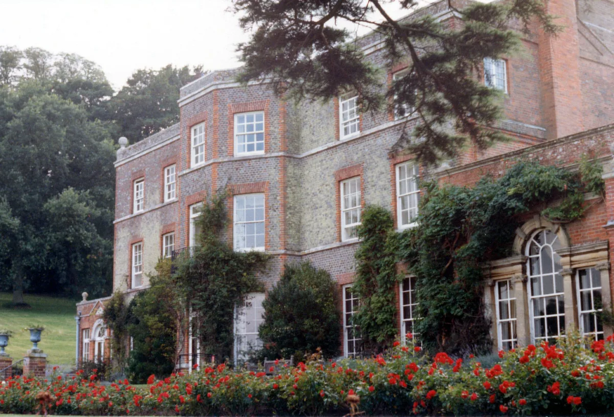
Nunwell House
Stately homes · 2.1 km

Alverstone Ponds
Caravan parks · 2.2 km
.jpg?width=1200)
Alverstone Mead
Wildlife reserves · 2.2 km

Newchurch War Memorial
Memorials & monuments · 2.2 km

Spicers Bridge
Historic bridges · 2.3 km
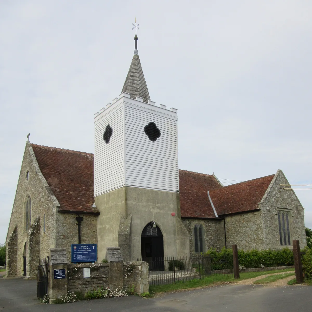
All Saints' Church, Newchurch
Historic churches · 2.4 km
Nearby
📷 5Forests & woodlands · South East England
Eaglehead & Bloodstone Copses Nature Reserve
Eaglehead & Bloodstone Copses Nature Reserve is a forest or woodland in the United Kingdom.
📷 5Mountains & hills · South East England
Brading Down
Brading Down — a hill or mountain in england south east.
📷 5Vineyards · South East England
Medieval settlement 100m south east and 350m north east of East Ashey Manor Farm
Medieval settlement 100m south east and 350m north east of East Ashey Manor Farm — a UK vineyard in england south east, producing English or Welsh wine from cool-climate grape varieties.
📷 5Farms (open to visitors) · South East England
The Garlic Farm
The Garlic Farm — a other in england-south-east, United Kingdom.
📷 5Gardens · South East England
Nunwell House and Garden
Nunwell House and Garden — a garden in england-south-east, United Kingdom.
📷 5Historic bridges · South East England
Alverstone Bridge
Alverstone Bridge — Grade II listed building-listed bridge in england-south-east, United Kingdom.
Where to eat & stay near Sea Mark
Places to stay
📷 5Caravan parks · South East England
Alverstone Ponds
Alverstone Ponds — a caravan park in england south east.
 📷 5
📷 5Campsites · South East England
C&CC
C&CC — a campsite in england south east.
 📷 5
📷 5Caravan parks · South East England
Fairway Holiday Park
Fairway Holiday Park — a caravan park in england south east.
 📷 5
📷 5Campsites · South East England
Sunrise Hill Camping
Sunrise Hill Camping — a campsite in england south east.
 📷 4
📷 4Caravan parks · South East England
Southland
Southland — a caravan park in england south east.
 📷 5
📷 5Campsites · South East England
Whitefield Forest Campsite
Whitefield Forest Campsite — a campsite in england south east.
Places to eat & drink
 📷 7
📷 7Historic pubs · South East England
The Swans Nest
The Swans Nest in England South East, United Kingdom.
 📷 2
📷 2Historic pubs · South East England
The Castle Hotel
The Castle Hotel in England South East, United Kingdom.
 📷 7
📷 7Historic pubs · South East England
Wellington Tavern
Wellington Tavern in England South East, United Kingdom.
 📷 5
📷 5Restaurants · South East England
Vernon Cottage
Vernon Cottage — a restaurant in england south east.
 📷 7
📷 7Cafés · South East England
Pencil Cottage
Pencil Cottage — a café in england south east.
 📷 7
📷 7Historic pubs · South East England
King Harry's Bar
King Harry's Bar in England South East, United Kingdom.
More memorials in this region
 📷 5
📷 5Memorials & monuments · South East England
Air Forces Memorial
Air Forces Memorial is a memorial in the United Kingdom.
 📷 5
📷 5Memorials & monuments · South East England
All Saints Church
All Saints Church is a memorial in the United Kingdom.
 📷 5
📷 5Memorials & monuments · South East England
Bevans War Memorial
Bevans War Memorial is a memorial in the United Kingdom.
.jpg?width=1200) 📷 5
📷 5Memorials & monuments · South East England
Cumberland Obelisk
Cumberland Obelisk is a memorial in the United Kingdom.
Frequently asked questions
- Where is Sea Mark?
- Sea Mark is in South-East England, United Kingdom (postcode PO33 4AX), in the parish of Havenstreet and Ashey.
- What is Sea Mark?
- Sea Mark is a memorial in the United Kingdom.
- How do I get to Sea Mark?
- The nearest railway station is Ashey, about 1.3 km away. Drivers can use postcode PO33 4AX.
- Is Sea Mark a protected site?
- Yes — Sea Mark is part of the Isle Of Wight National Landscape (AONB) and the Solent & Southampton Water Ramsar wetland.
- Is Sea Mark free to visit?
- Yes, Sea Mark is free to enter.
- How do I get to Sea Mark?
- The nearest railway station is Ashey, about 1.3 km away. Drivers can navigate to postcode PO33 4AX.