
Gardens · South East England
Nunwell House and Garden
In or near St Helens.
Nunwell House and Garden — a garden in england-south-east, United Kingdom.

Jo Turner — CC BY-SA 2.0 via Wikimedia Commons licence

Plan your visit
- Typical visit
- 1 h–2.5 h
- Best time of year
- Spring & summer (Apr–Sep)
- Nearest railway station
- Brading · 1.6 km
- Free entry
- Family-friendly
- Dog-friendly
About
Nunwell House and Garden is a garden located in england-south-east, United Kingdom. Sourced from OpenStreetMap (ODbL licence); see local listings for visitor information, opening hours and admission details.
Photo gallery
Official information
Nunwell House and Gardens is a historic family home located on the Isle of Wight, surrounded by five acres of tranquil gardens. Visitors can enjoy beautiful views of Brading Haven and Bembridge Harbour, with the gardens open for charity events and exclusive group visits.
Protected designations
- Area of Outstanding Natural Beauty: Isle Of Wight
- Ramsar wetland: Solent & Southampton Water
Designations sourced from Natural England open data under OGL v3.
Place summary
Nunwell House and Garden is located in South-East England, postcode PO36. This site features a historic garden known for its diverse plant collection and design. The house itself is an example of Georgian architecture, reflecting the era's style and significance.
AI-generated from the structured facts on this page (operator, designation, listing, era). Not a substitute for visiting.
- Coordinates
- 50.6835, -1.1591
- District
- Isle of Wight
- Parish
- Brading
- Postcode
- PO36 0JE
- Parliamentary constituency
- Isle of Wight East
- Phone
- +44 1983 407240
- Nearest railway station
- Brading — 1.6 km
- Opening
- Sunday 19 July 2026 1pm–4.30pm; closed for the foreseeable future
- Official site
- www.nunwellhouse.co.uk
Sources
- osm: way/409443281 (ODbL)
Other places nearby
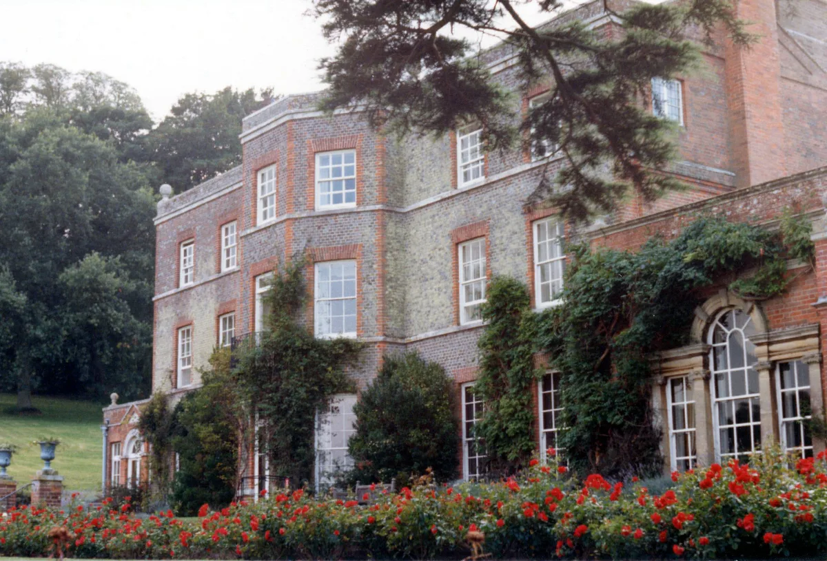
Nunwell House
Stately homes · 0.1 km

Lilliput Doll and Toy Museum
Museums · 1.1 km

Brading Down
Mountains & hills · 1.1 km

Brading Heritage Centre
Natural landmarks · 1.1 km

Brading War Memorial
Memorials & monuments · 1.1 km

Sunrise Hill Camping
Campsites · 1.1 km
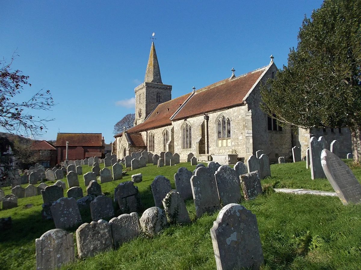
St. Mary's Church, Brading
Historic churches · 1.2 km

Monument To Thomas Wiseman Approximately 3 Metres East Of North Corner Of De Aula Chapel
Memorials & monuments · 1.2 km

Monument Approximately 8 Metres North Of Item 6/66
Memorials & monuments · 1.2 km
Monument Approximately 12 Metres South Of East Wall Of Oglander Chapel
Memorials & monuments · 1.2 km
Monument Approximately 5 Metres South East Of Item 6/56
Memorials & monuments · 1.2 km
Monument To Sarah, Wife Of Robert Love
Memorials & monuments · 1.2 km
Nearby
📷 5Stately homes · South East England
Nunwell House
Nunwell House — country house in Brading, Isle of Wight, England, UK.
📷 5Museums · South East England
Lilliput Doll and Toy Museum
Lilliput Doll and Toy Museum — a museum in england-south-east, United Kingdom.
📷 5Mountains & hills · South East England
Brading Down
Brading Down — a hill or mountain in england south east.
📷 5Natural landmarks · South East England
Brading Heritage Centre
Brading Heritage Centre — a other in england-south-east, United Kingdom.
📷 5Memorials & monuments · South East England
Brading War Memorial
Brading War Memorial — Grade II listed building-listed memorial in england-south-east, United Kingdom.
📷 5Campsites · South East England
Sunrise Hill Camping
Sunrise Hill Camping — a campsite in england south east.
Where to eat & stay near Nunwell House and Garden
Places to stay
📷 5Campsites · South East England
Sunrise Hill Camping
Sunrise Hill Camping — a campsite in england south east.
 📷 5
📷 5Campsites · South East England
Beaper Farm Campsite
Beaper Farm Campsite — a campsite in england south east.
📷 5Campsites · South East England
Whitefield Forest Campsite
Whitefield Forest Campsite — a campsite in england south east.
 📷 5
📷 5Caravan parks · South East England
Fairway Holiday Park
Fairway Holiday Park — a caravan park in england south east.
 📷 5
📷 5Caravan parks · South East England
Carpenters Farm Campsite
Carpenters Farm Campsite — a caravan park in england south east.
 📷 5
📷 5Caravan parks · South East England
Alverstone Ponds
Alverstone Ponds — a caravan park in england south east.
Places to eat & drink
 📷 7
📷 7Historic pubs · South East England
The Swans Nest
The Swans Nest in England South East, United Kingdom.
 📷 2
📷 2Historic pubs · South East England
The Castle Hotel
The Castle Hotel in England South East, United Kingdom.
 📷 7
📷 7Historic pubs · South East England
Wellington Tavern
Wellington Tavern in England South East, United Kingdom.
 📷 5
📷 5Restaurants · South East England
Vernon Cottage
Vernon Cottage — a restaurant in england south east.
 📷 7
📷 7Cafés · South East England
Pencil Cottage
Pencil Cottage — a café in england south east.
 📷 7
📷 7Historic pubs · South East England
King Harry's Bar
King Harry's Bar in England South East, United Kingdom.
More gardens in this region
 📷 5
📷 5Gardens · South East England
Emmetts Garden
Emmetts Garden — Edwardian house and gardens at Ide Hill, Kent, England.
 📷 5
📷 5Gardens · South East England
Great Comp Garden
Great Comp Garden — garden in Comp, Kent, England, UK.
.jpg?width=1200) 📷 5
📷 5Gardens · South East England
Muslim Burial Ground, Horsell Common
Muslim Burial Ground, Horsell Common — former cemetery and current peace garden in Woking, Surrey, England, UK.
 📷 5
📷 5Gardens · South East England
Riverhill House
Riverhill House — country house in Sevenoaks Weald, Kent, England, UK.
Frequently asked questions
- Where is Nunwell House and Garden?
- Nunwell House and Garden is in South-East England, United Kingdom (postcode PO36 0JE), in the parish of Brading.
- What is Nunwell House and Garden?
- Nunwell House and Garden — a garden in england-south-east, United Kingdom.
- How do I get to Nunwell House and Garden?
- The nearest railway station is Brading, about 1.6 km away. Drivers can use postcode PO36 0JE.
- Is Nunwell House and Garden a protected site?
- Yes — Nunwell House and Garden is part of the Isle Of Wight National Landscape (AONB) and the Solent & Southampton Water Ramsar wetland.
- How do I get to Nunwell House and Garden?
- The nearest railway station is Brading, about 1.6 km away. Drivers can navigate to postcode PO36 0JE.