
Mountains & hills · Northern Ireland
Sanda
Sanda — mountain in northern ireland. Elevation: 123 m.

Julian Thomas — CC BY-SA 2.0 via Wikimedia Commons licence

Plan your visit
- Typical visit
- 3 h–8 h
- Best time of year
- Late spring – early autumn (May–Oct)
- Dog-friendly
About
Sanda is a mountain located in northern ireland. Elevation: 123 m. A named British peak recorded in OpenStreetMap. Peaks are typically named on Ordnance Survey 1:50k mapping.
Photo gallery
Place summary
Sanda is a mountain located in Northern Ireland, specifically in the postcode area PA28. It features rugged terrain typical of the region and offers various outdoor activities for visitors. The mountain is part of a scenic landscape that attracts hikers and nature enthusiasts. Its elevation provides panoramic views of the surrounding area, making it a notable landmark for outdoor pursuits.
AI-generated from the structured facts on this page (operator, designation, listing, era). Not a substitute for visiting.
- Coordinates
- 55.2805, -5.5759
- District
- Argyll and Bute
- Postcode
- PA28 6RS
- Parliamentary constituency
- Argyll, Bute and South Lochaber
Sources
- osm: n530980954 (ODbL)
Other places nearby
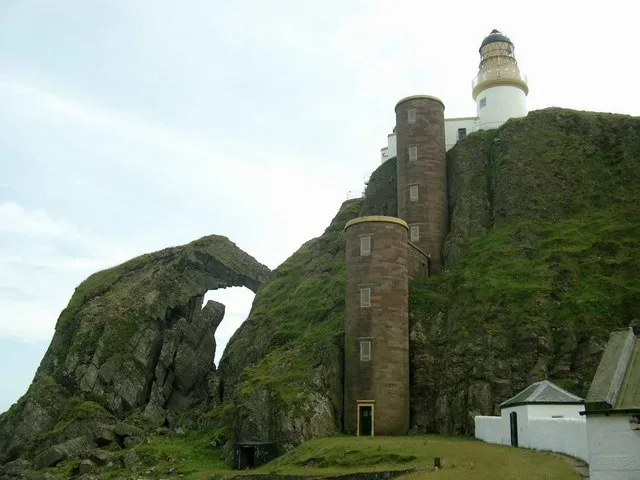
Sanda Island
Islands · 0.5 km
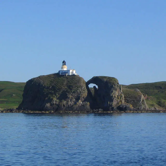
Sanda Island Lighthouse
Lighthouses · 0.8 km

Sheep Island
Islands · 1.2 km

HMS Untamed
Natural landmarks · 1.3 km

Glunimore Island
Islands · 1.3 km

Cnoc Eibhleach, dun site
Archaeological sites · 3.8 km

Polliwilline Bay
Natural landmarks · 4.3 km

Brunerican Bay
Natural landmarks · 4.4 km

Memorial to the 8th Duke of Argyll
Memorials & monuments · 4.5 km
Macharioch, dun site
Archaeological sites · 4.5 km

Macharioch Bay
Natural landmarks · 4.6 km

standing stone 225m SW of Brunerican
Windmills · 4.8 km
Nearby
Flagship📷 5Islands · Northern Ireland
Sanda Island
Sanda Island — a small island in Argyll and Bute, Scotland, UK.
📷 3Lighthouses · Northern Ireland
Sanda Island Lighthouse
Sanda Island Lighthouse — lighthouse in Argyll and Bute, Scotland, UK.
📷 5📷 4Natural landmarks · Northern Ireland
HMS Untamed
HMS Untamed in Northern Ireland, United Kingdom.
📷 3Islands · Northern Ireland
Glunimore Island
Glunimore Island — island in Argyll and Bute, Scotland, UK.
📷 5Archaeological sites · Northern Ireland
Cnoc Eibhleach, dun site
Cnoc Eibhleach, dun site — an archaeological site in Northern Ireland, United Kingdom.
Where to eat & stay near Sanda
Places to stay
 📷 5
📷 5 📷 5
📷 5Hotels · Scottish Lowlands
The Royal Hotel
The Royal Hotel — a hotel in scotland lowlands.
Caravan parks · Scottish Lowlands
Machrihanish Holiday Park
Machrihanish Holiday Park — a caravan park in scotland lowlands.
 📷 5
📷 5Caravan parks · Scottish Lowlands
Peninver Sands Holiday Park
Peninver Sands Holiday Park — a caravan park in scotland lowlands.
📷 5Caravan parks · Scottish Lowlands
Peninver Sands Holiday Park
Peninver Sands Holiday Park — a caravan park in scotland lowlands.
Places to eat & drink
 📷 5
📷 5Historic pubs · Scottish Lowlands
40 Main Street, Campbeltown
40 Main Street, Campbeltown in Northern Ireland, United Kingdom.
More mountains in this region
 📷 5
📷 5Mountains & hills · Northern Ireland
Belfast Lough
Belfast Lough — intertidal inlet in Northern Ireland.
 📷 5
📷 5 📷 4
📷 4 📷 3
📷 3Mountains & hills · Northern Ireland
Benbradagh
Benbradagh — Named summit at 465 m.
Frequently asked questions
- Where is Sanda?
- Sanda is in Northern Ireland, United Kingdom (postcode PA28 6RS).
- What is Sanda?
- Sanda — mountain in northern ireland. Elevation: 123 m.
- How do I get to Sanda?
- Drivers can use postcode PA28 6RS.
- How do I get to Sanda?
- Drivers can navigate to postcode PA28 6RS. It sits within the Argyll, Bute and South Lochaber parliamentary constituency.