Islands · Northern Ireland
Sanda Island
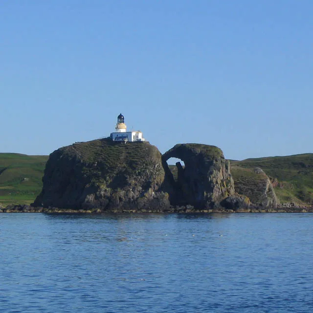
Sanda Island — a small island in Argyll and Bute, Scotland, UK.

Wikimedia Commons contributors — see linked file page for photographer and licence licence
Plan your visit
- Typical visit
- 4 h–12 h
- Free entry
- Dog-friendly
About
Sanda Island is a island in the United Kingdom. It covers approximately 127 km². Part of Inner Hebrides. Wikidata describes it as: "a small island in Argyll and Bute, Scotland, UK". Coordinates: 55.2819°, -5.5836°.
Photo gallery
From the Wikipedia article
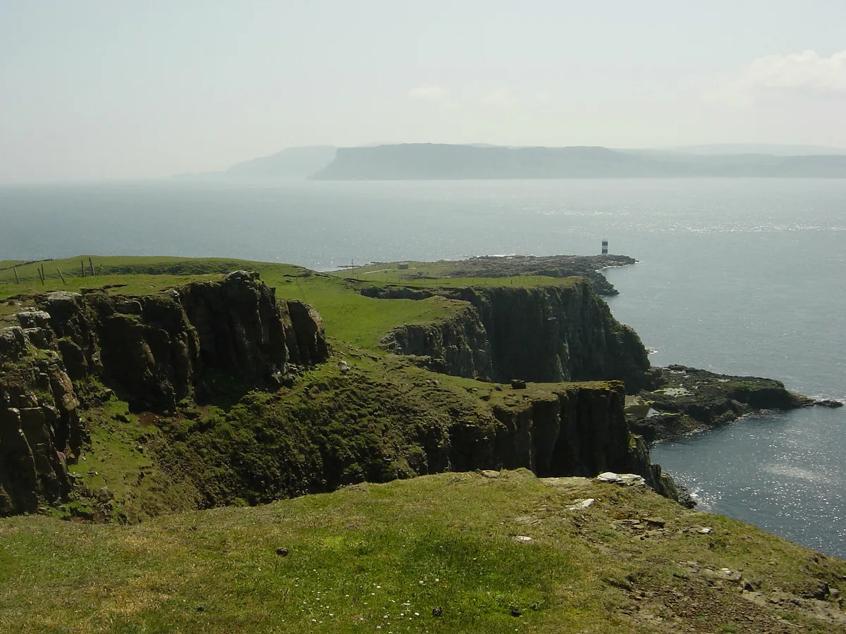
Sanda Island (Scottish Gaelic: Sandaigh) is a small island in the Firth of Clyde, off of Argyll and Bute, Scotland, near the southern tip of the Kintyre peninsula, near Southend and Dunaverty Castle. On clear days Sanda can be seen from the southern tip of the Kintyre peninsula, from the Isle of Arran and from northeast County Antrim. It is known locally on Arran and on the Antrim coast as "Spoon Island" because of its resemblance to an upturned spoon.
Excerpt from Wikipedia under CC BY-SA 4.0. See the source article linked in Sources below.
Background
History
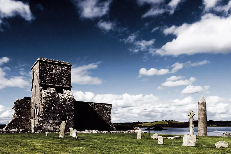
The island has connections with several well-known historical personages, including the Bruce family, Wallace and Saint Ninian, the first evangeliser north of Hadrian's Wall. The island is known for the ruins of a chapel built by Saint Ninian, for its Celtic crosses and its reputed holy well. It is said that Ninian was buried here, and indeed, the island was in possession of the Priory of Whithorn in Galloway until the Reformation. It is said that Ninian's grave was marked by an alder tree, and that whoever stepped on it would die. those MacDonalds were also caught up in related fighting from the 1630s onwards, and lost their position as a result of the Dunaverty Massacre. The island has…
Sourced from Wikipedia under CC BY-SA 4.0.
- Coordinates
- 55.2819, -5.5836
- District
- Argyll and Bute
- Postcode
- PA28 6RS
- Parliamentary constituency
- Argyll, Bute and South Lochaber
Sources
- wikidata: Q3175659 (CC0)
- wikipedia: Sanda Island (CC BY-SA 4.0)
- commons: Sandalighthouse.jpg (CC BY-SA 4.0)
Other places nearby
Loading nearby places…
Nearby
 📷 3
📷 3Lighthouses · Northern Ireland
Sanda Island Lighthouse
Sanda Island Lighthouse — lighthouse in Argyll and Bute, Scotland, UK.
 📷 4
📷 4Natural landmarks · Northern Ireland
HMS Untamed
HMS Untamed in Northern Ireland, United Kingdom.
 📷 5
📷 5Islands · Northern Ireland
Sheep Island
Sheep Island — island in Argyll and Bute, Scotland, UK.
 📷 3
📷 3Islands · Northern Ireland
Glunimore Island
Glunimore Island — island in Argyll and Bute, Scotland, UK.

Archaeological sites · Northern Ireland
Cnoc Eibhleach, dun site
Cnoc Eibhleach, dun site — a archaeological in northern-ireland, United Kingdom.
 📷 3
📷 3Mountains & hills · Northern Ireland
Brunerican Bay
Brunerican Bay — bay at the south of the Mull of Kintyre, Scotland, UK.
More places in this region
 Flagship📷 3
Islands · Northern Ireland
Derrywarragh Island
Derrywarragh Island — island in County Armagh, Northern Ireland, United Kingdom.
 Flagship📷 5
Islands · Northern Ireland
Devenish Island
Devenish Island — island in Lower Lough Erne, Northern Ireland.
 Flagship📷 3
Islands · Northern Ireland
Rathlin Island
Rathlin Island — island in County Antrim, Northern Ireland, UK.
 📷 4
📷 4Islands · Northern Ireland
Boa Island
Boa Island is a island in the United Kingdom.
Frequently asked questions
- Where is Sanda Island?
- Sanda Island is in Northern Ireland, United Kingdom (postcode PA28 6RS).
- Is Sanda Island free to visit?
- Yes, Sanda Island is free to enter.
- How do I get to Sanda Island?
- Drivers can navigate to postcode PA28 6RS. It sits within the Argyll, Bute and South Lochaber parliamentary constituency.