
Mountains & hills · Northern Ireland
Belfast Lough
Also known as: Loch Lao
In or near Helen's Bay.
Belfast Lough — intertidal inlet in Northern Ireland.

Wikimedia Commons contributors — see linked file page for photographer and licence licence

Plan your visit
- Typical visit
- 3 h–8 h
- Best time of year
- Late spring – early autumn (May–Oct)
- Nearest railway station
- Carrickfergus · 3.3 km
- Free entry
- Dog-friendly
Getting there & planning your visit
To visit Belfast Lough, the nearest railway station is Carrickfergus, which is 3.3 km away. Entry to the area is free.
About
Belfast Lough is a named summit in the United Kingdom. Wikidata describes it as: "intertidal inlet in Northern Ireland". Coordinates: 54.6910°, -5.7850°.
Photo gallery
From the Wikipedia article
Belfast Lough is a large sea inlet on the east coast of Northern Ireland. At its head is the city and port of Belfast, which sits at the mouth of the River Lagan. The lough opens into the North Channel and connects Belfast to the Irish Sea. Belfast Lough is a long, wide and deep expanse of water, virtually free of strong tides. The inner part of the lough comprises a series of mudflats and lagoons. The outer lough is restricted to mainly rocky shores with some small sandy bays. The outer boundary of the lough is a line joining Orlock Point and Blackhead. The main coastal towns are Bangor on the southern shore (County Down) and Carrickfergus on the northern shore (County Antrim). Other coastal settlements include Holywood, Helen's Bay, Greenisland and Whitehead.
Excerpt from Wikipedia under CC BY-SA 4.0. See the source article linked in Sources below.
Background
History
In 1689 during the War of the Two Kings the Williamite expeditionary force under Marshal Schomberg landed at Bangor, after the lough had been cleared of French shipping by George Rooke. Schomberg occupied the towns of Bangor and Belfast, before successfully laying siege to Carrickfergus. The following year William III also used the lough as a safe anchorage when he arrived in Ireland with reinforcements for Schomberg in the run-up to the victory over the Jacobite army at the Battle of the Boyne.
Sourced from Wikipedia under CC BY-SA 4.0.
- Coordinates
- 54.6910, -5.7850
- Address
- Northern Ireland
- Nearest railway station
- Carrickfergus — 3.3 km
Sources
- wikidata: Q2360948 (CC0)
- wikipedia: Belfast Lough (CC BY-SA 4.0)
- commons: Belfast with Lough by Sentinel-2.jpg (CC BY-SA 4.0)
Other places nearby

Carrickfergus Harbour
Marinas · 2.6 km

Carrickfergus Sailing Club
Natural landmarks · 2.7 km

Carrickfergus Lifeboat Station
Natural landmarks · 2.7 km

Battle of Carrickfergus
Battlefields & battle sites · 2.8 km
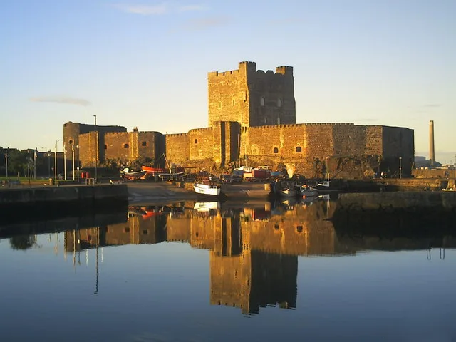
Carrickfergus Castle
Castles · 2.8 km

Carrickfergus Omniplex
Theatres · 2.9 km

King William III Monument
Memorials & monuments · 2.9 km
Carrickfergus
Natural landmarks · 2.9 km

arts
Public art & sculpture · 2.9 km

Carrickfergus Castle
Castles · 2.9 km

Carrickfergus Waterfront
Natural landmarks · 2.9 km

Omniplex
Cinemas · 3.0 km
Nearby
📷 5Marinas · Northern Ireland
Carrickfergus Harbour
Carrickfergus Harbour — a marina in northern ireland.
📷 3Natural landmarks · Northern Ireland
Carrickfergus Sailing Club
Carrickfergus Sailing Club in Northern Ireland, United Kingdom.
📷 4Natural landmarks · Northern Ireland
Carrickfergus Lifeboat Station
Carrickfergus Lifeboat Station in Northern Ireland, United Kingdom.
📷 4Battlefields & battle sites · Northern Ireland
Battle of Carrickfergus
Battle of Carrickfergus in Northern Ireland, United Kingdom.
📷 5Castles · Northern Ireland
Carrickfergus Castle
Carrickfergus Castle is a castle in the United Kingdom.
📷 3Theatres · Northern Ireland
Carrickfergus Omniplex
Carrickfergus Omniplex in Northern Ireland, United Kingdom.
Where to eat & stay near Belfast Lough
Places to stay
 📷 5
📷 5Campsites · Northern Ireland
Lorne Estate
Lorne Estate — a campsite in northern ireland.
 📷 5
📷 5Campsites · Northern Ireland
Crawfordsburn Scout Centre
Crawfordsburn Scout Centre — a campsite in northern ireland.
 📷 5
📷 5 📷 5
📷 5Caravan parks · Northern Ireland
Jordanstown Loughshore Caravan Park
Jordanstown Loughshore Caravan Park — a caravan park in northern ireland.
 📷 5📷 5
Places to eat & drink
 📷 5
📷 5 📷 5
📷 5 📷 7
📷 7Historic pubs · Northern Ireland
Kelly's Cellars
Kelly's Cellars in Northern Ireland, United Kingdom.
 📷 7
📷 7Historic pubs · Northern Ireland
Crown Liquor Saloon
Crown Liquor Saloon in Northern Ireland, United Kingdom.
 📷 3
📷 3Historic pubs · Northern Ireland
Red Lion Pub bombing
Red Lion Pub bombing in Northern Ireland, United Kingdom.
 📷 5
📷 5More mountains in this region
 📷 5
📷 5 📷 4
📷 4 📷 3
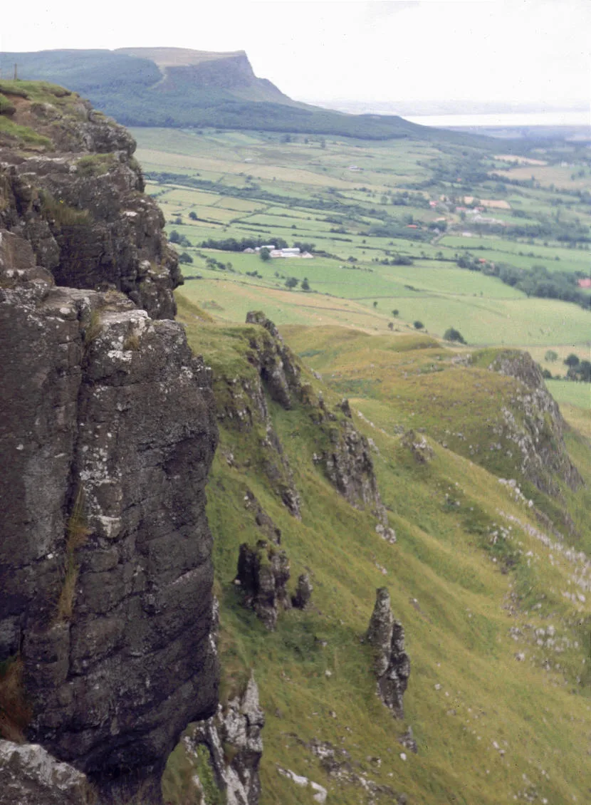
📷 3Mountains & hills · Northern Ireland
Benbradagh
Benbradagh — Named summit at 465 m.
 📷 3
📷 3Frequently asked questions
- Where is Belfast Lough?
- Belfast Lough is in Northern Ireland, United Kingdom.
- What is Belfast Lough?
- Belfast Lough — intertidal inlet in Northern Ireland.
- How do I get to Belfast Lough?
- The nearest railway station is Carrickfergus, about 3.3 km away. Its coordinates are 54.6910°, -5.7850°.
- Is Belfast Lough free to visit?
- Yes, Belfast Lough is free to enter.
- How do I get to Belfast Lough?
- The nearest railway station is Carrickfergus, about 3.3 km away.