
Reservoirs & lochs · East Midlands
Redmires Reservoirs
In or near Hathersage.
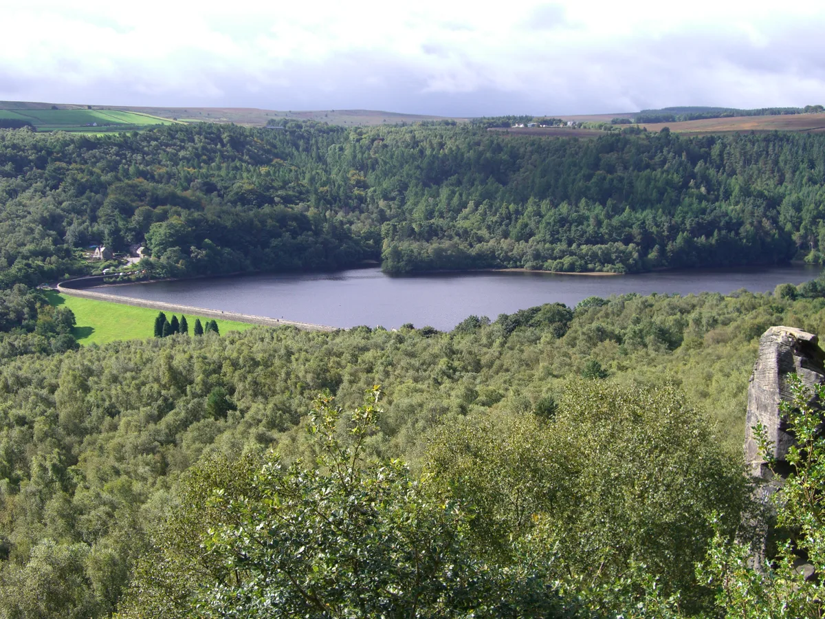
Redmires Reservoirs — group of reservoirs in Sheffield, South Yorkshire, England, UK.

Wikimedia Commons licence
Plan your visit
- Typical visit
- 1 h–2.5 h
- Nearest railway station
- Hathersage · 5.4 km
- Free entry
- Dog-friendly
Getting there & planning your visit
To visit Redmires Reservoirs, the nearest railway station is Hathersage, located 5.4 km away. The postcode for your sat-nav is S10 4QZ. Entry is free.
About
Redmires Reservoirs is a reservoir in the United Kingdom. Wikidata describes it as: "group of reservoirs in Sheffield, South Yorkshire, England, UK". Coordinates: 53.3678°, -1.6105°.
Photo gallery
Official information
Redmires Reservoirs is a nature reserve that features a variety of habitats, including wet pasture and grassland, which support diverse wildlife. Visitors can enjoy birdwatching and observing various species of flora and fauna in this tranquil setting.
Protected designations
- Site of Special Scientific Interest: Eastern Peak District Moors SSSI
Designations sourced from Natural England open data under OGL v3.
From the Wikipedia article
The Redmires Reservoirs are a group of three reservoirs in Fulwood, Sheffield, South Yorkshire, England. They are fed from the Hallam Moors by various small streams including Fairthorn Clough. The three reservoirs are named Upper, Middle and Lower; they were authorised by the Sheffield Water Act 1830 (11 Geo. 4 & 1 Will. 4. c. lv) and were built between 1833 and 1854 to provide clean drinking water via an open water course which led to the Hadfield Dam situated in Crookes, following the devastating Sheffield cholera epidemic of 1832. The dams were built as part of the Sheffield Waterworks Company's continuing expansion to meet the ever growing population of Sheffield. The area is popular with walkers and bird watchers. Adjacent to the Middle Reservoir is Hammond's Field Nature Reserve, which is managed by The Wildlife Trust for Sheffield and Rotherham. The nature reserve forms part of the South Pennine Moors Special Protected Area. A path, the Long Causeway leads from the Upper reservoir, onto the moors to Stanedge Pole and then onto Stanage Edge. This route was once thought to be a Roman road but is now thought to be a Medieval packhorse saltway, used to convey salt from Cheshire to Yorkshire. The Grouse and Trout Inn, opened in 1852, once stood close to Middle Reservoir. It closed in 1913 and was demolished in 1934. All that remains of the public house is a bas-relief from the facade.
Excerpt from Wikipedia under CC BY-SA 4.0. See the source article linked in Sources below.
- Coordinates
- 53.3678, -1.6105
- District
- Sheffield
- Parish
- Sheffield, unparished area
- Postcode
- S10 4QZ
- Parliamentary constituency
- Sheffield Hallam
- Nearest railway station
- Hathersage — 5.4 km
- Official site
- www.wildsheffield.com
Sources
- wikidata: Q7306099 (CC0)
- wikipedia: Redmires Reservoirs (CC BY-SA 4.0)
Other places nearby

Redmires
Reservoirs & lochs · 0.0 km

Grouse and Trout Shield
Memorials & monuments · 0.1 km

Ocean View
Historic houses · 0.4 km

Hammond's Field
Forests & woodlands · 0.4 km
Quarry Hill & Hill 60 WW1 training trenches
Archaeological sites · 0.7 km

Quarry Hill & Hill 60 WW1 training trenches
Archaeological sites · 0.7 km

Wyming Brook Farm Certificated Site
Campsites · 1.0 km

Stone Circle
Archaeological sites · 1.1 km

Ash Cabin Flat
Vineyards · 1.3 km
Rivelin Dams
Reservoirs & lochs · 1.6 km

Sheep fold
Historic houses · 1.8 km

Rud Hill
Mountains & hills · 1.8 km
Nearby
📷 5📷 3Memorials & monuments · East Midlands
Grouse and Trout Shield
Grouse and Trout Shield — a memorial in East Midlands, United Kingdom.
📷 3Historic houses · East Midlands
Ocean View
Ocean View — a historic house in East Midlands, United Kingdom.
📷 3Forests & woodlands · East Midlands
Hammond's Field
Hammond's Field is a forest or woodland in the United Kingdom.
📷 3Archaeological sites · East Midlands
Quarry Hill & Hill 60 WW1 training trenches
Quarry Hill & Hill 60 WW1 training trenches — an archaeological site in East Midlands, United Kingdom.
📷 5Archaeological sites · East Midlands
Quarry Hill & Hill 60 WW1 training trenches
Quarry Hill & Hill 60 WW1 training trenches — archaeological in england east midlands.
Where to eat & stay near Redmires Reservoirs
Places to stay
📷 5Campsites · East Midlands
Wyming Brook Farm Certificated Site
Wyming Brook Farm Certificated Site — a campsite in england east midlands.
 📷 5
📷 5Campsites · East Midlands
Fox Hagg Farm Camp Site
Fox Hagg Farm Camp Site — a campsite in england east midlands.
 📷 5
📷 5Campsites · East Midlands
North Lees Campsite
North Lees Campsite — a campsite in england east midlands.
 📷 5
📷 5 📷 5
📷 5Hostels · East Midlands
Thorpe Farm Bunkhouses
Thorpe Farm Bunkhouses — a hostel in england east midlands.
📷 5Places to eat & drink
 📷 5
📷 5Historic pubs · Yorkshire & the Humber
Norfolk Arms Public House
Norfolk Arms Public House in England Yorkshire, United Kingdom.
 📷 7
📷 7Historic pubs · Yorkshire & the Humber
The Fox House
The Fox House in England Yorkshire, United Kingdom.
 📷 5
📷 5Historic pubs · Yorkshire & the Humber
Rose And Crown Public House And Attached Wall
Rose And Crown Public House And Attached Wall in England Yorkshire, United Kingdom.
 📷 5
📷 5Historic pubs · Yorkshire & the Humber
Union Hotel and adjoining boundary wall
Union Hotel and adjoining boundary wall in England Yorkshire, United Kingdom.
 📷 7
📷 7Historic pubs · Yorkshire & the Humber
Glossop Road Baths
Glossop Road Baths in England Yorkshire, United Kingdom.
 📷 5
📷 5Historic pubs · Yorkshire & the Humber
The Owl Public House
The Owl Public House in England Yorkshire, United Kingdom.
More places in this region
 Flagship📷 5
Reservoirs & lochs · East Midlands
Ladybower Reservoir
Ladybower Reservoir — reservoir in Derbyshire, England.
 📷 3
📷 3Reservoirs & lochs · East Midlands
Toddbrook Reservoir
Toddbrook Reservoir — reservoir in Derbyshire, England, UK.
 📷 3
📷 3Reservoirs & lochs · East Midlands
Agden Reservoir
Agden Reservoir — reservoir in South Yorkshire, England, UK.
 📷 5
📷 5Reservoirs & lochs · East Midlands
Arnfield Reservoir
Arnfield Reservoir — reservoir in Derbyshire, England, UK.
Frequently asked questions
- Where is Redmires Reservoirs?
- Redmires Reservoirs is in the East Midlands, United Kingdom (postcode S10 4QZ), in the parish of Sheffield, unparished area.
- What is Redmires Reservoirs?
- Redmires Reservoirs — group of reservoirs in Sheffield, South Yorkshire, England, UK.
- How do I get to Redmires Reservoirs?
- The nearest railway station is Hathersage, about 5.4 km away. The nearest town is Hathersage. Drivers can use postcode S10 4QZ.
- Is Redmires Reservoirs a protected site?
- Yes — Redmires Reservoirs is part of the Eastern Peak District Moors SSSI Site of Special Scientific Interest.
- Is Redmires Reservoirs free to visit?
- Yes, Redmires Reservoirs is free to enter.
- How do I get to Redmires Reservoirs?
- The nearest railway station is Hathersage, about 5.4 km away. Drivers can navigate to postcode S10 4QZ.