
Reservoirs & lochs · East Midlands
Agden Reservoir
In or near Langsett.
Agden Reservoir — reservoir in South Yorkshire, England, UK.

Wikimedia Commons contributors — see linked file page for photographer and licence licence

Plan your visit
- Typical visit
- 1 h–2.5 h
- Nearest railway station
- Forge Halt · 8.1 km
- Free entry
- Dog-friendly
Getting there & planning your visit
To visit Agden Reservoir, the nearest railway station is Forge Halt, located 8.1 km away. The postcode for navigation is S6 6LA, and entry to the reservoir is free.
About
Agden Reservoir is a reservoir in the United Kingdom. Owned by Yorkshire Water. Managed by Yorkshire Water. Wikidata describes it as: "reservoir in South Yorkshire, England, UK". Coordinates: 53.4286°, -1.6102°.
Photo gallery
From the Wikipedia article
Agden Reservoir is a water storage reservoir, situated at grid reference SK260925, 6+1⁄2 miles (10 kilometres) west of the centre of Sheffield, South Yorkshire, England. It is owned by Yorkshire Water / Kelda Group. The reservoir covers an area of 25 hectares (62 acres) and has a capacity of 559 million imperial gallons (2.54 gigalitres) of water; the dam wall has a width of approximately 380 feet (120 m) with a height of 100 feet (30 m). "Agden" means "Valley of the Oak Trees". The reservoir is one of four built in the second half of the 19th century to satisfy the developing steel industry of Sheffield, collecting water from the moorlands around the village of Low Bradfield, west of Sheffield. The other three being Damflask, Dale Dike and Strines reservoirs. Agden was completed in 1869 and is fed by Hobson Moss Dike and Emlin Dike which flow off the Broomhead and Bradfield moors respectively. The reservoir is surrounded mainly by coniferous woodland, however, Sheffield City Council who own much of the woodland have started a policy of replanting and thinning to encourage broadleaved varieties of trees which give a better habitat for wildlife and also look more attractive. The reservoir is ringed by a popular walk which starts in the village of Low Bradfield and takes in Agden Bog which is a protected wetland area managed by the Wildlife Trust for Sheffield and Rotherham. The Peak District Boundary Walk runs past the eastern end of the dam. The former Keeper's cottage is at the western side of the dam wall, now a private home, and Agden Lodge built in 1870 for Samuel Fox of Stocksbridge, remains as a private residence. There are also remnants of old farm dwellings around the reservoir - the Water Authorities allegedly had a policy of buying any available property around their reservoirs, solely for demolition, claiming they were a source of possible water contamination. Many fine old buildings were lost to this rationale, including Frost House early-1950s, Rocher…
Excerpt from Wikipedia under CC BY-SA 4.0. See the source article linked in Sources below.
- Coordinates
- 53.4286, -1.6102
- District
- Sheffield
- Parish
- Bradfield
- Postcode
- S6 6LA
- Parliamentary constituency
- Sheffield Hallam
- Nearest railway station
- Forge Halt — 8.1 km
Sources
- wikidata: Q4691682 (CC0)
- wikipedia: Agden Reservoir (CC BY-SA 4.0)
- commons: Agden Reservoir.jpg (CC BY-SA 4.0)
Other places nearby

Cotton Star Camping
Campsites · 0.3 km

Bailey Hill motte and bailey castle
Literary houses · 0.6 km
Bradfield Bailey Hill
Castles · 0.6 km

Bailey Hill
Archaeological sites · 0.6 km
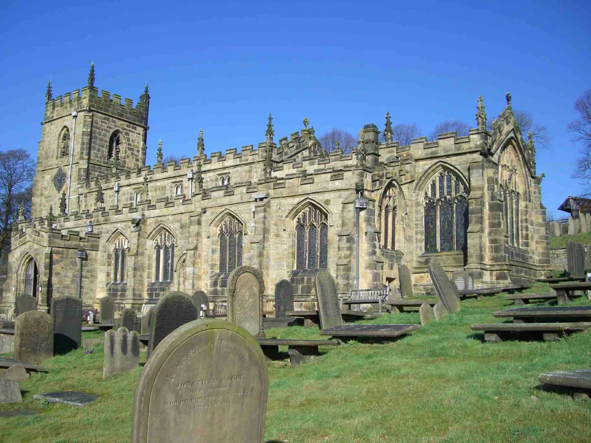
Church of St Nicholas, Bradfield
Historic churches · 0.7 km

Bradfield, South Yorkshire
Castles · 0.8 km

Agden Rocher
Climbing & bouldering crags · 1.0 km

Bradfield Castle Hill
Castles · 1.1 km
Castle Hill motte and bailey castle
Literary houses · 1.2 km

Slopey Blocks
Climbing & bouldering crags · 1.2 km

The Edgefield Obelisk
Memorials & monuments · 1.6 km

Handsome Cross (milestone)
Memorials & monuments · 1.6 km
Nearby
📷 5Campsites · East Midlands
Cotton Star Camping
Cotton Star Camping — a campsite in england east midlands.
📷 5Literary houses · East Midlands
Bailey Hill motte and bailey castle
Bailey Hill motte and bailey castle — a literary house museum in england east midlands.
📷 5Castles · East Midlands
Bradfield Bailey Hill
Bradfield Bailey Hill — a castle in england east midlands.
📷 3Archaeological sites · East Midlands
Bailey Hill
Bailey Hill — a archaeological in england-east-midlands, United Kingdom.
📷 5Historic churches · East Midlands
Church of St Nicholas, Bradfield
Church of St Nicholas, Bradfield — Grade I listed church in High Bradfield, South Yorkshire, England, UK.
📷 5Castles · East Midlands
Bradfield, South Yorkshire
Bradfield, South Yorkshire — a castle in england-east-midlands, United Kingdom.
Where to eat & stay near Agden Reservoir
Places to stay
📷 5Campsites · East Midlands
Cotton Star Camping
Cotton Star Camping — a campsite in england east midlands.
 📷 5
📷 5Campsites · East Midlands
Fox Hagg Farm Camp Site
Fox Hagg Farm Camp Site — a campsite in england east midlands.
 📷 5
📷 5Campsites · East Midlands
Wyming Brook Farm Certificated Site
Wyming Brook Farm Certificated Site — a campsite in england east midlands.
 📷 5
📷 5Hostels · East Midlands
Russell Scott Backpackers Hostel
Russell Scott Backpackers Hostel — a hostel in england east midlands.
 📷 5
📷 5Campsites · East Midlands
North Lees Campsite
North Lees Campsite — a campsite in england east midlands.
 📷 5
📷 5Campsites · Yorkshire & the Humber
Hoodlands Farm Campsite
Hoodlands Farm Campsite — a campsite in england yorkshire.
Places to eat & drink
 📷 5
📷 5Historic pubs · Yorkshire & the Humber
Rose And Crown Public House And Attached Wall
Rose And Crown Public House And Attached Wall in England Yorkshire, United Kingdom.
 📷 5
📷 5Historic pubs · Yorkshire & the Humber
The Owl Public House
The Owl Public House in England Yorkshire, United Kingdom.
 📷 7
📷 7Historic pubs · Yorkshire & the Humber
Wagon And Horses Public House
Wagon And Horses Public House in England Yorkshire, United Kingdom.
 📷 5
📷 5Historic pubs · Yorkshire & the Humber
Norfolk Arms Public House
Norfolk Arms Public House in England Yorkshire, United Kingdom.
 📷 7
📷 7Historic pubs · Yorkshire & the Humber
Glossop Road Baths
Glossop Road Baths in England Yorkshire, United Kingdom.
 📷 7
📷 7Historic pubs · Yorkshire & the Humber
Kelham Island Tavern
Kelham Island Tavern in England Yorkshire, United Kingdom.
More places run by Yorkshire Water
 📷 3
📷 3Reservoirs & lochs · East Midlands
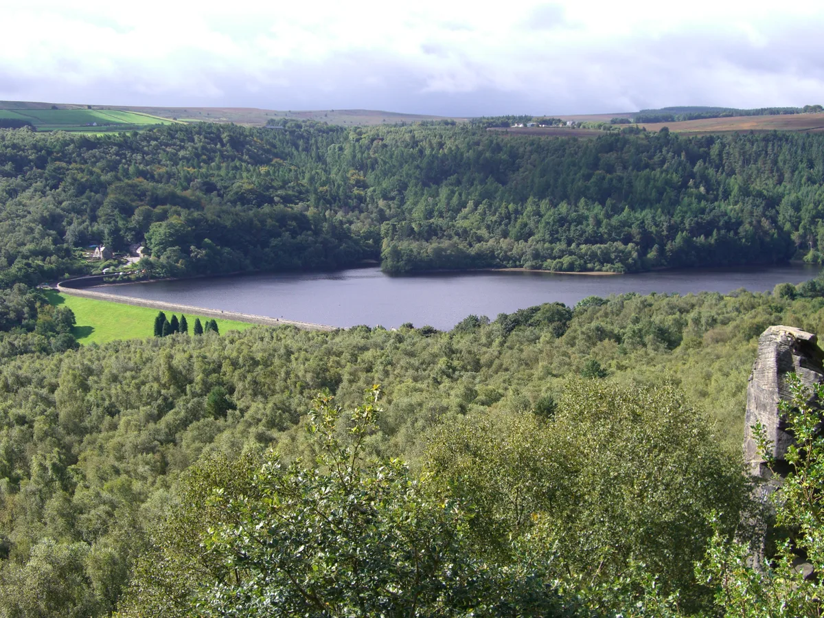
Rivelin Dams
Rivelin Dams — pair of reservoirs in South Yorkshire, England.
More places in this region
 Flagship📷 5
Reservoirs & lochs · East Midlands
Ladybower Reservoir
Ladybower Reservoir — reservoir in Derbyshire, England.
 📷 3
📷 3Reservoirs & lochs · East Midlands
Toddbrook Reservoir
Toddbrook Reservoir — reservoir in Derbyshire, England, UK.
 📷 5
📷 5Reservoirs & lochs · East Midlands
Arnfield Reservoir
Arnfield Reservoir — reservoir in Derbyshire, England, UK.
 📷 3
📷 3Reservoirs & lochs · East Midlands
Blackbrook Reservoir
Blackbrook Reservoir — reservoir and Site of Special Scientific Interest in Leicestershire, United Kingdom.
Frequently asked questions
- Where is Agden Reservoir?
- Agden Reservoir is in the East Midlands, United Kingdom (postcode S6 6LA), in the parish of Bradfield.
- What is Agden Reservoir?
- Agden Reservoir — reservoir in South Yorkshire, England, UK.
- How do I get to Agden Reservoir?
- The nearest railway station is Forge Halt, about 8.1 km away. The nearest town is Langsett. Drivers can use postcode S6 6LA.
- Who runs Agden Reservoir?
- Agden Reservoir is operated by Yorkshire Water.
- Is Agden Reservoir free to visit?
- Yes, Agden Reservoir is free to enter.
- How do I get to Agden Reservoir?
- Drivers can navigate to postcode S6 6LA. It sits within the Sheffield Hallam parliamentary constituency.