
Reservoirs & lochs · East Midlands
Rivelin Dams
In or near Hathersage.
Rivelin Dams — pair of reservoirs in South Yorkshire, England.

Wikimedia Commons contributors — see linked file page for photographer and licence licence

Plan your visit
- Typical visit
- 1 h–2.5 h
- Nearest railway station
- Hathersage · 7.0 km
- Free entry
- Dog-friendly
About
Rivelin Dams is a reservoir in the United Kingdom. Managed by Yorkshire Water. Wikidata describes it as: "pair of reservoirs in South Yorkshire, England". Coordinates: 53.3779°, -1.5936°.
Photo gallery
Protected designations
- Site of Special Scientific Interest: Eastern Peak District Moors SSSI
Designations sourced from Natural England open data under OGL v3.
From the Wikipedia article
Rivelin Dams are a pair of water storage reservoirs situated in the upper part of the Rivelin Valley, 5 miles (8 km) west of Sheffield in South Yorkshire, England. The dams are owned by Yorkshire Water and provide water to 319,000 people as well as compensation water for the River Rivelin. They are named Upper and Lower and fall just within the eastern boundary of the Peak District.
Excerpt from Wikipedia under CC BY-SA 4.0. See the source article linked in Sources below.
Background
History
Water provision for the growing city of Sheffield was taken over by the private Sheffield Waterworks Company in 1830. The Rivelin Dams were part of a series of reservoirs subsequently built to the west of the city by the company with the Lower being completed in 1845 and the Upper in 1848. When the company's plans to build the Rivelin Dams were approved, a proviso was inserted into the agreement which stipulated that they must supply 3,210,338 impgal per day of compensation water into the River Rivelin for the benefit of the mill owners and other users further downstream. In the second half of the 19th century this compensation water often had to be provided by letting water enter the…
Description
The Lower reservoir is the larger of the two and has easier public access with a tarmac road giving vehicular access to a small car park at the southern end of the dam wall. Access to the Upper reservoir and the woodland around it is by permit, there is a track with a locked gate which gives access for water board vehicles from the A57 road. The Lower reservoir has a capacity of 175 e6impgal, with a surface area of 12 ha, the dam height is 20 m and its length is approximately 300 m. The Upper reservoir has a capacity of 48.4 e6impgal, with a surface area of 4 ha, the dam height is 12 m with an approximate length of 220 metres. Both the dam walls are faced with stone pitching in the upstream…
Sourced from Wikipedia under CC BY-SA 4.0.
- Coordinates
- 53.3779, -1.5936
- District
- Sheffield
- Parish
- Bradfield
- Postcode
- S6 6GH
- Parliamentary constituency
- Sheffield Hallam
- Nearest railway station
- Hathersage — 7 km
Sources
- wikidata: Q7337012 (CC0)
- wikipedia: Rivelin Dams (CC BY-SA 4.0)
- commons: Rivelin Dams from Rivelin Rocks 45.JPG (CC BY-SA 4.0)
Other places nearby

Ash Cabin Flat
Vineyards · 0.4 km

Rivelin Quarries
Natural landmarks · 0.4 km

Stone Circle
Archaeological sites · 0.6 km

Rivelin Edge
Climbing & bouldering crags · 1.0 km
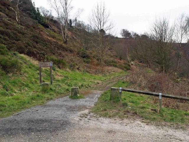
Fox Hagg
Wildlife reserves · 1.1 km

Wyming Brook Farm Certificated Site
Campsites · 1.1 km

Lodge Moor Camp - WWI and II POW Camp.
Archaeological sites · 1.2 km

Lodge Moor Camp - WWI and II POW Camp.
Archaeological sites · 1.2 km

Hammond's Field
Forests & woodlands · 1.2 km

Grouse and Trout Shield
Memorials & monuments · 1.5 km

Redmires Reservoirs
Reservoirs & lochs · 1.6 km

Redmires
Reservoirs & lochs · 1.6 km
Nearby
📷 5Vineyards · East Midlands
Ash Cabin Flat
Ash Cabin Flat — a UK vineyard in england east midlands, producing English or Welsh wine from cool-climate grape varieties.
📷 5Natural landmarks · East Midlands
Rivelin Quarries
Rivelin Quarries — natural landmark in england east midlands.
📷 5Archaeological sites · East Midlands
Stone Circle
Stone Circle — archaeological in england east midlands.
📷 5Climbing & bouldering crags · East Midlands
Rivelin Edge
Rivelin Edge — a climbing crag in england east midlands.
📷 3Wildlife reserves · East Midlands
Fox Hagg
Fox Hagg — nature Reserve in Sheffield, South Yorkshire, England.
📷 5Campsites · East Midlands
Wyming Brook Farm Certificated Site
Wyming Brook Farm Certificated Site — a campsite in england east midlands.
Where to eat & stay near Rivelin Dams
Places to stay
📷 5Campsites · East Midlands
Wyming Brook Farm Certificated Site
Wyming Brook Farm Certificated Site — a campsite in england east midlands.
 📷 5
📷 5Campsites · East Midlands
Fox Hagg Farm Camp Site
Fox Hagg Farm Camp Site — a campsite in england east midlands.
 📷 5
📷 5Hostels · East Midlands
Westfield Barn (Whirlow Hall Farm Trust)
Westfield Barn (Whirlow Hall Farm Trust) — a hostel in england east midlands.
 📷 5
📷 5Campsites · East Midlands
North Lees Campsite
North Lees Campsite — a campsite in england east midlands.
 📷 5
📷 5Campsites · East Midlands
Cotton Star Camping
Cotton Star Camping — a campsite in england east midlands.
 📷 5
📷 5Places to eat & drink
 📷 5
📷 5Historic pubs · Yorkshire & the Humber
Norfolk Arms Public House
Norfolk Arms Public House in England Yorkshire, United Kingdom.
 📷 5
📷 5Historic pubs · Yorkshire & the Humber
Rose And Crown Public House And Attached Wall
Rose And Crown Public House And Attached Wall in England Yorkshire, United Kingdom.
 📷 7
📷 7Historic pubs · Yorkshire & the Humber
The Fox House
The Fox House in England Yorkshire, United Kingdom.
 📷 5
📷 5Historic pubs · Yorkshire & the Humber
Union Hotel and adjoining boundary wall
Union Hotel and adjoining boundary wall in England Yorkshire, United Kingdom.
 📷 7
📷 7Historic pubs · Yorkshire & the Humber
Glossop Road Baths
Glossop Road Baths in England Yorkshire, United Kingdom.
 📷 5
📷 5Historic pubs · Yorkshire & the Humber
The Owl Public House
The Owl Public House in England Yorkshire, United Kingdom.
More places run by Yorkshire Water
 📷 3
📷 3Reservoirs & lochs · East Midlands
Agden Reservoir
Agden Reservoir — reservoir in South Yorkshire, England, UK.
More places in this region
 Flagship📷 5
Reservoirs & lochs · East Midlands
Ladybower Reservoir
Ladybower Reservoir — reservoir in Derbyshire, England.
 📷 3
📷 3Reservoirs & lochs · East Midlands
Toddbrook Reservoir
Toddbrook Reservoir — reservoir in Derbyshire, England, UK.
 📷 5
📷 5Reservoirs & lochs · East Midlands
Arnfield Reservoir
Arnfield Reservoir — reservoir in Derbyshire, England, UK.
 📷 3
📷 3Reservoirs & lochs · East Midlands
Blackbrook Reservoir
Blackbrook Reservoir — reservoir and Site of Special Scientific Interest in Leicestershire, United Kingdom.
Frequently asked questions
- Where is Rivelin Dams?
- Rivelin Dams is in the East Midlands, United Kingdom (postcode S6 6GH), in the parish of Bradfield.
- What is Rivelin Dams?
- Rivelin Dams — pair of reservoirs in South Yorkshire, England.
- How do I get to Rivelin Dams?
- The nearest railway station is Hathersage, about 7.0 km away. The nearest town is Hathersage. Drivers can use postcode S6 6GH.
- Who runs Rivelin Dams?
- Rivelin Dams is operated by Yorkshire Water.
- Is Rivelin Dams a protected site?
- Yes — Rivelin Dams is part of the Eastern Peak District Moors SSSI Site of Special Scientific Interest.
- Is Rivelin Dams free to visit?
- Yes, Rivelin Dams is free to enter.
- How do I get to Rivelin Dams?
- The nearest railway station is Hathersage, about 7.0 km away. Drivers can navigate to postcode S6 6GH.