Forests & woodlands · Mid Wales
Radnor Forest
Also known as: Fforest Clud
In or near Llangunllo with Norton.
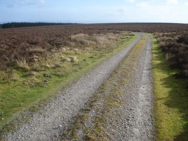
Radnor Forest in Wales Mid, United Kingdom.

Peter Evans — CC BY-SA 2.0 via Wikimedia Commons licence
Plan your visit
- Typical visit
- 1 h–3 h
- Nearest railway station
- Dolau · 6.9 km
- Free entry
- Family-friendly
- Dog-friendly
Getting there & planning your visit
To visit Radnor Forest, the nearest railway station is Dolau, located 6.9 km away. Entry to the forest is free.
About
Radnor Forest is a place of interest in Wales Mid, United Kingdom — drawn from open-data sources for visitor reference. See the linked Wikipedia article for the full description.
Photo gallery
Protected designations
- Site of Special Scientific Interest: River Teme SSSI
Designations sourced from Natural England open data under OGL v3.
From the Wikipedia article
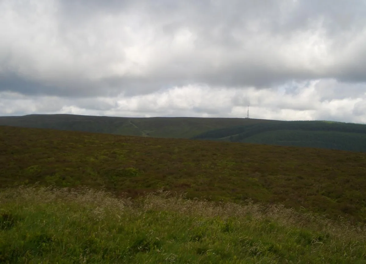
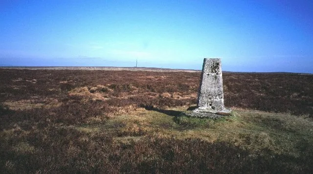
Radnor Forest (Welsh: Fforest Clud) is a rock dome composed of Silurian shales, mudstones and limestone in the historic county of Radnorshire, Powys, Mid Wales. It is a forest in the medieval sense of the word (an area of land set aside for hunting). It lies within the Welsh Marches region since Offa's Dyke lies nearby to the east. The area lies to the north of the Black Mountains and to the east of the Cambrian Mountains. Hergest Ridge is immediately to the south-east of the area (just across the English border into Herefordshire), near the small town of Kington. The highest point in the area is Rhos Fawr a broad plateau which reaches 660 metres (2,165 ft), and is equipped with a trig point to mark the summit. A similar plateau adjoining to the east, Black Mixen is the only Nuttall to have a communications mast (a radio transmitter) on its summit.
Excerpt from Wikipedia under CC BY-SA 4.0. See the source article linked in Sources below.
Background
Architecture
Part of the area is a designated and protected SSSI, with rare saxifrage and other plants. It covers the highest peaks and a rocky gorge near the centre. The vegetation of the summit ridges is fairly uniform, and is dominated by a mixture of dwarf shrubs, heather, crowberry, and bilberry. Mixed with these dwarf shrubs are hare's-tail cottongrass, purple moor-grass, sedges such as Carex binervis and a number of mosses and lichens. The dwarf shrubs are very well grown and suggest the area has suffered little from fires in the recent past and that grazing pressures are light. Purple moor-grass is but thinly scattered and does not form the extensive stands so familiar only a few miles west.…
Sourced from Wikipedia under CC BY-SA 4.0.
- Coordinates
- 52.2700, -3.1700
- Nearest railway station
- Dolau — 6.9 km
Sources
- wikidata: Q3407024 (CC0)
- wikipedia: Radnor Forest (CC BY-SA 4.0)
Other places nearby

Black Mixen
Mountains & hills · 0.6 km
Black Mixen
Natural landmarks · 0.6 km

Great Creigiau
Mountains & hills · 0.7 km

Bâch Hill
Mountains & hills · 1.2 km
Bache Hill
Natural landmarks · 1.3 km

The Whimble
Vineyards · 1.6 km
Whimble
Mountains & hills · 1.6 km

Whimble
Mountains & hills · 1.6 km

Rhos Fawr
Natural landmarks · 2.1 km

Great Rhos
Mountains & hills · 2.1 km
Rhos Fawr
Mountains & hills · 2.1 km

Stanlo Tump Mound
Literary houses · 2.5 km
Nearby
📷 3📷 3📷 3Mountains & hills · Mid Wales
Great Creigiau
Great Creigiau — a mountain in wales-mid, United Kingdom, 646 m.
📷 5📷 3📷 5Vineyards · Mid Wales
The Whimble
The Whimble — a UK vineyard in wales mid, producing English or Welsh wine from cool-climate grape varieties.
Where to eat & stay near Radnor Forest
Places to stay
 📷 5
📷 5Caravan parks · Mid Wales
Presteign Holiday Park (E)
Presteign Holiday Park (E) — a caravan park in wales mid.
 📷 5
📷 5Caravan parks · Mid Wales
Presteign Holiday Park (W)
Presteign Holiday Park (W) — a caravan park in wales mid.
 📷 5
📷 5 📷 5
📷 5Caravan parks · Mid Wales
Spring Rock Caravan Park
Spring Rock Caravan Park — a caravan park in wales mid.
 📷 5
📷 5 📷 5
📷 5Places to eat & drink
 📷 4
📷 4Historic pubs · Mid Wales
Radnorshire Arms
Radnorshire Arms in Wales Mid, United Kingdom.
 📷 5
📷 5Historic pubs · Mid Wales
The Royal Oak Public House Including Rubblestone Wing To East
The Royal Oak Public House Including Rubblestone Wing To East in Wales Mid, United Kingdom.
 📷 5
📷 5Historic pubs · Mid Wales
32 and 33, Church Street
32 and 33, Church Street in Wales Mid, United Kingdom.
 📷 4
📷 4 Flagship📷 6
 📷 7
📷 7More forests in this region
 📷 3
📷 3Forests & woodlands · Mid Wales
Cardigan Island / Ynys Aberteifi
Cardigan Island / Ynys Aberteifi is a forest or woodland in the United Kingdom.
 📷 5
📷 5Forests & woodlands · Mid Wales
Cemaes Head Nature Reserve
Cemaes Head Nature Reserve is a forest or woodland in the United Kingdom.
 📷 3
📷 3Forests & woodlands · Mid Wales
Coed Rheidol National Nature Reserve
Coed Rheidol National Nature Reserve is a forest or woodland in the United Kingdom.
 📷 5
📷 5Forests & woodlands · Mid Wales
Coedmor National Nature Reserve
Coedmor National Nature Reserve is a forest or woodland in the United Kingdom.
Frequently asked questions
- Where is Radnor Forest?
- Radnor Forest is in Mid Wales, United Kingdom.
- What is Radnor Forest?
- Radnor Forest in Wales Mid, United Kingdom.
- How do I get to Radnor Forest?
- The nearest railway station is Dolau, about 6.9 km away. Its coordinates are 52.2700°, -3.1700°.
- Is Radnor Forest a protected site?
- Yes — Radnor Forest is part of the River Teme SSSI Site of Special Scientific Interest.
- Is Radnor Forest free to visit?
- Yes, Radnor Forest is free to enter.
- How do I get to Radnor Forest?
- The nearest railway station is Dolau, about 6.9 km away.