
Mountains & hills · Mid Wales
Rhos Fawr
In or near Llangunllo with Norton.
Rhos Fawr — Named summit at 660 m.

Wikimedia Commons contributors — see linked file page for photographer and licence licence

Plan your visit
- Typical visit
- 3 h–8 h
- Best time of year
- Late spring – early autumn (May–Oct)
- Nearest railway station
- Dolau · 5.3 km
- Free entry
- Dog-friendly
Getting there & planning your visit
To visit Rhos Fawr in Mid Wales, the nearest railway station is Dolau, located 5.3 km away. Entry to the mountain is free.
About
Rhos Fawr is a named summit in the United Kingdom. Wikidata describes it as: "Named summit at 660 m.". Coordinates: 52.2670°, -3.1999°.
Photo gallery
Protected designations
- Site of Special Scientific Interest: River Teme SSSI
Designations sourced from Natural England open data under OGL v3.
From the Wikipedia article
Rhos Fawr is a mountain summit in the Radnor Forest (Mid Wales), a rather isolated dome of hills to the north of the village of New Radnor. The local rocks are sedimentary shales and mudstones with some Silurian limestone. With a height of 660 metres (2,170 ft), it is the highest point in the Radnor Forest and the historic county top of Radnorshire. The summit is located on a broad heathery plateau, which is separated from Black Mixen: the eastern plateau summit, by the cwm of Harvey Dingle. To the west is Drygarn Fawr and Gorllwyn, to the northwest Plynlimon, to the north Beacon Hill and the Clun Forest (Shropshire), and to the south the Black Mountains. There is a prominent trig point at the summit, and a very useful landmark for walkers on the broad and featureless summit plateau.
Excerpt from Wikipedia under CC BY-SA 4.0. See the source article linked in Sources below.
- Coordinates
- 52.2670, -3.1999
- Address
- Powys, Wales, historic county Radnorshire
- Nearest railway station
- Dolau — 5.3 km
Sources
- osm: n29274641 (ODbL)
- wikipedia: Rhos Fawr (CC BY-SA 4.0)
- commons: Great Rhos.jpg (CC BY-SA 4.0)
Other places nearby
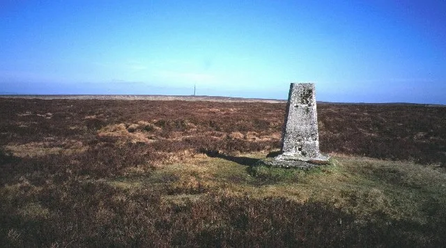
Rhos Fawr
Natural landmarks · 0.0 km

Great Rhos
Mountains & hills · 0.0 km

Esgairnantau
Mountains & hills · 1.5 km
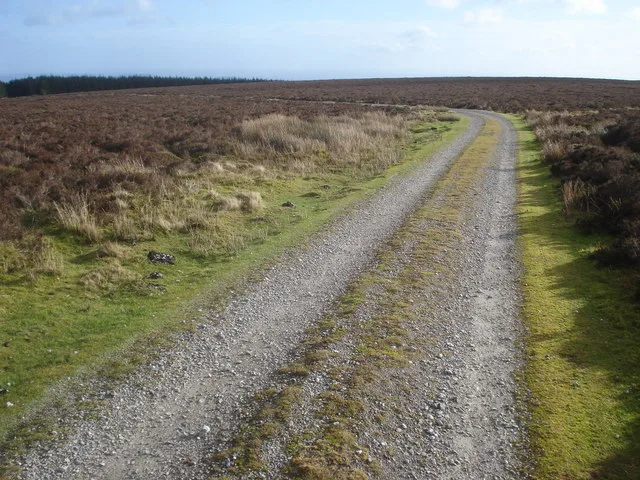
Black Mixen
Natural landmarks · 1.5 km
Black Mixen
Mountains & hills · 1.5 km

Great Creigiau
Mountains & hills · 1.6 km

Radnor Forest
Forests & woodlands · 2.1 km

Fron-wen
Mountains & hills · 2.1 km

Cowlod
Mountains & hills · 2.3 km

Whimble
Mountains & hills · 2.6 km
The Whimble
Vineyards · 2.6 km

Whimble
Mountains & hills · 2.6 km
Nearby
📷 3📷 5📷 5📷 3📷 3📷 3Mountains & hills · Mid Wales
Great Creigiau
Great Creigiau — a mountain in wales-mid, United Kingdom, 646 m.
Where to eat & stay near Rhos Fawr
Places to stay
 📷 5
📷 5Caravan parks · Mid Wales
Presteign Holiday Park (W)
Presteign Holiday Park (W) — a caravan park in wales mid.
 📷 5
📷 5Caravan parks · Mid Wales
Presteign Holiday Park (E)
Presteign Holiday Park (E) — a caravan park in wales mid.
 📷 5
📷 5 📷 5
📷 5Caravan parks · Mid Wales
Spring Rock Caravan Park
Spring Rock Caravan Park — a caravan park in wales mid.
 📷 5
📷 5 📷 5
📷 5Campsites · Mid Wales
Church House Farm Caravan & Campsite
Church House Farm Caravan & Campsite — a campsite in wales mid.
Places to eat & drink
 📷 7
📷 7 📷 4
📷 4Historic pubs · Mid Wales
Radnorshire Arms
Radnorshire Arms in Wales Mid, United Kingdom.
 📷 5
📷 5Historic pubs · Mid Wales
The Royal Oak Public House Including Rubblestone Wing To East
The Royal Oak Public House Including Rubblestone Wing To East in Wales Mid, United Kingdom.
 📷 5
📷 5Historic pubs · Mid Wales
32 and 33, Church Street
32 and 33, Church Street in Wales Mid, United Kingdom.
 📷 4
📷 4 Flagship📷 6
More mountains in this region
 📷 3
📷 3 📷 3
📷 3 📷 3
📷 3 📷 3
📷 3Frequently asked questions
- Where is Rhos Fawr?
- Rhos Fawr is in Mid Wales, United Kingdom.
- What is Rhos Fawr?
- Rhos Fawr — Named summit at 660 m.
- How do I get to Rhos Fawr?
- The nearest railway station is Dolau, about 5.3 km away. Its coordinates are 52.2670°, -3.1999°.
- Is Rhos Fawr a protected site?
- Yes — Rhos Fawr is part of the River Teme SSSI Site of Special Scientific Interest.
- Is Rhos Fawr free to visit?
- Yes, Rhos Fawr is free to enter.
- How do I get to Rhos Fawr?
- The nearest railway station is Dolau, about 5.3 km away.