
Forests & woodlands · Mid Wales
Cardigan Island / Ynys Aberteifi
Also known as: Ynys Aberteifi
In or near Aberporth.
Cardigan Island / Ynys Aberteifi is a forest or woodland in the United Kingdom.

Wikimedia Commons contributors — see linked file page for photographer and licence licence

Plan your visit
- Typical visit
- 1 h–3 h
- Free entry
- Family-friendly
- Dog-friendly
About
Cardigan Island / Ynys Aberteifi is a named forest, woodland or nature reserve in the United Kingdom. Also known as: Ynys Aberteifi. Coordinates: 52.1322°, -4.6909°.
Photo gallery
Place summary
Cardigan Island, also known as Ynys Aberteifi, is a forested area located in Mid Wales, within the parish of Y Ferwig. The site is notable for its natural landscapes and coastal views.
AI-generated from the structured facts on this page (operator, designation, listing, era). Not a substitute for visiting.
- Coordinates
- 52.1322, -4.6909
- District
- Ceredigion
- Parish
- Y Ferwig
- Postcode
- SA43 1PR
- Parliamentary constituency
- Ceredigion Preseli
- Official site
- www.welshwildlife.org
Sources
- osm: w1493651984 (ODbL)
- commons: Cardigan Island - geograph.org.uk - 27332.jpg (CC BY-SA 4.0)
Other places nearby

Cardigan Island
Mountains & hills · 0.1 km
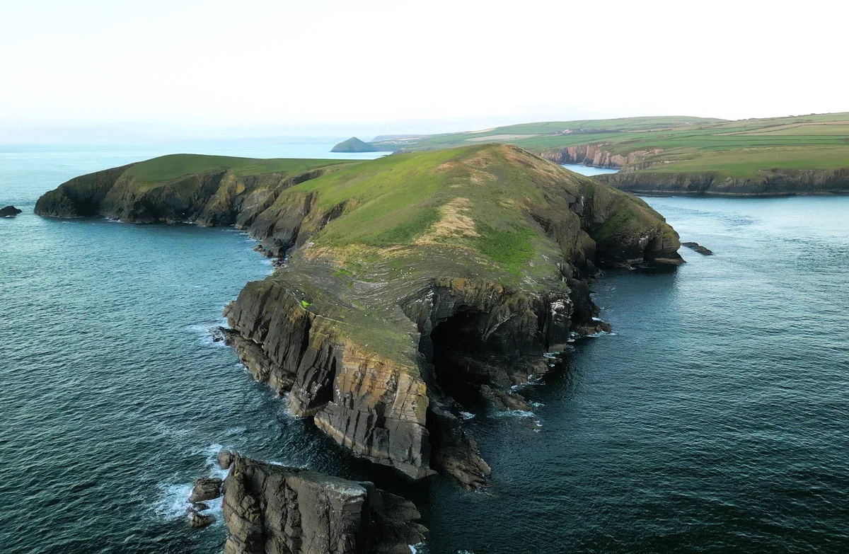
Cardigan Island
Islands · 0.2 km

Cardigan Island Coastal Farm Park
Parks · 1.2 km

Clyn-yr-Ynys
Vineyards · 1.4 km

Graig y Gwbert
Vineyards · 1.4 km

Craig Y Gwbert
Archaeological sites · 1.4 km

Gwbert Hotel
Hotels · 1.8 km
Gwbert
Villages · 1.8 km

Cardigan
Natural landmarks · 1.8 km

Crug Bychan Round Barrow
Burial mounds & barrows · 2.0 km

Towyn Warren
Mountains & hills · 2.3 km

Gwbert
Beaches · 2.5 km
Nearby
📷 5Mountains & hills · Mid Wales
Cardigan Island
Cardigan Island — mountain in wales mid. Elevation: 52 m.
📷 3📷 3Parks · Mid Wales
Cardigan Island Coastal Farm Park
Cardigan Island Coastal Farm Park — a place in Mid Wales, United Kingdom.
📷 5Vineyards · Mid Wales
Clyn-yr-Ynys
Clyn-yr-Ynys — a UK vineyard in wales mid, producing English or Welsh wine from cool-climate grape varieties.
📷 5Vineyards · Mid Wales
Graig y Gwbert
Graig y Gwbert — a UK vineyard in wales mid, producing English or Welsh wine from cool-climate grape varieties.
📷 3Archaeological sites · Mid Wales
Craig Y Gwbert
Craig Y Gwbert — an archaeological site in Mid Wales, United Kingdom.
Where to eat & stay near Cardigan Island / Ynys Aberteifi
Places to stay
📷 5 📷 5
Caravan parks · Mid Wales
Patch Caravan Park
Patch Caravan Park — a caravan park in wales mid.
 📷 5
 📷 5
Campsites · Mid Wales
Alltycoed Campsite
Alltycoed Campsite — a campsite in wales mid.
 📷 5
Caravan parks · Mid Wales
Cardigan Bay Holiday Park
Cardigan Bay Holiday Park — a caravan park in wales mid.
 📷 5
Caravan parks · Mid Wales
Ty Gwyn Caravan & Camping Park
Ty Gwyn Caravan & Camping Park — a caravan park in wales mid.
Places to eat & drink
 📷 3
Historic pubs · Mid Wales
Bar 45
Bar 45 — Historic pub — listed building or notable heritage status.
 📷 5
Historic pubs · Mid Wales
The Grosvenor
The Grosvenor — Historic pub — listed building or notable heritage status.
 📷 5
Restaurants · Mid Wales
Fusion Bar and Restaurant
Fusion Bar and Restaurant — a restaurant in wales mid.
 📷 4
Historic pubs · Mid Wales
Cardiff Arms
Cardiff Arms — Historic pub — listed building or notable heritage status.
 📷 3
Historic pubs · Mid Wales
The Pendre Inn
The Pendre Inn — Historic pub — listed building or notable heritage status.
 📷 5
More forests in this region
 📷 5
Forests & woodlands · Mid Wales
Cemaes Head Nature Reserve
Cemaes Head Nature Reserve is a forest or woodland in the United Kingdom.
 📷 3
Forests & woodlands · Mid Wales
Coed Rheidol National Nature Reserve
Coed Rheidol National Nature Reserve is a forest or woodland in the United Kingdom.
 📷 5
Forests & woodlands · Mid Wales
Coedmor National Nature Reserve
Coedmor National Nature Reserve is a forest or woodland in the United Kingdom.
 📷 3
Forests & woodlands · Mid Wales
Cors Dyfi Nature Reserve
Cors Dyfi Nature Reserve is a forest or woodland in the United Kingdom.
Frequently asked questions
- Where is Cardigan Island / Ynys Aberteifi?
- Cardigan Island / Ynys Aberteifi is in Mid Wales, United Kingdom (postcode SA43 1PR), in the parish of Y Ferwig.
- What is Cardigan Island / Ynys Aberteifi?
- Cardigan Island / Ynys Aberteifi is a forest or woodland in the United Kingdom.
- How do I get to Cardigan Island / Ynys Aberteifi?
- The nearest town is Aberporth. Drivers can use postcode SA43 1PR.
- Is Cardigan Island / Ynys Aberteifi free to visit?
- Yes, Cardigan Island / Ynys Aberteifi is free to enter.
- How do I get to Cardigan Island / Ynys Aberteifi?
- Drivers can navigate to postcode SA43 1PR. It sits within the Ceredigion Preseli parliamentary constituency.