
Mountains & hills · North East England
Pate Hole
In or near Sandford.
Pate Hole is a mountain or hill in the United Kingdom.

Wikimedia Commons contributors — see linked file page for photographer and licence licence

Plan your visit
- Typical visit
- 3 h–8 h
- Best time of year
- Late spring – early autumn (May–Oct)
- Nearest railway station
- Warcop · 8.3 km
- Free entry
- Dog-friendly
Getting there & planning your visit
To visit Pate Hole, the nearest railway station is Warcop, located 8.3 km away. The postcode for sat-nav is CA16 6HB, and entry is free.
About
Pate Hole is a named summit in the United Kingdom. Coordinates: 54.5035°, -2.4981°. This entry is part of The Great Britain Guide, a free, ad-free, open-data tourist directory.
Photo gallery
Protected designations
- Site of Special Scientific Interest: River Eden and Tributaries SSSI
- Area of Outstanding Natural Beauty: North Pennines
Designations sourced from Natural England open data under OGL v3.
From the Wikipedia article
Pate Hole is a solutional cave located adjacent to Asby Gill 1 kilometre (0.62 mi) south of Great Asby in Cumbria, England. It is 970 metres (3,180 ft) long and has a vertical range of 33 metres (108 ft). The entrance is normally dry, but in flood it becomes an impressive resurgence. Its name derives from the north country word for badger. It consists of three main passages. From the entrance a stooping height passage heading south-east reaches a large 6 metres (20 ft) deep pool after 330 metres (1,080 ft) from which a stream emerges. This flows down a low passage to the north for some 270 metres (890 ft) where a sump is reached. The third main passage continues south underwater from the pool for 225 metres (738 ft) at a depth of 27 metres (89 ft) where it reaches a junction and becomes too restricted. The cave is formed in Carboniferous limestone, and is thought to drain the Great Asby Scar area 3 kilometres (1.9 mi) to the south-west. The resurgence is presumed to be St. Thomas's Well in Great Asby. The main part of the cave has been known for a long time, and it was an object of curiosity in the nineteenth century. A brief foray into it was described in The Gentleman's Magazine in 1791, and a description appeared in The Monthly Magazine in 1802. The first full description complete with passage lengths appeared in 1813. The first account of an exploration by cavers was in 1941 by members of the Yorkshire Ramblers' Club, and in November 1946 it was surveyed by a group from Appleby Grammar School led by Brian Price. The upstream sump was first dived for about 10 metres (33 ft) to a descending rift in 1960 by members of the Cave Diving Group, at which time the main part of the cave was re-surveyed by Warburton et alia. Further exploration took place in 1975-1976 by members of the same group to reach the current limit.
Excerpt from Wikipedia under CC BY-SA 4.0. See the source article linked in Sources below.
- Coordinates
- 54.5035, -2.4981
- District
- Westmorland and Furness
- Parish
- Asby
- Postcode
- CA16 6HB
- Parliamentary constituency
- Westmorland and Lonsdale
- Nearest railway station
- Warcop — 8.3 km
Sources
- wikidata: Q7144386 (CC0)
- wikipedia: Pate Hole (CC BY-SA 4.0)
- commons: Pate Hole - entrance.jpg (CC BY-SA 4.0)
Other places nearby

Coast to Coast Walk
Long-distance walking trails · 0.4 km

Great Asby
Historic churches · 0.9 km

Romano-British enclosed hut circle settlement
Archaeological sites · 1.3 km

Romano-British enclosed hut circle settlement
Archaeological sites · 1.3 km

Great Asby
Villages · 1.3 km

Asby
Other places · 1.3 km

Turkeytarn Hill
Mountains & hills · 1.4 km

Drybeck
Historic churches · 1.9 km

Whitley Crag, Asby
Vineyards · 2.3 km

Grange Scar
Mountains & hills · 2.5 km

Linglow Hill
Mountains & hills · 2.6 km
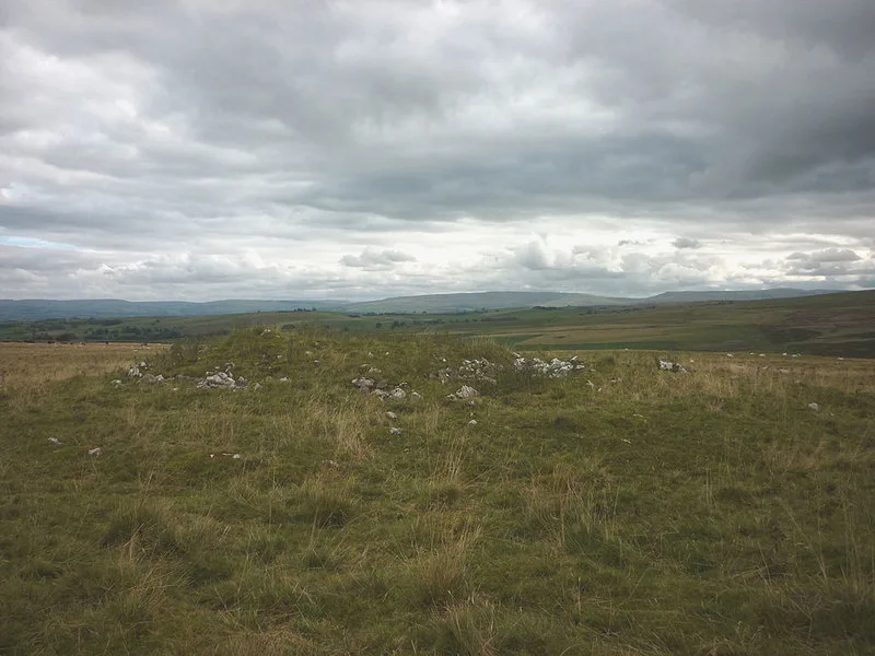
Hollin Stump round cairn
Archaeological sites · 2.7 km
Nearby
★ Iconic📷 4Long-distance walking trails · North West England
Coast to Coast Walk
Wainwright's 192-mile route from the Lake District to North York Moors coast.
📷 4Historic churches · North East England
Great Asby
Great Asby in England North East, United Kingdom.
📷 3Archaeological sites · North West England
Romano-British enclosed hut circle settlement
Romano-British enclosed hut circle settlement — a archaeological in england-north-west, United Kingdom.
📷 5Archaeological sites · North West England
Romano-British enclosed hut circle settlement
Romano-British enclosed hut circle settlement — archaeological in england north west.
📷 5📷 4Where to eat & stay near Pate Hole
Places to stay
 📷 5
📷 5Caravan parks · North West England
Chapel Farm Caravan Park
Chapel Farm Caravan Park — a caravan park in england north west.
 📷 5
📷 5 📷 5
📷 5Caravan parks · North East England
Wild Rose Caravan Site
Wild Rose Caravan Site — a caravan park in england north east.
 📷 5
📷 5Caravan parks · North East England
Midtown Farm Camping & Caravan Site
Midtown Farm Camping & Caravan Site — a caravan park in england north east.
 📷 5
📷 5Hostels · North West England
Bents Camping Barn
Bents Camping Barn — a hostel in england north west.
 📷 5
📷 5B&Bs · North East England
Bongate House
Bongate House — a bed-and-breakfast in england north east.
Places to eat & drink
 📷 5
📷 5Historic pubs · North East England
1, Scattergate
1, Scattergate in England North East, United Kingdom.
 📷 7
📷 7Cafés · North West England
The White Hare Cafe
The White Hare Cafe — a café in england north west.
 📷 5
📷 5Cafés · North West England
The Cross Keys Temperance Inn
The Cross Keys Temperance Inn — a café in england north west.
 📷 5
📷 5Cafés · North West England
Gun Dog Coffee Shop
Gun Dog Coffee Shop — a café in england north west.
 📷 5
📷 5 📷 3
📷 3More mountains in this region
 📷 5
📷 5Mountains & hills · North East England
Danby High Moor
Danby High Moor — a hill or mountain in england yorkshire.
 📷 5
📷 5Mountains & hills · North East England
Arndale Hill
Arndale Hill — mountain in england yorkshire. Elevation: 515.7 m.
 📷 5
📷 5Mountains & hills · North East England
Peat Hill
Peat Hill — mountain in england yorkshire. Elevation: 396 m.
 📷 5
📷 5Mountains & hills · North East England
Cocker Hill
Cocker Hill — mountain in england yorkshire. Elevation: 470 m.
Frequently asked questions
- Where is Pate Hole?
- Pate Hole is in North-East England, United Kingdom (postcode CA16 6HB), in the parish of Asby.
- What is Pate Hole?
- Pate Hole is a mountain or hill in the United Kingdom.
- How do I get to Pate Hole?
- The nearest railway station is Warcop, about 8.3 km away. The nearest town is Sandford. Drivers can use postcode CA16 6HB.
- Is Pate Hole a protected site?
- Yes — Pate Hole is part of the River Eden and Tributaries SSSI Site of Special Scientific Interest and the North Pennines National Landscape (AONB).
- Is Pate Hole free to visit?
- Yes, Pate Hole is free to enter.
- How do I get to Pate Hole?
- Drivers can navigate to postcode CA16 6HB. It sits within the Westmorland and Lonsdale parliamentary constituency.