
Canals · East Midlands
Oakham Canal
In or near Burley.
Oakham Canal — disused canal in the English Midlands.

Wikimedia Commons contributors — see linked file page for photographer and licence licence

Plan your visit
- Typical visit
- 1 h–2 h
- Nearest railway station
- Oakham · 0.9 km
- Free entry
- Dog-friendly
Getting there & planning your visit
To visit Oakham Canal, the nearest railway station is Oakham, located 0.9 km away. Entry to the canal is free.
About
Oakham Canal is a canal in the United Kingdom. Wikidata describes it as: "disused canal in the English Midlands". Coordinates: 52.6792°, -0.7261°.
Photo gallery
From the Wikipedia article
The Oakham Canal ran from Oakham, Rutland to Melton Mowbray, Leicestershire in the East Midlands of England. It opened in 1802, but it was never a financial success, and it suffered from the lack of an adequate water supply. It closed after 45 years, when it was bought by the Midland Railway to allow the Syston and Peterborough Railway to be built, partly along its course. Most of it is infilled, although much of its route can still be seen in the landscape, and there are short sections which still hold water.
Excerpt from Wikipedia under CC BY-SA 4.0. See the source article linked in Sources below.
Background
History
| repeal_date = | amendments = Oakham Canal Act 1800 | repealing_legislation = | related_legislation = | status = Amended | original_text = https://books.google.co.uk/books?id=XwbC08mcZ-4C&pg=PA363 | collapsed = yes }} Plans for a canal to Oakham were first conceived in 1785, by some of those proposing the Melton Mowbray Navigation. William Jessop was asked to survey a route, but it was Robert Whitworth who carried out the work. His route was generally further west than the adopted route, passing to the west of Stapleford, and then through Leesthorpe and Ashwell to reach Oakham. It would have required 13 locks. Meetings were held in December 1785 to consider proposals for an extension…
Sourced from Wikipedia under CC BY-SA 4.0.
- Coordinates
- 52.6792, -0.7261
- District
- Rutland
- Parish
- Oakham
- Postcode
- LE15 6PS
- Parliamentary constituency
- Rutland and Stamford
- Established
- 1802
- Nearest railway station
- Oakham — 0.9 km
Sources
- wikidata: Q7073886 (CC0)
- wikipedia: Oakham Canal (CC BY-SA 4.0)
- commons: The Oakham Canal - geograph.org.uk - 146257.jpg (CC BY-SA 4.0)
Other places nearby

Rutland County College
Natural landmarks · 0.8 km

Oakham Castle
Literary houses · 0.9 km

Oakham Castle
Castles · 0.9 km
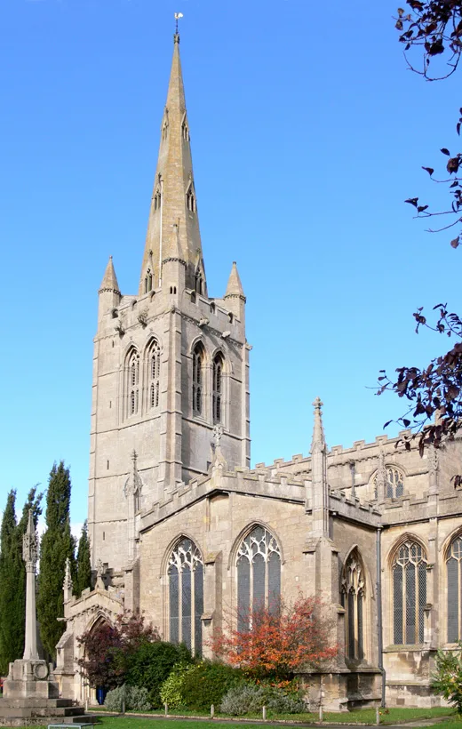
All Saints' Church, Oakham
Historic churches · 0.9 km

Oakham railway station
Heritage railway stations · 0.9 km

Barleythorpe
Historic churches · 0.9 km

Oakham War Memorial
Memorials & monuments · 0.9 km

San Giorgio
Restaurants · 1.0 km

Dean's Street
Memorials & monuments · 1.0 km

Hayne House
Historic houses · 1.1 km

Flores House
Historic houses · 1.1 km

Oakham Village Sign
Public art & sculpture · 1.1 km
Nearby
📷 5Natural landmarks · East Midlands
Rutland County College
Rutland County College — a school heritage in england-west-midlands, United Kingdom.
📷 5Literary houses · East Midlands
Oakham Castle
Oakham Castle — a literary house museum in england west midlands.
📷 3📷 4Historic churches · East Midlands
All Saints' Church, Oakham
All Saints' Church, Oakham — church in Rutland, East Midlands, England, UK.
📷 5Heritage railway stations · East Midlands
Oakham railway station
Oakham railway station — a Grade II-listed railway station in england-west-midlands, United Kingdom.
📷 5Historic churches · East Midlands
Barleythorpe
Barleythorpe is a village and civil parish in the county of Rutland in the East Midlands of England. It is located about a mile (1.6 km) north-west of Oakham. The population at the 2001 census was 178
Where to eat & stay near Oakham Canal
Places to stay
 📷 7
📷 7Hotels · East Midlands
Wisteria Hotel
Wisteria Hotel — a hotel in england west midlands.
 📷 5
📷 5Caravan parks · East Midlands
Greendale Farm Caravan Park
Greendale Farm Caravan Park — a caravan park in england east midlands.
 📷 5
📷 5Campsites · East Midlands
The Paddock
The Paddock — a campsite in england west midlands.
📷 5Campsites · East Midlands
Lyndon Top
Lyndon Top — a campsite in england west midlands.
 📷 5
📷 5Campsites · East Midlands
Rutland Water Campsite
Rutland Water Campsite — a campsite in england west midlands.
 📷 5
📷 5Campsites · East Midlands
Wing Hall Camping & Caravan Site
Wing Hall Camping & Caravan Site — a campsite in england west midlands.
Places to eat & drink
📷 5 📷 5
📷 5Historic pubs · East Midlands
Three Horse Shoes Public House
Three Horse Shoes Public House in England East, United Kingdom.
 📷 5
📷 5Historic pubs · East Midlands
The Stilton Cheese
The Stilton Cheese in England East Midlands, United Kingdom.
 📷 5
📷 5 📷 5
📷 5Historic pubs · East Midlands
The White Swan Public House And Attached Carriage Arch
The White Swan Public House And Attached Carriage Arch in England East, United Kingdom.
 📷 7
📷 7More places in this region
 📷 5
📷 5 📷 3
📷 3Canals · East Midlands
Bond End Canal
Bond End Canal — canal in Staffordshire, England, 1775–1874.
 📷 3
📷 3Canals · East Midlands
Catchwater Drain
Catchwater Drain — artificial watercourse in Lincolnshire, England.
 📷 3
📷 3Canals · East Midlands
Charnwood Forest Canal
Charnwood Forest Canal is a canal in the United Kingdom.
Frequently asked questions
- Where is Oakham Canal?
- Oakham Canal is in the East Midlands, United Kingdom (postcode LE15 6PS), in the parish of Oakham.
- What is Oakham Canal?
- Oakham Canal — disused canal in the English Midlands.
- How do I get to Oakham Canal?
- The nearest railway station is Oakham, about 0.9 km away. The nearest town is Burley. Drivers can use postcode LE15 6PS.
- When was Oakham Canal built?
- Built or established in 1802.
- Is Oakham Canal free to visit?
- Yes, Oakham Canal is free to enter.
- How do I get to Oakham Canal?
- The nearest railway station is Oakham, about 0.9 km away. Drivers can navigate to postcode LE15 6PS.