Canals · East Midlands
Bond End Canal
Bond End Canal — canal in Staffordshire, England, 1775–1874.

Wikimedia Commons licence
Plan your visit
- Typical visit
- 1 h–2 h
- Nearest railway station
- Burton-on-Trent · 0.9 km
- Free entry
- Dog-friendly
About
Bond End Canal is a canal in the United Kingdom. Wikidata describes it as: "canal in Staffordshire, England, 1775–1874". Coordinates: 52.8064°, -1.6553°.
Photo gallery
From the Wikipedia article
The Bond End Canal was a canal in Burton-on-Trent, Staffordshire, England. It was built in 1774–75 by the Burton Boat Company who operated the Trent Navigation between Wilden Ferry and Burton and who feared that the Trent and Mersey Canal would threaten their trade (the canal joined the river downstream of Wilden Ferry and ran via Burton to North West England). The Bond End Canal ran between the Trent at Bond End, near the town centre, and a basin adjacent to the Trent and Mersey Canal at Shobnall. Originally cargo had to be unloaded to pass between vessels on the two canals but in 1794 permission was granted for a lock to provide direct passage between the two. The Trent and Mersey Canal eventually won the battle for trade and the Trent Navigation was abandoned by the 1810s. The Bond End Canal remained in use until the 1860s. In 1874 the Midland Railway received permission to build a branch line along the route of the canal. They retained the lock at Shobnall as an interchange between the railway and the Trent and Mersey Canal but most of the Bond End Canal was infilled by 1900. After nationalisation the lock at Shobnall was purchased and converted into a marina and chandlery. After the branch line fell into disuse much of the route of the Bond End Canal now forms the alignment of the A5189 Evershed Way.
Excerpt from Wikipedia under CC BY-SA 4.0. See the source article linked in Sources below.
Background
History
William Paget, 6th Baron Paget and his successors had the right under the River Trent Navigation Act 1698 (10 Will. 3. c. 26) to make the River Trent navigable from Wilden Ferry to Bond End in Burton on Trent, and to charge a toll on freight. The Bond End Canal has sometimes been referred to as a branch of the Trent and Mersey Canal but this is incorrect as they were always in separate ownership.
Architecture
The Bond End Canal provided a useful link between the Trent and Mersey Canal and many of Burton's breweries which were located closer to the River Trent, generally around the town's High Street. The canal facilitated the shipment of beer to Hull and Liverpool. Lord Paget leased rights over the canal to the Burton Boat Company which ran its own fleet on the canal and maintained depots as far afield as Birmingham. The Burton Boat Company fleet ceased operation in 1805 and most other waterborne traffic on the Trent above Wilden Ferry ceased. The Bond End Canal survived for longer than the Trent Navigation and in 1843 a system was installed at the Bond End lock to help flush the town's main…
Sourced from Wikipedia under CC BY-SA 4.0.
- Coordinates
- 52.8064, -1.6553
- County
- Staffordshire
- District
- East Staffordshire
- Parish
- Shobnall
- Postcode
- DE14 2AU
- Parliamentary constituency
- Burton and Uttoxeter
- Established
- 1775
- Nearest railway station
- Burton-on-Trent — 0.9 km
Sources
- wikidata: Q135436280 (CC0)
- wikipedia: Bond End Canal (CC BY-SA 4.0)
Other places nearby
Loading nearby places…
Nearby
 📷 3
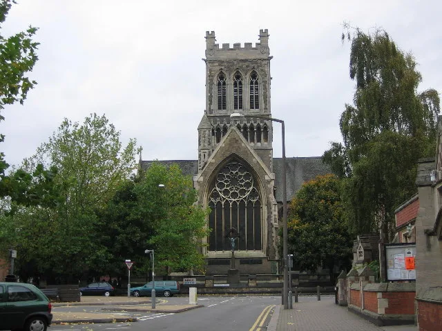
📷 3Historic churches · East Midlands
St Paul's, Burton upon Trent
St Paul's, Burton upon Trent — church in Shobnall, East Staffordshire, England, UK.
 📷 5
📷 5Museums · East Midlands
East Staffordshire
East Staffordshire is a local government district with borough status in Staffordshire, England. The council is based in Burton upon Trent. The borough also contains the town of Uttoxeter and numerous
 📷 3
📷 3Public art & sculpture · East Midlands
Michael Arthur Bass
Michael Arthur Bass — a public art in england-east-midlands, United Kingdom.
 📷 3
📷 3Theatres · East Midlands
Odeon Burton-upon-Trent
Odeon Burton-upon-Trent in England East Midlands, United Kingdom.
Hotels · East Midlands
Travelodge Burton upon Trent Central
Travelodge Burton upon Trent Central — a hotel in england east midlands. 2-star. Brand: Travelodge.
 📷 3
📷 3Museums · East Midlands
Sinai Park House
Sinai Park House — a museum in england-east-midlands, United Kingdom.
More places in this region
 📷 5
📷 5Canals · East Midlands
Black Sluice
Black Sluice is a canal in the United Kingdom.
 📷 3
📷 3Canals · East Midlands
Catchwater Drain
Catchwater Drain — artificial watercourse in Lincolnshire, England.
 📷 3
📷 3Canals · East Midlands
Charnwood Forest Canal
Charnwood Forest Canal is a canal in the United Kingdom.
 📷 3
📷 3Canals · East Midlands
Chesterfield Canal
Chesterfield Canal — Canal in the East Midlands of England.
Frequently asked questions
- Where is Bond End Canal?
- Bond End Canal is in Staffordshire, the East Midlands, United Kingdom (postcode DE14 2AU), in the parish of Shobnall.
- When was Bond End Canal built?
- Built or established in 1775.
- Is Bond End Canal free to visit?
- Yes, Bond End Canal is free to enter.
- How do I get to Bond End Canal?
- The nearest railway station is Burton-on-Trent, about 0.9 km away. Drivers can navigate to postcode DE14 2AU.