
Canals · East Midlands
Black Sluice
In or near Sutterton.
Black Sluice is a canal in the United Kingdom.

Wikimedia Commons licence
Plan your visit
- Typical visit
- 1 h–2 h
- Nearest railway station
- Boston · 1.3 km
- Free entry
- Dog-friendly
About
Black Sluice is a canal in the United Kingdom. Coordinates: 52.9666°, -0.0259°. This entry is part of The Great Britain Guide, a free, ad-free, open-data tourist directory.
Photo gallery
From the Wikipedia article
The Black Sluice is the name given to the structure that controls the flow of the South Forty-Foot Drain into The Haven, at Boston, Lincolnshire, England.
Excerpt from Wikipedia under CC BY-SA 4.0. See the source article linked in Sources below.
Background
History
The original Black Sluice was probably the Skirbeck Sluice where Earl of Lindsey's 1635 attempt to drain what was then called the Lindsey Levels ran to the sea. The ensuing battle with the population left the works destroyed, and this seems to be the origin of the name Black Sluice. The name became associated with the area drained by the original 40 foot drain, and has been used for each successive outfall from the area, and for the name of the authority responsible for the drainage. Created in 1765 the Black Sluice Commissioners are succeeded today by the Black Sluice Internal Drainage Board and a range of interlocking boards and authorities: The Witham and Steeping Rivers Catchment Board,…
Description
The lock which gave passage past the Black Sluice fell into disrepair after the second world war, but was restored to full operation in 2008 as part of the Fens Waterways Link scheme to improve navigation through the fens for pleasure craft. A formal opening of the lock was held on 20 March 2009. The new lock can handle boats up to 21 m long, 6 m broad, and with draught of up to 2.8 m on the most favourable tides. While the lock itself has no airdraught restrictions, London Road Bridge, immediately upstream has limited headroom in the form of an arch at nearly 3.4 m in the centre and as little as 1.7 m at the lowest usable point. Connection to Lincoln is further restricted by the size of…
Sourced from Wikipedia under CC BY-SA 4.0.
- Coordinates
- 52.9666, -0.0259
- County
- Lincolnshire
- District
- Boston
- Parish
- Boston, unparished area
- Postcode
- PE21 7RE
- Parliamentary constituency
- Boston and Skegness
- Nearest railway station
- Boston — 1.3 km
Sources
- wikidata: Q4921859 (CC0)
- wikipedia: Black Sluice (CC BY-SA 4.0)
Other places nearby

Skirbeck Quarter War Memorial
Memorials & monuments · 0.3 km

Port of Boston
Marinas · 0.5 km

Baptist Chapel And Schoolroom
Chapels · 0.8 km

Boston, Lincolnshire
Castles · 0.9 km

Hussey Tower
Natural landmarks · 0.9 km

Haven Cinema
Theatres · 0.9 km

Savoy
Cinemas · 1.0 km

Fydell House And Wall And Railings And 2 Urns
Historic houses · 1.0 km

Boston Guildhall Museum
Museums · 1.1 km
Boston Guildhall
Museums · 1.1 km

Cosy Picturehouse
Theatres · 1.1 km
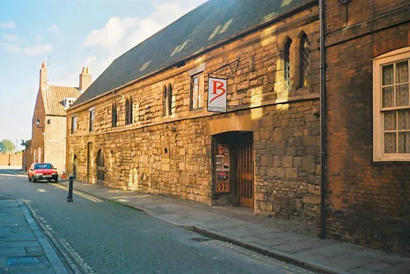
Blackfriars Theatre & Arts Centre
Theatres · 1.1 km
Nearby
📷 3Memorials & monuments · East Midlands
Skirbeck Quarter War Memorial
Skirbeck Quarter War Memorial — Grade II listed building-listed memorial in england-east-midlands, United Kingdom.
📷 5Marinas · East Midlands
Port of Boston
Port of Boston — a marina in england east midlands.
📷 3Chapels · East Midlands
Baptist Chapel And Schoolroom
Baptist Chapel And Schoolroom — chapel in Boston, Lincolnshire, England, UK.
📷 5Castles · East Midlands
Boston, Lincolnshire
Boston, Lincolnshire — a castle in england-east-midlands, United Kingdom.
📷 3Natural landmarks · East Midlands
Hussey Tower
Hussey Tower — a place in East Midlands, United Kingdom.
📷 4Where to eat & stay near Black Sluice
Places to stay
 📷 5
📷 5Hotels · East Midlands
The White Hart Hotel
The White Hart Hotel — a hotel in england east midlands.
 📷 5
📷 5Campsites · East Midlands
Meadowvale Park
Meadowvale Park — a campsite in england east midlands.
 📷 5
📷 5 📷 5
📷 5Caravan parks · East Midlands
Hall Hills Park
Hall Hills Park — a caravan park in england east midlands.
 📷 5
📷 5Campsites · East Midlands
Orchard Holiday Park
Orchard Holiday Park — a campsite in england east midlands.
 📷 5
📷 5Campsites · East Midlands
Orchard Holiday Park
Orchard Holiday Park — a campsite in england east midlands.
Places to eat & drink
 📷 5
📷 5 📷 5
📷 5 📷 5
📷 5Restaurants · East Midlands
Captain Cod Fish and Chip Restaurant
Captain Cod Fish and Chip Restaurant — a restaurant in england east midlands.
 📷 5
📷 5Historic pubs · East Midlands
The Old King's Head
The Old King's Head in England East, United Kingdom.
 📷 5
📷 5 📷 5
📷 5Historic pubs · East Midlands
Lea Gate Public House
Lea Gate Public House in England East, United Kingdom.
More places in this region
 📷 3
📷 3Canals · East Midlands
Bond End Canal
Bond End Canal — canal in Staffordshire, England, 1775–1874.
 📷 3
📷 3Canals · East Midlands
Catchwater Drain
Catchwater Drain — artificial watercourse in Lincolnshire, England.
 📷 3
📷 3Canals · East Midlands
Charnwood Forest Canal
Charnwood Forest Canal is a canal in the United Kingdom.
 📷 3
📷 3Canals · East Midlands
Chesterfield Canal
Chesterfield Canal — Canal in the East Midlands of England.
Frequently asked questions
- Where is Black Sluice?
- Black Sluice is in Lincolnshire, the East Midlands, United Kingdom (postcode PE21 7RE), in the parish of Boston, unparished area.
- What is Black Sluice?
- Black Sluice is a canal in the United Kingdom.
- How do I get to Black Sluice?
- The nearest railway station is Boston, about 1.3 km away. The nearest town is Sutterton. Drivers can use postcode PE21 7RE.
- Is Black Sluice free to visit?
- Yes, Black Sluice is free to enter.
- How do I get to Black Sluice?
- The nearest railway station is Boston, about 1.3 km away. Drivers can navigate to postcode PE21 7RE.