
Historic churches · East Midlands
Barleythorpe
In or near Langham.
Barleythorpe is a village and civil parish in the county of Rutland in the East Midlands of England. It is located about a mile (1.6 km) north-west of Oakham. The population at the 2001 census was 178

Andrew Tatlow — CC BY-SA 2.0 via Wikimedia Commons licence

Plan your visit
- Typical visit
- 30 min–1 h
- Nearest railway station
- Oakham · 0.9 km
- Free entry
Getting there & planning your visit
Barleythorpe is located in the West Midlands region, with the postcode LE15 7GH. The nearest railway station is Oakham, which is 0.9 km away. Entry to the church is free.
About
Barleythorpe is a village and civil parish in the county of Rutland in the East Midlands of England. It is located about a mile (1.6 km) north-west of Oakham. The population at the 2001 census was 178, increasing to 207 at the 2011 census. The village's name means 'Outlying farm/settlement'. 'Barley' comes from the later addition of the family name 'le Bolour' which is often confused with the crop. Barleythorpe Hall was a home of Lord Lonsdale until 1926. After being sold by Lord Lonsdale to Lawrence Kimball, the Hall burned down in 1934 and was rebuilt in a more modern style. It was later an elderly person's home from 1970 until 2006. It was sold to Hazelton Homes, who in 2018, transformed the building into luxury apartments. Alongside was the training and conference centre of EEF East Midlands and Mid-Anglia which was sold to Rutland County Council in 2011. The building was refurbished and let to Rutland County College and Oakham United Football Club. In August 2017 the college moved back to their main site at Great Casterton and Rutland County Council opened a serviced business centre called The King Centre, named after former Leader of Rutland County Council, Terry King, who retired in 2016. The building is now home to around 30 small businesses and a café which is open to the public. Until January 2007, Main Street was the A606 but the village now benefits from the Oakham Bypass and the main road has become the B640. New housing estates are being built in the parish
Photo gallery
From the Wikipedia article
Barleythorpe is a village and civil parish in the county of Rutland in the East Midlands of England. It is located about a mile (1.6 km) north-west of Oakham. The population at the 2001 census was 178, increasing to 207 at the 2011 census. The village's name means 'Outlying farm/settlement'. 'Barley' comes from the later addition of the family name 'le Bolour' which is often confused with the crop. Barleythorpe Hall was a home of Lord Lonsdale until 1926. After being sold by Lord Lonsdale to Lawrence Kimball, the Hall burned down in 1934 and was rebuilt in a more modern style. It was later an elderly person's home from 1970 until 2006. It was sold to Hazelton Homes, who in 2018, transformed the building into luxury apartments. Alongside was the training and conference centre of EEF East Midlands and Mid-Anglia which was sold to Rutland County Council in 2011. The building was refurbished and let to Rutland County College and Oakham United Football Club. In August 2017 the college moved back to their main site at Great Casterton and Rutland County Council opened a serviced business centre called The King Centre, named after former Leader of Rutland County Council, Terry King, who retired in 2016. The building is now home to around 30 small businesses and a café which is open to the public. Until January 2007, Main Street was the A606 but the village now benefits from the Oakham Bypass and the main road has become the B640. New housing estates are being built in the parish as Oakham expands. Facilities in Barleythorpe include the supermarket Aldi, and a BP filling station with a Marks and Spencer Simply Food store attached.[1]
Excerpt from Wikipedia under CC BY-SA 4.0. See the source article linked in Sources below.
- Coordinates
- 52.6800, -0.7400
- District
- Rutland
- Parish
- Barleythorpe
- Postcode
- LE15 7GH
- Parliamentary constituency
- Rutland and Stamford
- Nearest railway station
- Oakham — 0.9 km
- Official site
- www.visionofbritain.org.uk
Sources
- wikipedia: Barleythorpe (CC BY-SA 4.0)
Other places nearby

Rutland County College
Natural landmarks · 0.6 km

Oakham railway station
Heritage railway stations · 0.9 km

Oakham Canal
Canals · 0.9 km

Hayne House
Historic houses · 1.1 km

Mini Monsters
Theme parks · 1.2 km
.jpg?width=1200)
Chapel Of The Hospitallers Of St John The Evangelist And St Anne
Chapels · 1.3 km

San Giorgio
Restaurants · 1.3 km
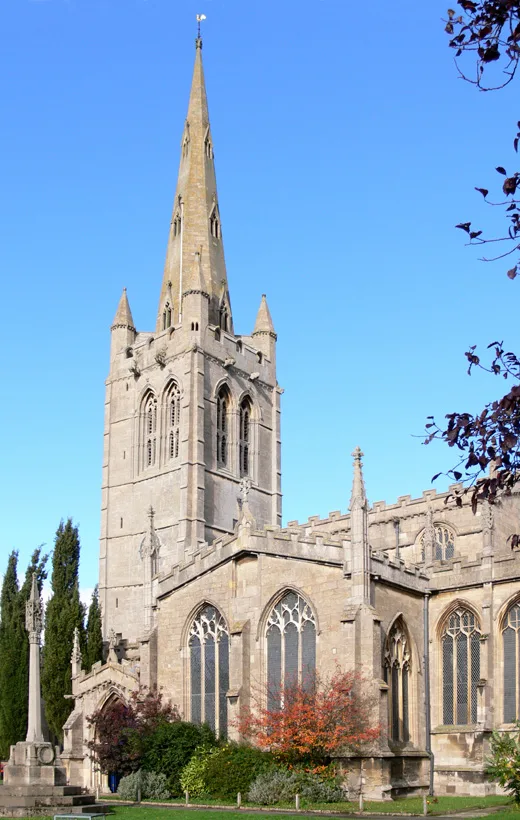
All Saints' Church, Oakham
Historic churches · 1.3 km

Dean's Street
Memorials & monuments · 1.3 km

Oakham War Memorial
Memorials & monuments · 1.3 km

Oakham Castle
Literary houses · 1.3 km

Oakham Castle
Castles · 1.3 km
Nearby
📷 5Natural landmarks · East Midlands
Rutland County College
Rutland County College — a school heritage in england-west-midlands, United Kingdom.
📷 5Heritage railway stations · East Midlands
Oakham railway station
Oakham railway station — a Grade II*-listed railway station in england-west-midlands, United Kingdom.
📷 3📷 3📷 3Theme parks · East Midlands
Mini Monsters
Mini Monsters — a theme park in england-west-midlands, United Kingdom.
📷 3Chapels · East Midlands
Chapel Of The Hospitallers Of St John The Evangelist And St Anne
Chapel Of The Hospitallers Of St John The Evangelist And St Anne — chapel in Oakham, Rutland, England, UK.
Where to eat & stay near Barleythorpe
Places to stay
 📷 7
📷 7Hotels · East Midlands
Wisteria Hotel
Wisteria Hotel — a hotel in england west midlands.
 📷 5
📷 5Caravan parks · East Midlands
Greendale Farm Caravan Park
Greendale Farm Caravan Park — a caravan park in england east midlands.
 📷 5
📷 5Campsites · East Midlands
The Paddock
The Paddock — a campsite in england west midlands.
📷 5Campsites · East Midlands
Lyndon Top
Lyndon Top — a campsite in england west midlands.
 📷 5
📷 5Campsites · East Midlands
Wing Hall Camping & Caravan Site
Wing Hall Camping & Caravan Site — a campsite in england west midlands.
 📷 5
📷 5Campsites · East Midlands
Rutland Water Campsite
Rutland Water Campsite — a campsite in england west midlands.
Places to eat & drink
📷 5 📷 5
📷 5Historic pubs · East Midlands
Three Horse Shoes Public House
Three Horse Shoes Public House in England East, United Kingdom.
 📷 5
📷 5Historic pubs · East Midlands
The Stilton Cheese
The Stilton Cheese in England East Midlands, United Kingdom.
 📷 5
📷 5 📷 7
📷 7 📷 7
📷 7Historic pubs · East Midlands
Anne of Cleves
Anne of Cleves — Historic pub — listed building or notable heritage status.
More places in this region
 📷 5
📷 5Historic churches · East Midlands
All Saints' Church, Stamford
All Saints' Church, Stamford — church in Stamford, Lincolnshire, England, UK.
 📷 5
📷 5Historic churches · East Midlands
Church of All Saints
Church of All Saints — church in Little Casterton, Rutland, United Kingdom.
 📷 5
📷 5Historic churches · East Midlands
Church of All Saints
Church of All Saints — church in Fenland, UK.
 📷 5
📷 5Historic churches · East Midlands
Church of St Leonard
Church of St Leonard — church in Fenland, UK.
Frequently asked questions
- Where is Barleythorpe?
- Barleythorpe is in the West Midlands, United Kingdom (postcode LE15 7GH), in the parish of Barleythorpe.
- What is Barleythorpe?
- Barleythorpe is a village and civil parish in the county of Rutland in the East Midlands of England. It is located about a mile (1.6 km) north-west of Oakham. The population at the 2001 census was 178
- How do I get to Barleythorpe?
- The nearest railway station is Oakham, about 0.9 km away. Drivers can use postcode LE15 7GH.
- Is Barleythorpe free to visit?
- Yes, Barleythorpe is free to enter.
- How do I get to Barleythorpe?
- The nearest railway station is Oakham, about 0.9 km away. Drivers can navigate to postcode LE15 7GH.