Natural landmarks · North West England
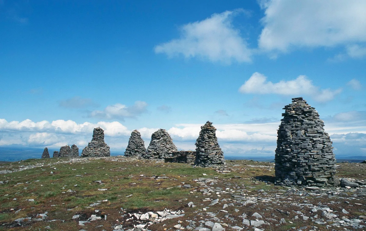
Nine Standards Rigg
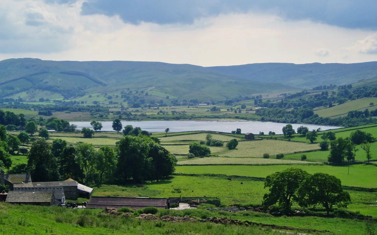
Nine Standards Rigg — mountain in United Kingdom.

Wikimedia Commons contributors — see linked file page for photographer and licence licence
Plan your visit
- Typical visit
- 1 h–2 h
- Nearest railway station
- Kirkby Stephen East · 5.7 km
- Free entry
- Dog-friendly
About
Nine Standards Rigg is a named natural landmark in the United Kingdom. Named after Nine Standards. Wikidata describes it as: "mountain in United Kingdom". Coordinates: 54.4541°, -2.2716°.
Photo gallery
Protected designations
- Area of Outstanding Natural Beauty: North Pennines
Designations sourced from Natural England open data under OGL v3.
From the Wikipedia article
Nine Standards Rigg is the summit of Hartley Fell in the Pennine Hills of England. It lies near the boundary between Cumbria and North Yorkshire, a few miles south-east of Kirkby Stephen and approximately 770 yards (700 m) outside the Yorkshire Dales National Park. Nine Standards Rigg lies within the North Pennines Area of Outstanding Natural Beauty (AONB). The name is derived from a group of cairns, the Nine Standards, located near the summit. The fell is listed as Nine Standards Rigg, rather than Hartley Fell, in Alan Dawson's book The Hewitts and Marilyns of England. The Nine Standards themselves, some of which were originally more than four metres high, are on the line of the Coast to Coast Walk between Kirkby Stephen and Keld, and are just to the north of the fell's summit. Situated at a height of 650 m, their original purpose is uncertain but one possibility is that they marked the boundary between Westmorland and Swaledale. They stand at the watershed between the Eden - headwaters to Scandal Beck catchment to the north west and the Whitsundale Beck from Source to River Swale catchment to the south east. The Nine Standards offer a better viewpoint than the Ordnance Survey trig point that marks the actual summit of the fell. Cross Fell and Great Dun Fell can be seen to the north-west and Wild Boar Fell and the Howgills feature in the south-west. The High Street Range of the eastern Lake District can be seen further to the west. Great Shunner Fell, crossed by the Pennine Way, and Rogan's Seat lie to the south-east.
Excerpt from Wikipedia under CC BY-SA 4.0. See the source article linked in Sources below.
- Coordinates
- 54.4541, -2.2716
- Address
- Pennines, England
- Nearest railway station
- Kirkby Stephen East — 5.7 km
Sources
- wikidata: Q7038441 (CC0)
- wikipedia: Nine Standards Rigg (CC BY-SA 4.0)
- commons: Nine Standards 1996.jpg (CC BY-SA 4.0)
Other places nearby
Loading nearby places…
Nearby
 📷 5
📷 5Archaeological sites · North West England
Nine Standards Rigg
Nine Standards Rigg — archaeological in england north west. Elevation: 662 m.
 📷 3
📷 3Mountains & hills · North West England
Nine Standards Rigg
Nine Standards Rigg — Named summit at 662 m.
 📷 5
📷 5Mountains & hills · North West England
Bastifell
Bastifell — mountain in england north west. Elevation: 620 m.
 📷 5
📷 5Mountains & hills · North West England
Bleatapow Hill
Bleatapow Hill — mountain in england north west. Elevation: 600 m.
 📷 5
📷 5Waterfalls · North West England
Winton Force
Winton Force — waterfall in england north west.
 📷 5
📷 5Mountains & hills · North West England
White Mossy Hill
White Mossy Hill — mountain in england north west. Elevation: 659 m.
Where to eat & stay near Nine Standards Rigg
Places to stay
 📷 5
📷 5Hostels · North West England
Kirkby Stephen Hostel
Kirkby Stephen Hostel — a hostel in england north west.
 📷 5
📷 5B&Bs · North West England
Fletcher House
Fletcher House — a bed-and-breakfast in england north west.
 📷 5
📷 5Hotels · North West England
Black Bull Hotel
Black Bull Hotel — a hotel in england north west.
 📷 5
📷 5Campsites · North West England
Pennine View Park
Pennine View Park — a campsite in england north west.
 📷 5
📷 5Hotels · North West England
The Pennine Hotel
The Pennine Hotel — a hotel in england north west.
 📷 5
📷 5Campsites · North West England
Hoggarths campsite
Hoggarths campsite — a campsite in england north west.
Places to eat & drink
📷 5Cafés · North West England
The White Hare Cafe
The White Hare Cafe — a café in england north west.
 📷 5
📷 5Historic pubs · North East England
Tan Hill Inn
Tan Hill Inn in England North East, United Kingdom.
 📷 5
📷 5Historic pubs · North West England
Kings Head Inn
Kings Head Inn in England North West, United Kingdom.
 📷 5
📷 5Cafés · North West England
The Cross Keys Temperance Inn
The Cross Keys Temperance Inn — a café in england north west.
 📷 5
📷 5Historic pubs · North East England
1, Scattergate
1, Scattergate in England North East, United Kingdom.
 📷 5
📷 5Historic pubs · North East England
Booze
Booze in England North East, United Kingdom.
More natural landmarks in this region
 ★ Iconic📷 4
Natural landmarks · North West England
Coniston Water
Lake District lake — Swallows and Amazons setting and Donald Campbell water-speed history.
 📷 3
📷 3Natural landmarks · North West England
Elter Water
Elter Water — lake in the United Kingdom.
 📷 3
📷 3Natural landmarks · North West England
Esthwaite Water
Esthwaite Water — lake in the United Kingdom.
 Flagship📷 5
Natural landmarks · North West England
Semerwater
Semerwater — lake in North Yorkshire, England, UK.
Frequently asked questions
- Where is Nine Standards Rigg?
- Nine Standards Rigg is in North-West England, United Kingdom.
- What is Nine Standards Rigg?
- Nine Standards Rigg — mountain in United Kingdom.
- How do I get to Nine Standards Rigg?
- The nearest railway station is Kirkby Stephen East, about 5.7 km away. Its coordinates are 54.4541°, -2.2716°.
- Is Nine Standards Rigg a protected site?
- Yes — Nine Standards Rigg is part of the North Pennines National Landscape (AONB).
- Is Nine Standards Rigg free to visit?
- Yes, Nine Standards Rigg is free to enter.
- How do I get to Nine Standards Rigg?
- The nearest railway station is Kirkby Stephen East, about 5.7 km away.