Mountains & hills · North West England
Bleatapow Hill
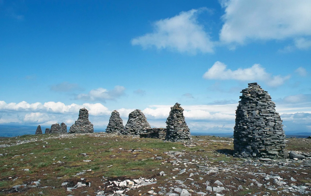
Bleatapow Hill — mountain in england north west. Elevation: 600 m.

Trevor Littlewood — CC BY-SA 2.0 via Wikimedia Commons licence
Plan your visit
- Typical visit
- 3 h–8 h
- Best time of year
- Late spring – early autumn (May–Oct)
About
Bleatapow Hill is a mountain located in england north west. Elevation: 600 m. A named British peak recorded in OpenStreetMap. Peaks are typically named on Ordnance Survey 1:50k mapping.
Photo gallery
Place summary
Bleatapow Hill is a mountain located in North-West England. It offers a variety of outdoor activities for walkers and climbers. The area is characterised by its rugged terrain and scenic views, typical of the region's landscape. Visitors can expect a range of hiking trails suitable for different skill levels.
AI-generated from the structured facts on this page (operator, designation, listing, era). Not a substitute for visiting.
- Coordinates
- 54.4627, -2.2668
Sources
- osm: n10242044476 (ODbL)
Other places nearby
Loading nearby places…
Nearby
📷 5Mountains & hills · North West England
Peatpot Hill
Peatpot Hill — mountain in england north west. Elevation: 580 m.
 📷 5
📷 5Mountains & hills · North West England
Bastifell
Bastifell — mountain in england north west. Elevation: 620 m.
 📷 3
📷 3Natural landmarks · North West England
Nine Standards Rigg
Nine Standards Rigg — mountain in United Kingdom.
 📷 5
📷 5Archaeological sites · North West England
Nine Standards Rigg
Nine Standards Rigg — archaeological in england north west. Elevation: 662 m.
 📷 5
📷 5Waterfalls · North West England
Winton Force
Winton Force — waterfall in england north west.
 📷 5
📷 5Mountains & hills · North West England
Collin Hill
Collin Hill — mountain in england north west. Elevation: 521 m.
Where to eat & stay near Bleatapow Hill
Places to stay
 📷 5
📷 5Hostels · North West England
Kirkby Stephen Hostel
Kirkby Stephen Hostel — a hostel in england north west.
 📷 5
📷 5B&Bs · North West England
Fletcher House
Fletcher House — a bed-and-breakfast in england north west.
 📷 5
📷 5Hotels · North West England
Black Bull Hotel
Black Bull Hotel — a hotel in england north west.
 📷 5
📷 5Hotels · North West England
The Pennine Hotel
The Pennine Hotel — a hotel in england north west.
 📷 5
📷 5Campsites · North West England
Pennine View Park
Pennine View Park — a campsite in england north west.
 📷 5
📷 5Hotels · North East England
Augill Castle
Augill Castle — a hotel in england north east.
Places to eat & drink
📷 5Cafés · North West England
The White Hare Cafe
The White Hare Cafe — a café in england north west.
 📷 5
📷 5Historic pubs · North East England
Tan Hill Inn
Tan Hill Inn in England North East, United Kingdom.
 📷 5
📷 5Historic pubs · North West England
Kings Head Inn
Kings Head Inn in England North West, United Kingdom.
 📷 5
📷 5Cafés · North West England
The Cross Keys Temperance Inn
The Cross Keys Temperance Inn — a café in england north west.
 📷 5
📷 5Historic pubs · North East England
1, Scattergate
1, Scattergate in England North East, United Kingdom.
 📷 5
📷 5Historic pubs · North East England
Booze
Booze in England North East, United Kingdom.
More mountains in this region
 📷 3
📷 3Mountains & hills · North West England
Allen Crags
Allen Crags — Named summit at 785 m.
 📷 3
📷 3Mountains & hills · North West England
Alum Pot
Alum Pot — Open shaft pothole in North Yorkshire.
 📷 3
📷 3Mountains & hills · North West England
Arnside Knott
Arnside Knott — Named summit at 159 m.
 📷 3
📷 3Mountains & hills · North West England
Aye Gill Pike
Aye Gill Pike — Named summit at 556.3 m.
Frequently asked questions
- Where is Bleatapow Hill?
- Bleatapow Hill is in North-West England, United Kingdom.
- What is Bleatapow Hill?
- Bleatapow Hill — mountain in england north west. Elevation: 600 m.
- How do I get to Bleatapow Hill?
- Its coordinates are 54.4627°, -2.2668°.