
Mountains & hills · Scottish Highlands
Mullach an Eilein
Mullach an Eilein — Named summit at 384 m.

Wikimedia Commons contributors — see linked file page for photographer and licence licence

Plan your visit
- Typical visit
- 3 h–8 h
- Best time of year
- Late spring – early autumn (May–Oct)
- Free entry
- Dog-friendly
About
Mullach an Eilein is a named summit in the United Kingdom. Wikidata describes it as: "Named summit at 384 m.". Coordinates: 57.8713°, -8.4917°.
Photo gallery
From the Wikipedia article
Boreray (Scottish Gaelic: Boraraigh; Scots: Boreray) is an uninhabited island in the St Kilda archipelago in the North Atlantic.
Excerpt from Wikipedia under CC BY-SA 4.0. See the source article linked in Sources below.
Background
History
Boreray has the Cleitean MacPhàidein, a "cleit village" of three small bothies used regularly during fowling expeditions from Hirta. As a result of a smallpox outbreak on Hirta in 1727, three men and eight boys were marooned on Stac an Armin off the coast of Boreray until the following May. There are also ruins of Taigh Stallar (the steward's house). The local tradition was that it was built by the "Man of the Rocks", who led a rebellion against the landlord's steward. RCAHMS surveyor Ian Parker said: <blockquote>“This new discovery shows that a farming community actually lived on Boreray, perhaps as long ago as the prehistoric period. The agricultural remains and settlement mounds give us…
Sourced from Wikipedia under CC BY-SA 4.0.
- Coordinates
- 57.8713, -8.4917
- Official site
- www.scottish.parliament.uk
Sources
- osm: n310279527 (ODbL)
- wikipedia: Boreray, St Kilda (CC BY-SA 4.0)
- commons: Boreray from Conachair.jpg (CC BY-SA 4.0)
Other places nearby
Loading nearby places…
Nearby
 📷 3
📷 3Archaeological sites · Scottish Highlands
Taigh Stallar
Taigh Stallar — a archaeological in scotland-highlands, United Kingdom.
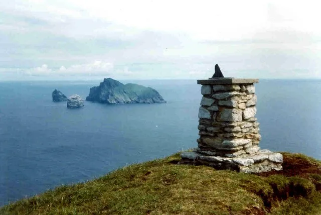 📷 4
📷 4Islands · Scottish Highlands
Boreray
Boreray — uninhabited island in St Kilda archipelago, Scotland.
 📷 3
📷 3Archaeological sites · Scottish Highlands
Cleitein McPhaidein
Cleitein McPhaidein — a archaeological in scotland-highlands, United Kingdom.
 Flagship📷 5
Islands · Scottish Highlands
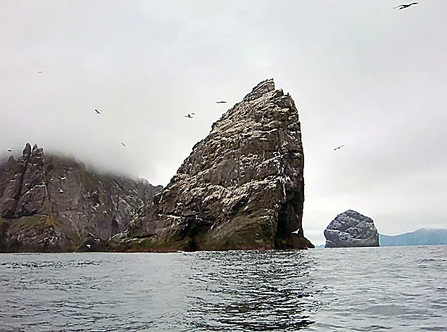
Stac an Armin
Stac an Armin — sea stack in the St Kilda archipelago, Scotland.
 Flagship📷 5
Islands · Scottish Highlands
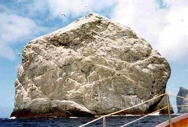
Stac Lee
Stac Lee — island in Outer Hebrides, Scotland, UK.
 📷 3
📷 3Islands · Scottish Highlands
Bradastac
Bradastac — islet in the United Kingdom.
More mountains in this region
 📷 3
📷 3Mountains & hills · Scottish Highlands
A' Bhuidheanach Bheag
A' Bhuidheanach Bheag — Named summit at 936 m.
 📷 3
📷 3Mountains & hills · Scottish Highlands
A' Chailleach
A' Chailleach — Named summit at 997 m.
 📷 3
📷 3Mountains & hills · Scottish Highlands
A' Chailleach
A' Chailleach — Named summit at 930 m.
 📷 3
📷 3Mountains & hills · Scottish Highlands
A' Chaoirnich
A' Chaoirnich — Named summit at 875 m.
Frequently asked questions
- Where is Mullach an Eilein?
- Mullach an Eilein is in Scottish Highlands, in the United Kingdom — coordinates 57.8713°, -8.4917°.
- Is Mullach an Eilein free to visit?
- Yes — admission to Mullach an Eilein is free.