Islands · Scottish Highlands
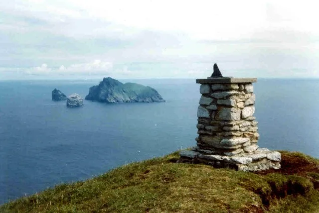
Stac an Armin
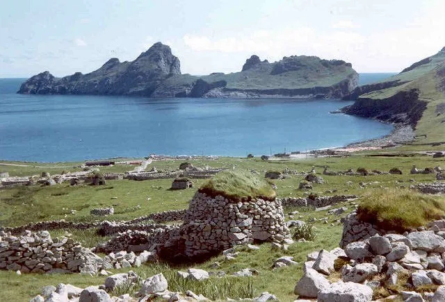
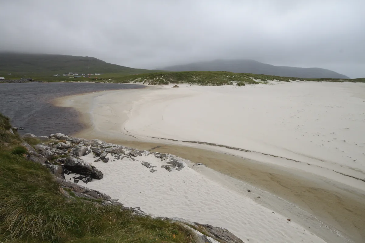
Stac an Armin — sea stack in the St Kilda archipelago, Scotland.

Wikimedia Commons contributors — see linked file page for photographer and licence licence
Plan your visit
- Typical visit
- 4 h–12 h
- Free entry
- Family-friendly
- Dog-friendly
- Limited wheelchair access
About
Stac an Armin is a island in the United Kingdom. It covers approximately 10 km². Owned by National Trust for Scotland. Managed by National Trust for Scotland. Part of Outer Hebrides. Wikidata describes it as: "sea stack in the St Kilda archipelago, Scotland". Coordinates: 57.8804°, -8.4976°.
Photo gallery
From the Wikipedia article
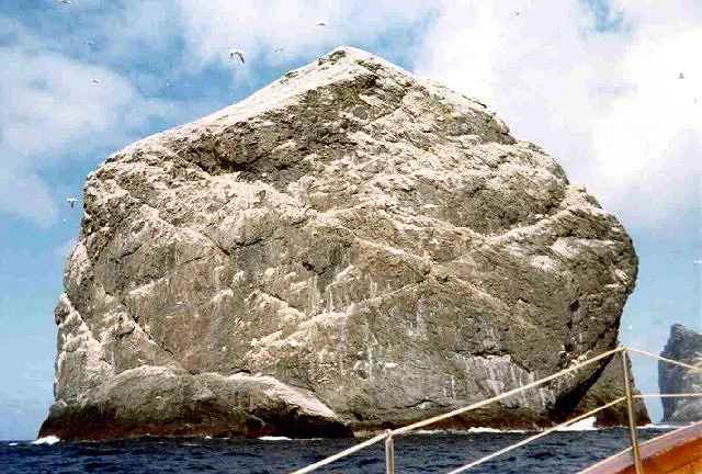
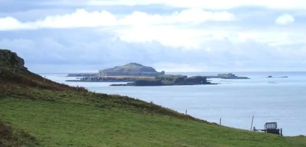
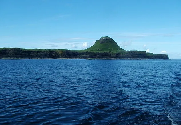
Stac an Armin (Scottish Gaelic: Stac an Àrmainn) is a sea stack in the St Kilda archipelago. It is 196 metres (643 ft) tall, qualifying it as a Marilyn. It is the highest sea stack in Scotland and the British Isles. The name Stac an Armin means stack of the soldier/warrior, and evidence remains showing it was used by people living nearby as a hunting grounds. It is not believed to have been inhabited year round, but has hosted some (involuntary) extended stays. Climbing the rocks was once done to collect eggs and has continued in the form of recreational sport. The island was once home to the now extinct great auk, and rules exist to protect the bird habitats and breeding grounds. Stac an Armin is 400 metres (1⁄4 mi) north of Boreray and near the 172-metre-high (564-foot) Stac Lee. Stac an Armin is separated from Boreray by a channel "so littered with rocks" that it should not be sailed, though sailors write passionately about the views.
Excerpt from Wikipedia under CC BY-SA 4.0. See the source article linked in Sources below.
Background
History
The first written account of the island was Martin Martin's description in the early 18th century. Martin wrote about the island after the Scottish writer had visited St Kilda in 1697 and included a few anecdotes about the stack in his A Description of the Western Isles of Scotland published in 1703. It was the first comprehensive book on the archipelago, to which was appended "A Late Voyage to St Kilda". Martin calls the island "Stack-Narmin." It was never inhabited full-time, but hunting its bird population helped sustain the way of life of the population of St Kilda, as evidenced by the buildings they left behind. There are no fewer than 78 storage cleitean on Stac an Armin and a small…
Description
, London]] On Stac an Armin, in July, 1840, the last great auk (Pinguinus impennis) seen in Britain was caught and killed. A then 75-year-old inhabitant of St Kilda told Henry Evans, a frequent visitor to the archipelago, that he and his father-in-law with another man had caught a "garefowl," noticing its little wings and the large white spot on its head. They tied it up and kept it alive for three days, and then killed it by beating it with a stick, apparently because they believed it to be a witch. The last known specimens in the world were killed a few years later either in Eldey, Iceland, or off Newfoundland.
Sourced from Wikipedia under CC BY-SA 4.0.
- Coordinates
- 57.8804, -8.4976
Sources
- wikidata: Q1639552 (CC0)
- wikipedia: Stac an Armin (CC BY-SA 4.0)
- commons: Stac an Armin and Boreray.jpg (CC BY-SA 4.0)
Other places nearby
Loading nearby places…
Nearby
 📷 4
📷 4Mountains & hills · Scottish Highlands
Mullach an Eilein
Mullach an Eilein — Named summit at 384 m.
 📷 3
📷 3Archaeological sites · Scottish Highlands
Taigh Stallar
Taigh Stallar — a archaeological in scotland-highlands, United Kingdom.
 📷 4
📷 4Islands · Scottish Highlands
Boreray
Boreray — uninhabited island in St Kilda archipelago, Scotland.
 Flagship📷 5
Islands · Scottish Highlands
Stac Lee
Stac Lee — island in Outer Hebrides, Scotland, UK.
 📷 3
📷 3Archaeological sites · Scottish Highlands
Cleitein McPhaidein
Cleitein McPhaidein — a archaeological in scotland-highlands, United Kingdom.
 📷 3
📷 3Islands · Scottish Highlands
Bradastac
Bradastac — islet in the United Kingdom.
More places run by National Trust for Scotland
 Flagship📷 5
Islands · Scottish Highlands
Barra Head
Barra Head — southernmost island of the Outer Hebrides in Scotland, UK.
📷 4Islands · Scottish Highlands
Boreray
Boreray — uninhabited island in St Kilda archipelago, Scotland.
 Flagship📷 5
Islands · Scottish Highlands
Canna
Canna — island in Inner Hebrides, Scotland, UK.
 Flagship📷 5
Islands · Scottish Highlands
Dùn
Dùn — island of St Kilda, Outer Hebrides, Scotland, UK.
More places in this region
 📷 5
📷 5Islands · Scottish Highlands
Bac Beag
Bac Beag — Scottish island, part of the Treshnish Isles in the Inner Hebrides.
 📷 5
📷 5Islands · Scottish Highlands
Bac Mòr
Bac Mòr — island in Argyll and Bute, Scotland, UK, one of the Treshnish Isles.
 Flagship📷 3
Islands · Scottish Highlands
Baleshare
Baleshare — flat tidal island in the Outer Hebrides, Scotland, UK.
 Flagship📷 5
Islands · Scottish Highlands
Barra
Barra — island in Outer Hebrides, Scotland, UK.
Frequently asked questions
- Where is Stac an Armin?
- Stac an Armin is in the Scottish Highlands, United Kingdom.
- Who runs Stac an Armin?
- Stac an Armin is operated by National Trust for Scotland.
- Is Stac an Armin free to visit?
- Yes, Stac an Armin is free to enter.