Mountains & hills · Scottish Lowlands
Mickle Fell
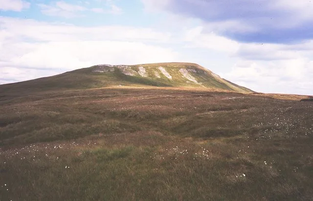
Mickle Fell — a hill or mountain in scotland lowlands.

shikari — CC BY-SA 2.0 via Wikimedia Commons licence
Plan your visit
- Typical visit
- 3 h–8 h
- Best time of year
- Late spring – early autumn (May–Oct)
About
A British hill or mountain, named on Ordnance Survey maps and walked by hill-baggers. Mickle Fell is a named hill or mountain in scotland lowlands, recorded in the GeoNames UK gazetteer. British landmarks of this type are typically marked on Ordnance Survey maps and recorded in the national gazetteer for cartographic and navigational reference. Coordinates and feature classification are sourced from the GeoNames open dataset.
Photo gallery
Place summary
Mickle Fell is a mountain located in the Scottish Lowlands. It is known for its rugged terrain and distinctive summit, offering panoramic views of the surrounding landscape. The area is popular with walkers and climbers seeking a challenging ascent in a relatively remote setting. The mountain contributes to the diverse geography of the region, characterised by its hills and valleys.
AI-generated from the structured facts on this page (operator, designation, listing, era). Not a substitute for visiting.
- Coordinates
- 54.6000, -2.3000
Sources
- manual: geonames-2642644 (CC BY 4.0)
Other places nearby
Loading nearby places…
Nearby
📷 5Waterfalls · North East England
The Force
The Force — waterfall in england north east.
 📷 5
📷 5Natural landmarks · Scottish Lowlands
Mickle Fell
Mickle Fell — fell in County Durham. United Kingdom.
 📷 5
📷 5Mountains & hills · Scottish Lowlands
Mickle Fell
Mickle Fell — Named summit at 790.2 m.
 📷 3
📷 3Mountains & hills · North East England
Hilton Fell
Hilton Fell — a mountain in england-north-east, United Kingdom.
 📷 5
📷 5Mountains & hills · North East England
Little Fell
Little Fell — mountain in england north east. Elevation: 748 m.
📷 5Mountains & hills · North East England
Little Fell
Little Fell — a hill or mountain in england north east.
Where to eat & stay near Mickle Fell
Places to stay
 📷 5
📷 5Hotels · North East England
Hilton
Hilton in England North East, United Kingdom.
 📷 5
📷 5Hotels · North East England
Augill Castle
Augill Castle — a hotel in england north east.
 📷 5
📷 5Hostels · Scottish Lowlands
Langdon Beck Youth Hostel
Langdon Beck Youth Hostel — a hostel in scotland lowlands.
 📷 5
📷 5Caravan parks · North East England
Park House Caravan Park
Park House Caravan Park — a caravan park in england north east.
 📷 5
📷 5B&Bs · Scottish Lowlands
Brow Farm
Brow Farm — a bed-and-breakfast in scotland lowlands.
 📷 5
📷 5Campsites · Scottish Lowlands
Low Way Farm Camping Site
Low Way Farm Camping Site — a campsite in scotland lowlands.

More mountains in this region
 📷 3
📷 3Mountains & hills · Scottish Lowlands
Andrewhinney Hill
Andrewhinney Hill — Named summit at 677 m.
 📷 3
📷 3Mountains & hills · Scottish Lowlands
Arbory Hill
Arbory Hill — Named summit at 429 m.
 📷 3
📷 3Mountains & hills · Scottish Lowlands
Auchenton Hill ( East Mount Lowther)
Auchenton Hill ( East Mount Lowther) — Named summit at 631 m.
 📷 3
📷 3Mountains & hills · Scottish Lowlands
Bakestall
Bakestall — Named summit at 673.5 m.
Frequently asked questions
- Where is Mickle Fell?
- Mickle Fell is in the Scottish Lowlands, United Kingdom.
- What is Mickle Fell?
- Mickle Fell — a hill or mountain in scotland lowlands.
- How do I get to Mickle Fell?
- Its coordinates are 54.6000°, -2.3000°.