Mountains & hills · Scottish Lowlands
Andrewhinney Hill
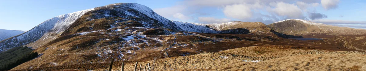
Andrewhinney Hill — Named summit at 677 m.

Wikimedia Commons contributors — see linked file page for photographer and licence licence
Plan your visit
- Typical visit
- 3 h–8 h
- Best time of year
- Late spring – early autumn (May–Oct)
- Free entry
- Dog-friendly
About
Andrewhinney Hill is a named summit in the United Kingdom. Wikidata describes it as: "Named summit at 677 m.". Coordinates: 55.4122°, -3.2690°.
Photo gallery
From the Wikipedia article
Andrewhinney Hill is a hill in the Ettrick Hills range, part of the Southern Uplands of Scotland. It is the highest summit of a ridge that runs parallel to the A708 road on its southern side, with the Grey Mare's Tail in the Moffat Hills directly opposite. The northwestern slopes are designated as part of the 'Moffat Hills' SSSI and SAC.
Excerpt from Wikipedia under CC BY-SA 4.0. See the source article linked in Sources below.
- Coordinates
- 55.4122, -3.2690
- Address
- Dumfries and Galloway, Scottish Borders, Scotland
- Official site
- www.hill-bagging.co.uk
Sources
- osm: n8904420151 (ODbL)
- wikipedia: Andrewhinney Hill (CC BY-SA 4.0)
- commons: Andrewhinney.jpg (CC BY-SA 4.0)
Other places nearby
Loading nearby places…
Nearby
 📷 3
📷 3Viewpoints · Scottish Lowlands
Grey Mare's Tail (waterfall)
Grey Mare's Tail (waterfall) is a viewpoint in the United Kingdom.
📷 3Natural landmarks · Scottish Lowlands
Grey Mare's Tail (NTS)
Grey Mare's Tail (NTS) — a other in scotland-lowlands, United Kingdom.
 📷 3
📷 3Natural landmarks · Scottish Lowlands
White Coomb
White Coomb — 821m high mountain in Dumfries and Galloway, Scotland, UK.
 📷 3
📷 3Mountains & hills · Scottish Lowlands
White Coomb
White Coomb — Named summit at 821 m.
 📷 3
📷 3Natural landmarks · Scottish Lowlands
Loch Skeen
Loch Skeen — lake in Dumfries and Galloway, Scotland, UK, outflows south to Tail Burn.
 📷 3
📷 3Memorials & monuments · Scottish Lowlands
Ettrick
Ettrick — a memorial in scotland-lowlands, United Kingdom.
More mountains in this region
 📷 3
📷 3Mountains & hills · Scottish Lowlands
Arbory Hill
Arbory Hill — Named summit at 429 m.
 📷 3
📷 3Mountains & hills · Scottish Lowlands
Auchenton Hill ( East Mount Lowther)
Auchenton Hill ( East Mount Lowther) — Named summit at 631 m.
 📷 3
📷 3Mountains & hills · Scottish Lowlands
Bakestall
Bakestall — Named summit at 673.5 m.
 📷 3
📷 3Mountains & hills · Scottish Lowlands
Bannerdale Crags (summit)
Bannerdale Crags (summit) — Named summit at 684.1 m.
Frequently asked questions
- Where is Andrewhinney Hill?
- Andrewhinney Hill is in Scottish Lowlands, in the United Kingdom — coordinates 55.4122°, -3.2690°.
- Is Andrewhinney Hill free to visit?
- Yes — admission to Andrewhinney Hill is free.