
Waterfalls · North East England
The Force
In or near Helbeck.
The Force — waterfall in england north east.

shikari — CC BY-SA 2.0 via Wikimedia Commons licence

Plan your visit
- Typical visit
- 1 h–2 h
- Nearest railway station
- Warcop · 8.3 km
About
The Force is a waterfall located in england north east. A British waterfall recorded in OpenStreetMap. Most are in upland country where rivers cross resistant rock.
Photo gallery
Protected designations
- Site of Special Scientific Interest: Upper Teesdale SSSI
- Site of Special Scientific Interest: Appleby Fells SSSI
- Site of Special Scientific Interest: River Eden and Tributaries SSSI
- Area of Outstanding Natural Beauty: North Pennines
Designations sourced from Natural England open data under OGL v3.
Place summary
The Force is a waterfall located in North-East England. It features cascading water that flows over rocky outcrops, creating a scenic natural feature. The site is accessible for visitors looking to enjoy the surrounding landscape and observe the waterfall's flow. This area is typically characterised by its rugged terrain and natural beauty.
AI-generated from the structured facts on this page (operator, designation, listing, era). Not a substitute for visiting.
- Coordinates
- 54.5987, -2.3137
- Nearest railway station
- Warcop — 8.3 km
Sources
- osm: n13196255754 (ODbL)
Other places nearby
Mickle Fell
Mountains & hills · 0.9 km

Hilton Fell
Mountains & hills · 1.6 km
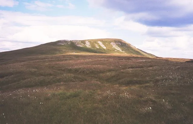
Mickle Fell
Natural landmarks · 1.7 km

Little Fell
Mountains & hills · 1.7 km
Little Fell
Mountains & hills · 1.8 km
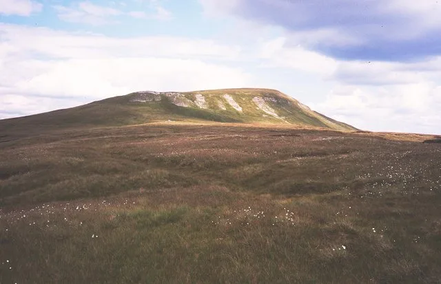
Mickle Fell
Mountains & hills · 2.0 km

Burton Fell
Mountains & hills · 2.5 km

Hillbeck Fell
Mountains & hills · 3.0 km

Tinside Rigg
Mountains & hills · 3.5 km

Long Fell
Mountains & hills · 4.1 km

Shotmoss Hill
Mountains & hills · 4.3 km

Appleby Fells
National landscapes (AONB) · 4.5 km
Nearby
📷 5Mountains & hills · North East England
Mickle Fell
Mickle Fell — a hill or mountain in scotland lowlands.
📷 3Mountains & hills · North East England
Hilton Fell
Hilton Fell — a mountain in england-north-east, United Kingdom.
📷 5Natural landmarks · North East England
Mickle Fell
Mickle Fell — fell in County Durham. United Kingdom.
📷 5Mountains & hills · North East England
Little Fell
Little Fell — mountain in england north east. Elevation: 748 m.
📷 5Mountains & hills · North East England
Little Fell
Little Fell — a hill or mountain in england north east.
📷 5Where to eat & stay near The Force
Places to stay
 📷 5
📷 5 📷 5
📷 5Hotels · North East England
Augill Castle
Augill Castle — a hotel in england north east.
 📷 5
📷 5Hostels · North East England
Langdon Beck Youth Hostel
Langdon Beck Youth Hostel — a hostel in scotland lowlands.
Hostels · North East England
Langdon Beck Youth Hostel
Langdon Beck Youth Hostel — a hostel in england north east. Brand: Youth Hostels Association.
 📷 5
📷 5Caravan parks · North East England
Park House Caravan Park
Park House Caravan Park — a caravan park in england north east.
 📷 6
📷 6B&Bs · North East England
Brow Farm
Brow Farm — a bed-and-breakfast in scotland lowlands.
Places to eat & drink
 📷 5
📷 5Historic pubs · North East England
1, Scattergate
1, Scattergate in England North East, United Kingdom.
 📷 7
📷 7Cafés · North West England
The White Hare Cafe
The White Hare Cafe — a café in england north west.
 📷 5
📷 5More places in this region
 📷 5
📷 5 📷 5
📷 5 📷 5
📷 5Waterfalls · North East England
Swinner Gill Kirk
Swinner Gill Kirk — waterfall in england north west.
 📷 5
📷 5Frequently asked questions
- Where is The Force?
- The Force is in North-East England, United Kingdom.
- What is The Force?
- The Force — waterfall in england north east.
- How do I get to The Force?
- The nearest railway station is Warcop, about 8.3 km away. The nearest town is Helbeck. Its coordinates are 54.5987°, -2.3137°.
- Is The Force a protected site?
- Yes — The Force is part of the Upper Teesdale SSSI Site of Special Scientific Interest and the Appleby Fells SSSI Site of Special Scientific Interest.