
Villages · East of England
Mickfield
In or near Stonham Aspal.
Mickfield — a village in england east.

Geographer — CC BY-SA 2.0 via Wikimedia Commons licence
Plan your visit
- Typical visit
- 1 h–2 h
- Nearest railway station
- Dovebrook · 4.2 km
About
A British village — settlements of this size traditionally cluster a green, parish church, pub and post office around historic land routes.
Photo gallery
Protected designations
- Area of Outstanding Natural Beauty: Suffolk Coast & Heaths
Designations sourced from Natural England open data under OGL v3.
Place summary
Mickfield is a village located in the East of England. It is characterised by its rural setting and traditional English architecture. The village is part of the Mid Suffolk district, providing a quiet, local atmosphere. Visitors can expect a peaceful environment typical of the English countryside.
AI-generated from the structured facts on this page (operator, designation, listing, era). Not a substitute for visiting.
- Coordinates
- 52.2129, 1.1253
- County
- Suffolk
- District
- Mid Suffolk
- Parish
- Mickfield
- Postcode
- IP14 5LQ
- Parliamentary constituency
- Central Suffolk and North Ipswich
- Nearest railway station
- Dovebrook — 4.2 km
Sources
- manual: geonames-2642646 (CC BY 4.0)
Other places nearby

Mickfield Village Sign
Public art & sculpture · 0.0 km

Church of St Andrew
Historic churches · 0.1 km
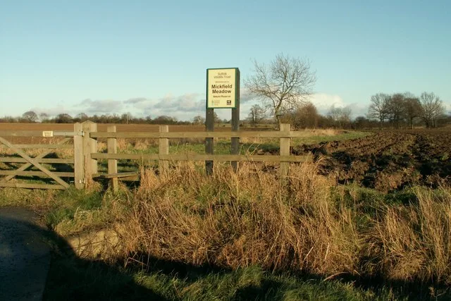
Mickfield Meadow
Wildlife reserves · 1.6 km

Stonham Aspal
Towns & cities · 2.2 km

Stonham Parva Village Sign
Public art & sculpture · 2.3 km

Broughton Hall Caravan Club CL
Campsites · 2.3 km

Stonham Aspal Village Sign
Public art & sculpture · 2.5 km

Suffolk Owl Sanctuary
Zoos & aquariums · 2.8 km
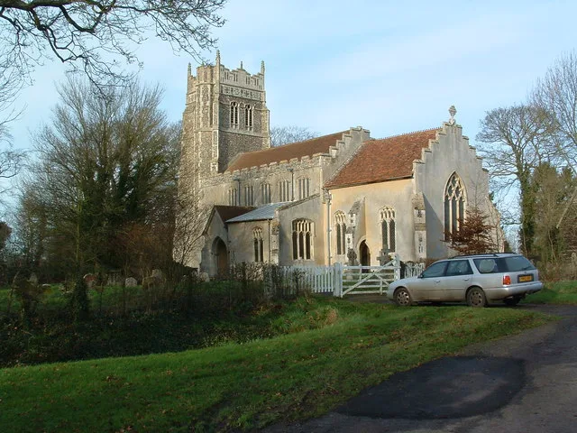
St Mary the Virgin's Church, Stonham Parva
Historic churches · 2.9 km

Pettaugh
Towns & cities · 3.7 km

Pettaugh Village Sign
Public art & sculpture · 3.8 km

Ancient House
Historic houses · 4.0 km
Nearby
📷 3Public art & sculpture · East of England
Mickfield Village Sign
Mickfield Village Sign — a public art in england-east, United Kingdom.
📷 3Historic churches · East of England
Church of St Andrew
Church of St Andrew — church in Mickfield, Suffolk, England, UK.
📷 3Wildlife reserves · East of England
Mickfield Meadow
Mickfield Meadow — Suffolk Wildlife Trust nature reserve.
📷 5Towns & cities · East of England
Stonham Aspal
Stonham Aspal — village and civil parish in Suffolk, UK.
📷 3Public art & sculpture · East of England
Stonham Parva Village Sign
Stonham Parva Village Sign — a public art in england-east, United Kingdom.
📷 5Campsites · East of England
Broughton Hall Caravan Club CL
Broughton Hall Caravan Club CL — a campsite in england east.
Where to eat & stay near Mickfield
Places to stay
📷 5Campsites · East of England
Broughton Hall Caravan Club CL
Broughton Hall Caravan Club CL — a campsite in england east.
 📷 5
📷 5 📷 7
📷 7Hotels · East of England
Limes Hotel
Limes Hotel — a hotel in england east.
 📷 7
📷 7 📷 5
📷 5Caravan parks · East of England
Red House Farm Caravan Site
Red House Farm Caravan Site — a caravan park in england east.
 📷 5
📷 5Places to eat & drink
 📷 5
📷 5Historic pubs · East of England
The Red Lion, Debenham
The Red Lion, Debenham in England East, United Kingdom.
 📷 5
📷 5 📷 7
📷 7 📷 7
📷 7Historic pubs · East of England
The Greyhound, Gosbeck
The Greyhound, Gosbeck in England East, United Kingdom.
 📷 5
📷 5Historic pubs · East of England
The Meadlands Public House
The Meadlands Public House in England East, United Kingdom.
 📷 6
📷 6More places in this region


Frequently asked questions
- Where is Mickfield?
- Mickfield is in Suffolk, East of England, United Kingdom (postcode IP14 5LQ), in the parish of Mickfield.
- What is Mickfield?
- Mickfield — a village in england east.
- How do I get to Mickfield?
- The nearest railway station is Dovebrook, about 4.2 km away. Drivers can use postcode IP14 5LQ.
- Is Mickfield a protected site?
- Yes — Mickfield is part of the Suffolk Coast & Heaths National Landscape (AONB).
- How do I get to Mickfield?
- The nearest railway station is Dovebrook, about 4.2 km away. Drivers can navigate to postcode IP14 5LQ.