
Towns & cities · East of England
Stonham Aspal
Stonham Aspal — village and civil parish in Suffolk, UK.

Wikimedia Commons contributors — see linked file page for photographer and licence licence

Plan your visit
- Typical visit
- 3 h–6 h
- Nearest railway station
- Needham Market · 6.3 km
- Free entry
- Family-friendly
- Dog-friendly
About
Stonham Aspal is a town, city, village or settlement in the United Kingdom. Recent population estimates put it at around 542 people. Address: IP14. Wikidata describes it as: "village and civil parish in Suffolk, UK". Coordinates: 52.1937°, 1.1188°.
Photo gallery
See it from the streetimagery from 2025
Imagery © Mapillary contributors, CC BY-SA 4.0
Official information
Stonham Aspal is a village that hosts various community events and activities, particularly in its Village Hall. Visitors can participate in events such as quiz nights, yoga classes, and cinema nights, fostering a sense of community.
Protected designations
- Area of Outstanding Natural Beauty: Suffolk Coast & Heaths
Designations sourced from Natural England open data under OGL v3.
From the Wikipedia article
Stonham Aspal is a village and civil parish in the Mid Suffolk district of Suffolk in eastern England, some five miles (8 km) east of the town of Stowmarket. Nearby villages include Mickfield, Little Stonham and Pettaugh. Its population in 2011 was 601. The village has a primary school. It is set in farmland, but has a busy main road, A1120, running through.
Excerpt from Wikipedia under CC BY-SA 4.0. See the source article linked in Sources below.
Background
History
Settlement at Stonham Aspal dates back to the Roman hypocaust period. It is mentioned in the 1086 Domesday Book as Estuna in the Bosmere hundred of Suffolk, with 2 villagers, 4 smallholders and 11 freemen. One-and-a-half lord's plough teams and two men's plough teams are also mentioned, along with a seven-acre (2.8 ha), meadow, woodland for 80 pigs, a church and church lands. In 1066 the lord was Aelmer, in 1086 Miles de Belefol. From 1292, the lord of the manor was Roger de Aspale. The 13th-century name "Stonham" translates as "Stone Homestead". Many houses in the village today are from the 14th and 15th centuries. The main occupation for men, according to census data in 1881, was…
Sourced from Wikipedia under CC BY-SA 4.0.
- Coordinates
- 52.1937, 1.1188
- County
- Suffolk
- District
- Mid Suffolk
- Parish
- Stonham Aspal
- Postcode
- IP14
- Parliamentary constituency
- Central Suffolk and North Ipswich
- Population
- 542
- Nearest railway station
- Needham Market — 6.3 km
- Official site
- www.stonhamaspal.co.uk
Sources
- wikidata: Q1902709 (CC0)
- wikipedia: Stonham Aspal (CC BY-SA 4.0)
- commons: The Ten Bells Stonham Aspal - geograph.org.uk - 529965.jpg (CC BY-SA 4.0)
Other places nearby

Broughton Hall Caravan Club CL
Campsites · 0.2 km

Stonham Aspal Village Sign
Public art & sculpture · 0.5 km

Suffolk Owl Sanctuary
Zoos & aquariums · 1.3 km

Stonham Parva Village Sign
Public art & sculpture · 1.5 km

Church of St Andrew
Historic churches · 2.1 km
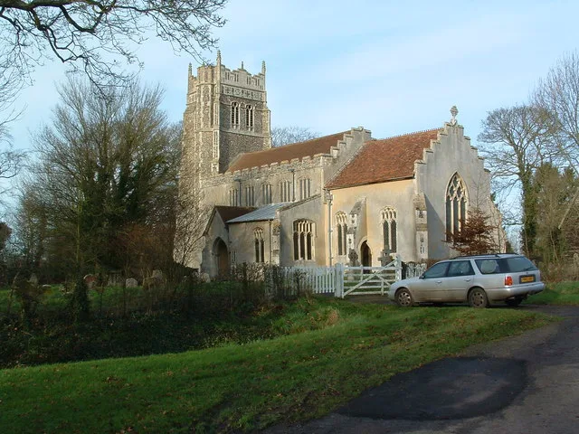
St Mary the Virgin's Church, Stonham Parva
Historic churches · 2.1 km

Mickfield
Villages · 2.2 km

Mickfield Village Sign
Public art & sculpture · 2.2 km

Earl Stonham War Memorial
Memorials & monuments · 2.6 km

Crowfield
Villages · 3.0 km

Crowfield Village Sign
Public art & sculpture · 3.1 km
Crowfield Windmill
Windmills · 3.1 km
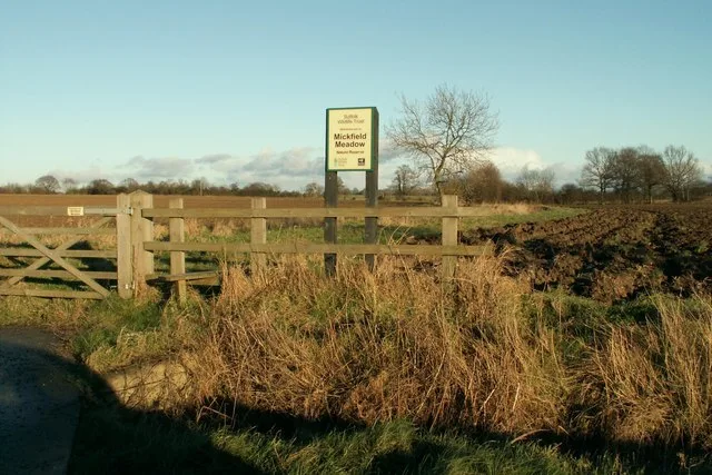
Stonham Aspal is a village in Suffolk, East of England, offering a peaceful setting for visitors. You can explore the historic St Mary the Virgin's Church, Stonham Parva, and visit the nearby Mickfield Meadow wildlife reserve. The area also features notable memorials, including the Creeting St Peter War Memorial and the Earl Stonham War Memorial.
At a glance
- Population
- 542
- Administrative county
- Suffolk
- Constituency
- Central Suffolk and North Ipswich
Things to see in Stonham Aspal
14 attractions within 12 km. Full guide: things to do in Stonham Aspal →
📷 3Historic churches · East of England
Church of St Andrew
Church of St Andrew — church in Mickfield, Suffolk, England, UK.
 📷 3
📷 3Historic churches · East of England
Church of St Peter
Church of St Peter — Grade I listed church in Creeting St Peter, Suffolk, England, UK.
 📷 3
📷 3Historic houses · East of England
Creeting Hall
Creeting Hall — house in Creeting St Peter, Mid Suffolk, England, UK.
.jpg?width=1200) 📷 3
📷 3Memorials & monuments · East of England
Creeting St Peter War Memorial
Creeting St Peter War Memorial is a memorial in the United Kingdom.
 📷 3
📷 3Wildlife reserves · East of England
Mickfield Meadow
Mickfield Meadow — Suffolk Wildlife Trust nature reserve.
📷 3Historic churches · East of England
St Mary the Virgin's Church, Stonham Parva
St Mary the Virgin's Church, Stonham Parva — church in Little Stonham, Suffolk, England, UK.
📷 3Zoos & aquariums · East of England
Suffolk Owl Sanctuary
Suffolk Owl Sanctuary — a zoo aquarium in East of England, United Kingdom.
📷 3Memorials & monuments · East of England
Earl Stonham War Memorial
Earl Stonham War Memorial — Grade II listed building-listed memorial in england-east, United Kingdom.
📷 3Public art & sculpture · East of England
Mickfield Village Sign
Mickfield Village Sign — a public art in East of England, United Kingdom.
📷 3Public art & sculpture · East of England
Stonham Aspal Village Sign
Stonham Aspal Village Sign — a public art in East of England, United Kingdom.
📷 3Public art & sculpture · East of England
Stonham Parva Village Sign
Stonham Parva Village Sign — a public art in East of England, United Kingdom.
 📷 3
📷 3Public art & sculpture · East of England
Earl Stonham Village Sign
Earl Stonham Village Sign — a public art in East of England, United Kingdom.
📷 5Campsites · East of England
Broughton Hall Caravan Club CL
Broughton Hall Caravan Club CL — a campsite in england east.
📷 5Nearby
📷 5Campsites · East of England
Broughton Hall Caravan Club CL
Broughton Hall Caravan Club CL — a campsite in england east.
📷 3Public art & sculpture · East of England
Stonham Aspal Village Sign
Stonham Aspal Village Sign — a public art in East of England, United Kingdom.
📷 3Zoos & aquariums · East of England
Suffolk Owl Sanctuary
Suffolk Owl Sanctuary — a zoo aquarium in East of England, United Kingdom.
📷 3Public art & sculpture · East of England
Stonham Parva Village Sign
Stonham Parva Village Sign — a public art in East of England, United Kingdom.
📷 3Historic churches · East of England
Church of St Andrew
Church of St Andrew — church in Mickfield, Suffolk, England, UK.
📷 3Historic churches · East of England
St Mary the Virgin's Church, Stonham Parva
St Mary the Virgin's Church, Stonham Parva — church in Little Stonham, Suffolk, England, UK.
Where to eat & stay near Stonham Aspal
Places to stay
📷 5Campsites · East of England
Broughton Hall Caravan Club CL
Broughton Hall Caravan Club CL — a campsite in england east.
 📷 5
📷 5 📷 7
📷 7Hotels · East of England
Limes Hotel
Limes Hotel — a hotel in england east.
 📷 7
📷 7 📷 5
📷 5Caravan parks · East of England
Red House Farm Caravan Site
Red House Farm Caravan Site — a caravan park in england east.
 📷 5
📷 5Places to eat & drink
 📷 7
📷 7 📷 7
📷 7Historic pubs · East of England
The Greyhound, Gosbeck
The Greyhound, Gosbeck in England East, United Kingdom.
 📷 5
📷 5Historic pubs · East of England
The Red Lion, Debenham
The Red Lion, Debenham in England East, United Kingdom.
 📷 5
📷 5 📷 5
📷 5Historic pubs · East of England
The Meadlands Public House
The Meadlands Public House in England East, United Kingdom.
 📷 6
📷 6More towns in this region
 Flagship📷 10
 Flagship📷 10
Towns & cities · East of England
Cambridge
Cambridge — city in Cambridgeshire, England.
 Flagship📷 10
Towns & cities · East of England
Chelmsford
Chelmsford — city in Essex, United Kingdom.
 Flagship📷 10
Towns & cities · East of England
Colney Heath
Colney Heath — village and civil parish in St Albans, Hertfordshire, England, UK.
Frequently asked questions
- Where is Stonham Aspal?
- Stonham Aspal is in Suffolk, East of England, United Kingdom (postcode IP14), in the parish of Stonham Aspal.
- What is Stonham Aspal?
- Stonham Aspal — village and civil parish in Suffolk, UK.
- How do I get to Stonham Aspal?
- The nearest railway station is Needham Market, about 6.3 km away. Drivers can use postcode IP14.
- Is Stonham Aspal a protected site?
- Yes — Stonham Aspal is part of the Suffolk Coast & Heaths National Landscape (AONB).
- Is Stonham Aspal free to visit?
- Yes, Stonham Aspal is free to enter.
- How do I get to Stonham Aspal?
- The nearest railway station is Needham Market, about 6.3 km away. Drivers can navigate to postcode IP14.