
Towns & cities · East of England
Pettaugh
Pettaugh — village in Suffolk, England, UK.

Wikimedia Commons licence
Plan your visit
- Typical visit
- 3 h–6 h
- Nearest railway station
- Dovebrook · 7.2 km
- Free entry
- Family-friendly
- Dog-friendly
Getting there & planning your visit
To visit Pettaugh, you can reach the nearest railway station, Dovebrook, which is 7.2 km away. The postcode for Pettaugh is IP14 6DH, which you can use for sat-nav coordinates. Entry to the town is free.
About
Pettaugh is a town, city, village or settlement in the United Kingdom. Recent population estimates put it at around 202 people. Wikidata describes it as: "village in Suffolk, England, UK". Coordinates: 52.1910°, 1.1670°.
Photo gallery
See it from the streetimagery from 2025
Imagery © Mapillary contributors, CC BY-SA 4.0
Protected designations
- Area of Outstanding Natural Beauty: Suffolk Coast & Heaths
Designations sourced from Natural England open data under OGL v3.
From the Wikipedia article
Pettaugh is a village and civil parish located within the district council area of Mid Suffolk, England. It is a small village of a little over 200 inhabitants in 85 households, 10 miles north of Ipswich and 2+1⁄2 miles south of Debenham, in the county of Suffolk. It is in a rural location surrounded by farmland, at the junction of the A1120 (Stowmarket to Yoxford) and the Coddenham to Debenham roads. An aerial view of Pettaugh shows a few houses surrounded on all sides by a patchwork of farm fields. Years ago the fields may have been smaller, with lots more hedges, but farm fields surrounding the village is probably the way it's been for a very long time. The village sign reflects this – it features a farmer with his horse-drawn plough, working the farmland around Pettaugh, an anvil, indicating the existence of a blacksmith in the village, essential to farming in the days of horse-drawn ploughs, and the windmill which stood at the centre of the village. Thus are the main occupations of Pettaugh residents of 'yesteryear' represented – farming, smithing and milling the grain, mostly working very close to home. Today, residents of Pettaugh commute to nearby towns to work – to Debenham, Ipswich, Bury St Edmunds, and even by train to London; very few earn a living in or near to the village. Even the children catch buses or are driven by parents to schools in Stonham Aspal, Debenham, Helmingham, etc. Occupations may have changed but Pettaugh thrives, at the heart of beautiful Suffolk countryside. History The place-name 'Pettaugh' is first attested in the Domesday Book of 1086, where it appears as Petehaga and Pettehaga. The name means 'Peota's enclosure'. The medieval parish church of St Catherine was renovated in 1861 and is a grade II* listed building.
Excerpt from Wikipedia under CC BY-SA 4.0. See the source article linked in Sources below.
- Coordinates
- 52.1910, 1.1670
- County
- Suffolk
- District
- Mid Suffolk
- Parish
- Pettaugh
- Postcode
- IP14 6DH
- Parliamentary constituency
- Central Suffolk and North Ipswich
- Population
- 202
- Nearest railway station
- Dovebrook — 7.2 km
- Official site
- neighbourhood.statistics.gov.uk
Sources
Other places nearby

Pettaugh Village Sign
Public art & sculpture · 0.1 km

Suffolk Owl Sanctuary
Zoos & aquariums · 2.1 km

Obelisk, About 750 Metres West Of Helmingham Hall
Forts · 2.2 km

Crowfield
Villages · 2.6 km

Winston War Memorial
Memorials & monuments · 2.6 km

Helmingham Hall Gardens
Gardens · 2.6 km

Winston
Towns & cities · 2.6 km

Winston Village Sign
Public art & sculpture · 2.6 km

Webster's Mill, Framsden
Mills · 2.6 km
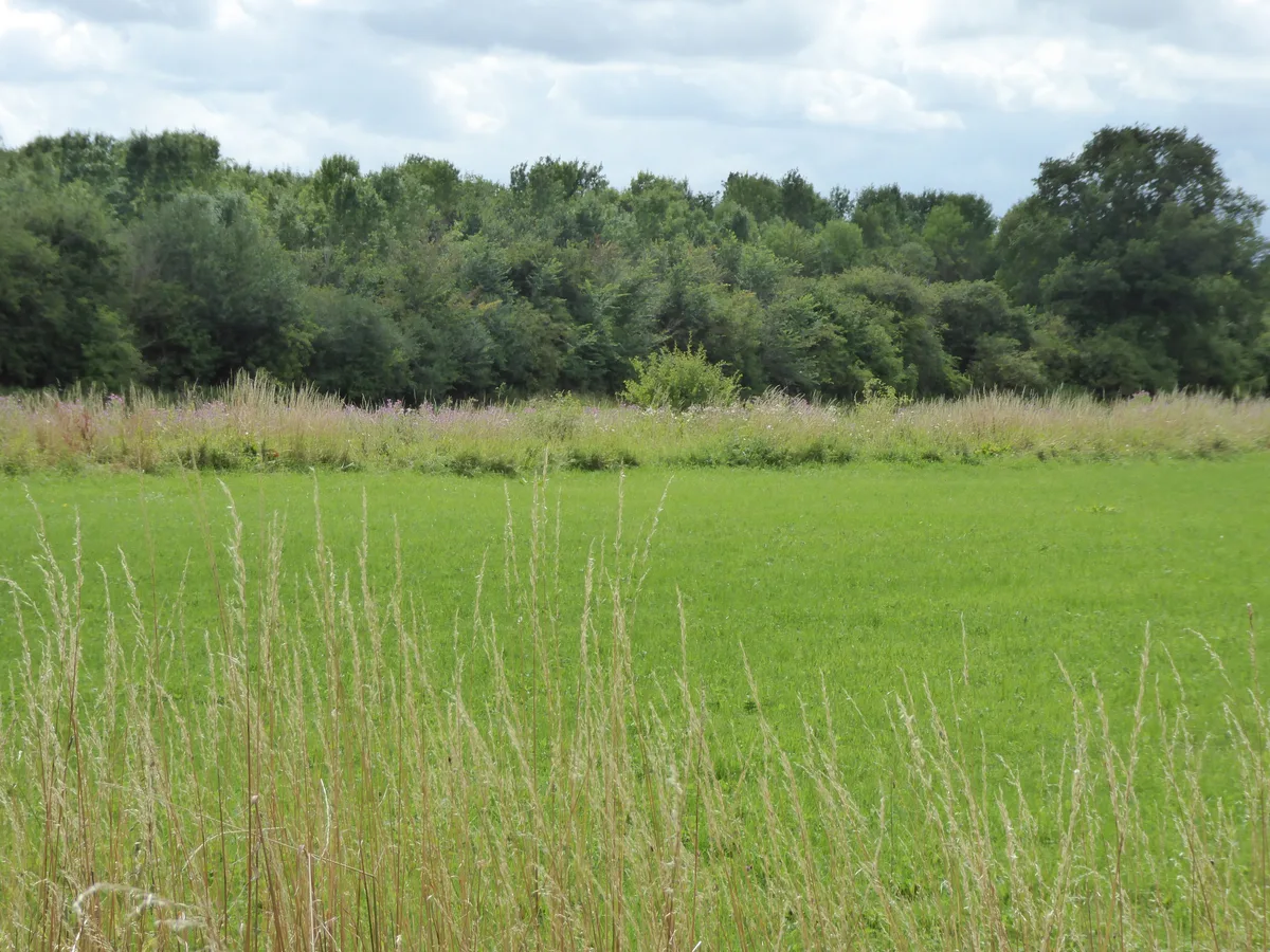
Fox Fritillary Meadow
Wildlife reserves · 2.6 km
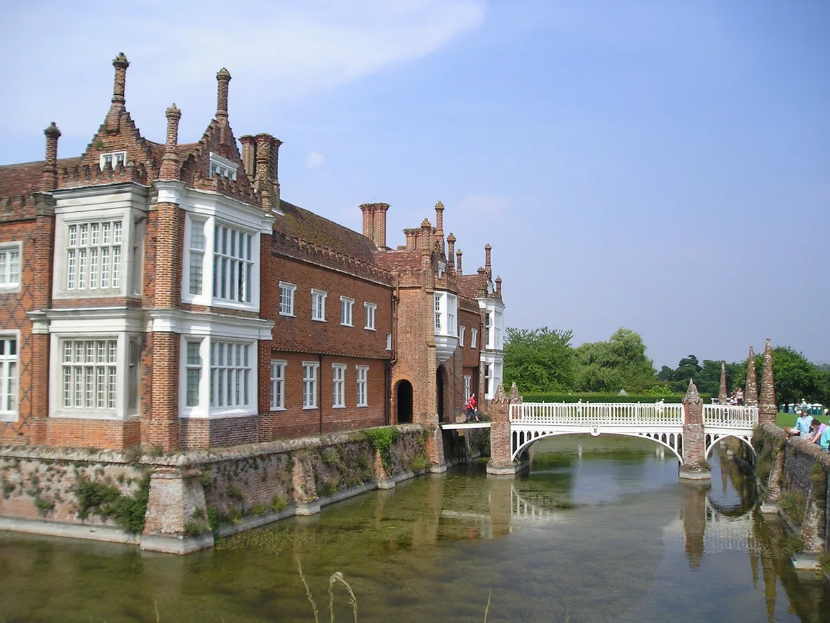
Helmingham Hall
Stately homes · 2.7 km

Framsden Village Sign
Public art & sculpture · 2.8 km
Pettaugh is a town in Suffolk, East of England. Visitors can explore Helmingham Hall, a notable stately home, and the nearby Church of St Mary in Helmingham. The area also features the Crowfield Windmill and a historic bridge located just east of the hall.
At a glance
- Population
- 202
- Administrative county
- Suffolk
- Constituency
- Central Suffolk and North Ipswich
- Top categories near here
Things to see in Pettaugh
9 attractions within 12 km. Full guide: things to do in Pettaugh →
📷 3Stately homes · East of England
Helmingham Hall
Helmingham Hall — country house in Helmingham, Suffolk, England, UK.
 📷 3
📷 3Windmills · East of England
Crowfield Windmill
Crowfield Windmill is a windmill in the United Kingdom.
📷 3Gardens · East of England
Helmingham Hall Gardens
Helmingham Hall Gardens — gardens in Helmingham Hall, United Kingdom.
 📷 3
📷 3Historic churches · East of England
Church of St Mary, Helmingham
Church of St Mary, Helmingham — a Grade I-listed church in england-east, United Kingdom.
 📷 3
📷 3Historic bridges · East of England
Bridge, About 300 Metres East Of Helmingham Hall
Bridge, About 300 Metres East Of Helmingham Hall — Grade II listed building-listed bridge in england-east, United Kingdom.
📷 3Public art & sculpture · East of England
Crowfield Village Sign
Crowfield Village Sign — a public art in East of England, United Kingdom.
📷 3Public art & sculpture · East of England
Pettaugh Village Sign
Pettaugh Village Sign — a public art in East of England, United Kingdom.
📷 5Forts · East of England
Obelisk, About 750 Metres West Of Helmingham Hall
Obelisk, About 750 Metres West Of Helmingham Hall — a martello broad in england-east, United Kingdom.
📷 5Nearby
📷 3Public art & sculpture · East of England
Pettaugh Village Sign
Pettaugh Village Sign — a public art in East of England, United Kingdom.
📷 3Zoos & aquariums · East of England
Suffolk Owl Sanctuary
Suffolk Owl Sanctuary — a zoo aquarium in East of England, United Kingdom.
📷 5Forts · East of England
Obelisk, About 750 Metres West Of Helmingham Hall
Obelisk, About 750 Metres West Of Helmingham Hall — a martello broad in england-east, United Kingdom.
📷 5📷 3Memorials & monuments · East of England
Winston War Memorial
Winston War Memorial — Grade II listed building-listed memorial in england-east, United Kingdom.
📷 3Gardens · East of England
Helmingham Hall Gardens
Helmingham Hall Gardens — gardens in Helmingham Hall, United Kingdom.
Where to eat & stay near Pettaugh
Places to stay
 📷 5
📷 5Campsites · East of England
Broughton Hall Caravan Club CL
Broughton Hall Caravan Club CL — a campsite in england east.
 📷 5
📷 5 📷 7
📷 7Hotels · East of England
Limes Hotel
Limes Hotel — a hotel in england east.
 📷 7
📷 7 📷 5
📷 5Caravan parks · East of England
Atherlington Hall
Atherlington Hall — a caravan park in england east.
 📷 5
📷 5Places to eat & drink
 📷 5
📷 5Historic pubs · East of England
The Red Lion, Debenham
The Red Lion, Debenham in England East, United Kingdom.
 📷 7
📷 7Historic pubs · East of England
The Greyhound, Gosbeck
The Greyhound, Gosbeck in England East, United Kingdom.
 📷 5
📷 5Historic pubs · East of England
New Bell Public House
New Bell Public House in England East, United Kingdom.
 📷 7
📷 7 📷 5
📷 5 📷 5
📷 5Historic pubs · East of England
The Swan Inn, Worlingworth
The Swan Inn, Worlingworth in England East, United Kingdom.
More towns in this region
 Flagship📷 10
 Flagship📷 10
Towns & cities · East of England
Cambridge
Cambridge — city in Cambridgeshire, England.
 Flagship📷 10
Towns & cities · East of England
Chelmsford
Chelmsford — city in Essex, United Kingdom.
 Flagship📷 10
Towns & cities · East of England
Colney Heath
Colney Heath — village and civil parish in St Albans, Hertfordshire, England, UK.
Frequently asked questions
- Where is Pettaugh?
- Pettaugh is in Suffolk, East of England, United Kingdom (postcode IP14 6DH), in the parish of Pettaugh.
- What is Pettaugh?
- Pettaugh — village in Suffolk, England, UK.
- How do I get to Pettaugh?
- The nearest railway station is Dovebrook, about 7.2 km away. Drivers can use postcode IP14 6DH.
- Is Pettaugh a protected site?
- Yes — Pettaugh is part of the Suffolk Coast & Heaths National Landscape (AONB).
- Is Pettaugh free to visit?
- Yes, Pettaugh is free to enter.
- How do I get to Pettaugh?
- The nearest railway station is Dovebrook, about 7.2 km away. Drivers can navigate to postcode IP14 6DH.