
Islands · East of England
Mersea Island
In or near East Mersea.
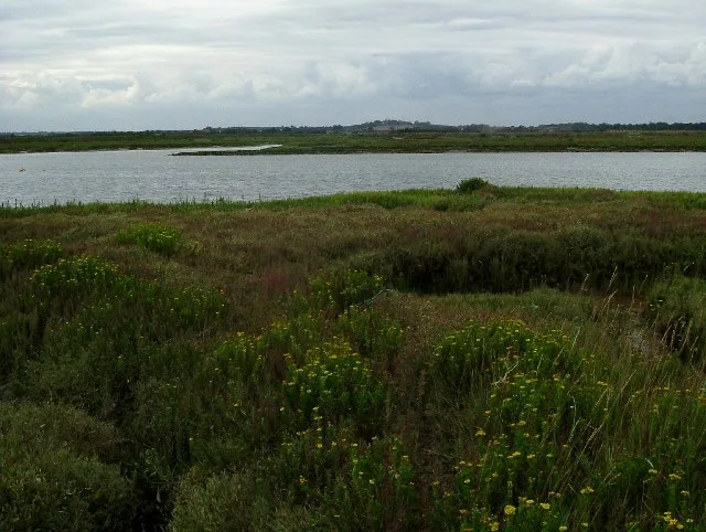
Mersea Island — island in Essex, England.

Wikimedia Commons contributors — see linked file page for photographer and licence licence

Plan your visit
- Typical visit
- 4 h–12 h
- Nearest railway station
- Wivenhoe · 6.9 km
- Free entry
- Dog-friendly
Getting there & planning your visit
To visit Mersea Island, the nearest railway station is Wivenhoe, which is 6.9 km away. The postcode for navigation is CO5 8SS. Entry to the island is free.
About
Mersea Island is a island in the United Kingdom. It covers approximately 18 km². Recent population estimates put it at around 6,500 people. Wikidata describes it as: "island in Essex, England". Coordinates: 51.7957°, 0.9400°.
Photo gallery
Protected designations
- Site of Special Scientific Interest: Colne Estuary SSSI
- Ramsar wetland: Colne Estuary (Mid-Essex Coast Phase 2)
Designations sourced from Natural England open data under OGL v3.
From the Wikipedia article
Mersea Island is a tidal island in Essex, England, in the Blackwater and Colne estuaries to the south of Colchester. Its name comes from the Old English word meresig, meaning "island of the pool" and thus is tautological. The island is split into two main areas, West Mersea and East Mersea, and connected to the mainland by the Strood, a causeway that can flood at high tide. The island has been inhabited since pre-Roman times. It was used as a holiday destination in Roman Britain for occupants of Camulodunum (Colchester). Fishing has been a key industry on the island since then, particularly oysters, and along with tourism makes up a significant part of the island's economy. The Church of St Peter & St Paul in West Mersea is thought to have existed since the 7th century, while the Church of St Edmund in East Mersea dates from around the 12th or 13th century. The island became popular with smugglers from the 16th to the 19th century. It became a focal point for troops in both world wars, and a number of observation posts can still be found on the island. Tourism remains popular, and there are a number of beach huts and holiday parks on the island. A week-long festival of boat racing, Mersea Week, takes place every summer.
Excerpt from Wikipedia under CC BY-SA 4.0. See the source article linked in Sources below.
Background
History
is believed to have been founded around the 7th century.]] There is evidence of pre-Roman settlement on Mersea in the form of "red hills" that are the remains of Celtic salt workings. A large Romano-British round barrow near the Strood contained the remains of a cremated adult in a glass urn, within a lead casket, The Anglo-Saxons established a large fish weir at Besom Fleet to the southwest of the island and built the church at West Mersea. It was damaged by Norse raiders in 894 and rebuilt afterwards. The west tower was added to the church around the 11th century, the south aisle in the 15th and various other rebuilds continued towards the end of the 18th century. The Strood causeway was…
Sourced from Wikipedia under CC BY-SA 4.0.
- Coordinates
- 51.7957, 0.9400
- County
- Essex
- District
- Colchester
- Parish
- West Mersea
- Postcode
- CO5 8SS
- Parliamentary constituency
- Harwich and North Essex
- Population
- 6,500
- Nearest railway station
- Wivenhoe — 6.9 km
Sources
- wikidata: Q1922080 (CC0)
- wikipedia: Mersea Island (CC BY-SA 4.0)
- commons: West Mersea beach 2.JPG (CC BY-SA 4.0)
Other places nearby

Mersea Mount
Archaeological sites · 0.8 km

Waldegraves
Caravan parks · 2.0 km

Seaview
Caravan parks · 2.2 km
Ray Island
Wildlife reserves · 2.3 km

Peldon Rose Public House
Historic pubs · 2.4 km

West Mersea
Museums · 2.5 km
British Legion Hall Cinema
Theatres · 2.5 km

The Sensory Garden
Gardens · 2.5 km
Barfield Road Cemetery
Cemeteries · 2.6 km

Coopers Beach Holiday Park
Caravan parks · 2.7 km

Dog And Pheasant Public House
Historic pubs · 2.7 km

Pewit Island
Islands · 2.8 km
Nearby
📷 3Archaeological sites · East of England
Mersea Mount
Mersea Mount — an archaeological site in East of England, United Kingdom.
📷 5📷 5Flagship📷 5Wildlife reserves · East of England
Ray Island
Ray Island — Essex Wildlife Trust Nature reserve.
📷 7Historic pubs · East of England
Peldon Rose Public House
Peldon Rose Public House in England East, United Kingdom.
📷 5Museums · East of England
West Mersea
West Mersea — a museum in england-east, United Kingdom.
Where to eat & stay near Mersea Island
Places to stay
📷 5📷 5📷 5Caravan parks · East of England
Coopers Beach Holiday Park
Coopers Beach Holiday Park — a caravan park in england east. Brand: Parkdean Resorts.
 📷 5📷 5
Caravan parks · East of England
Mersea Island Holiday Park
Mersea Island Holiday Park — a caravan park in england east.
 📷 5
📷 5Caravan parks · East of England
Brightlingsea Leisure Village
Brightlingsea Leisure Village — a caravan park in england east.
Places to eat & drink
📷 7Historic pubs · East of England
Peldon Rose Public House
Peldon Rose Public House in England East, United Kingdom.
📷 7Historic pubs · East of England
Dog And Pheasant Public House
Dog And Pheasant Public House in England East, United Kingdom.
 📷 7
📷 7Historic pubs · East of England
The Brewers Arms Public House
The Brewers Arms Public House in England East, United Kingdom.
 📷 7
📷 7Historic pubs · East of England
The Ipswich Arms Public House
The Ipswich Arms Public House in England East, United Kingdom.
 📷 7
📷 7Historic pubs · East of England
Donkey And Buskins Public House
Donkey And Buskins Public House in England East, United Kingdom.
 📷 5
📷 5Historic pubs · East of England
The King's Head Public House
The King's Head Public House in England East, United Kingdom.
More places in this region
 📷 5
📷 5 📷 4
📷 4 📷 3
📷 3Islands · East of England
New England Island
New England Island — island in Essex, United Kingdom.
 📷 5
📷 5Frequently asked questions
- Where is Mersea Island?
- Mersea Island is in Essex, East of England, United Kingdom (postcode CO5 8SS), in the parish of West Mersea.
- What is Mersea Island?
- Mersea Island — island in Essex, England.
- How do I get to Mersea Island?
- The nearest railway station is Wivenhoe, about 6.9 km away. The nearest town is East Mersea. Drivers can use postcode CO5 8SS.
- Is Mersea Island a protected site?
- Yes — Mersea Island is part of the Colne Estuary SSSI Site of Special Scientific Interest and the Colne Estuary (Mid-Essex Coast Phase 2) Ramsar wetland.
- Is Mersea Island free to visit?
- Yes, Mersea Island is free to enter.
- How do I get to Mersea Island?
- The nearest railway station is Wivenhoe, about 6.9 km away. Drivers can navigate to postcode CO5 8SS.