Museums · South East England
Meopham
In or near Cobham.
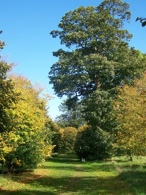
Meopham is a large linear village and civil parish in the Borough of Gravesham in north-west Kent, England, lying to the south of Gravesend. The parish covers 6.5 square miles (17 km2), and comprise

N Chadwick — CC BY-SA 2.0 via Wikimedia Commons licence
Plan your visit
- Typical visit
- 1.5 h–3 h
- Best time of year
- Year-round
- Nearest railway station
- Sole Street · 2.5 km
- Family-friendly
- Limited wheelchair access
Getting there & planning your visit
To visit Meopham museum, the nearest railway station is Sole Street, located 2.5 km away. The postcode for the museum is DA13 0AT. Please note that wheelchair accessibility is limited.
About
Meopham is a large linear village and civil parish in the Borough of Gravesham in north-west Kent, England, lying to the south of Gravesend. The parish covers 6.5 square miles (17 km2), and comprises two villages and two smaller settlements; it had a population of 6,795 at the 2021 census. Meopham village is sometimes described as the longest settlement in England although others such as Brinkworth which is one village make the same claim. Meopham is one of the longest linear settlements in Europe, being 7 miles (11 km) in length. Meopham is formally twinned with Ivanivka rural hromada in northern Ukraine. The twinning ceremony took place on 6th March 2025.
Photo gallery
Protected designations
- Site of Special Scientific Interest: Halling to Trottiscliffe Escarpment SSSI
- National Nature Reserve: NORTH KENT WOODS AND DOWNS
- Area of Outstanding Natural Beauty: Kent Downs
Designations sourced from Natural England open data under OGL v3.
From the Wikipedia article
Meopham is a large linear village and civil parish in the Borough of Gravesham in north-west Kent, England, lying to the south of Gravesend. The parish covers 6.5 square miles (17 km2), and comprises two villages and two smaller settlements; it had a population of 6,795 at the 2021 census. Meopham village is sometimes described as the longest settlement in England although others such as Brinkworth which is one village make the same claim. Meopham is one of the longest linear settlements in Europe, being 7 miles (11 km) in length. Meopham is formally twinned with Ivanivka rural hromada in northern Ukraine. The twinning ceremony took place on 6th March 2025.
Excerpt from Wikipedia under CC BY-SA 4.0. See the source article linked in Sources below.
Background
History
The name of the village derives from Meapaham (Meapa's village): it is first recorded in 788, in the reign of King Offa. The modern pronunciation of the name comes from different ways of writing and spelling. Benedictine monks established a priory hospital at Meopham in the 12th century and throughout the Middle Ages three medieval manor houses - those of Meopham, Dodmore and Nurstead - governed the land now encompassing the parish. Edward Hasted in 1797 described the village as being "out of the way" and with "no well frequented thoroughfare through it". Since the 1920s, when the road numbering scheme started, the main road through the village, the A227, has become busier as a…
Description
The parish comprises the main village, divided into four named settlements; the outlying village of Harvel (approx 2 miles south-east); and two other settlements: Dodmore (still comprising mostly rural land from The Street southeastwards for approx 1 mile towards Harvel) and Culverstone (approx 1.5 miles to the south). The Parish Council, which now owns the lordship of the manor of Meopham, meets at Meopham Windmill and consists of twelve members (aka joint trustees of the ancient manor).
Sourced from Wikipedia under CC BY-SA 4.0.
- Coordinates
- 51.3640, 0.3600
- County
- Kent
- District
- Gravesham
- Parish
- Meopham
- Postcode
- DA13 0AT
- Parliamentary constituency
- Gravesham
- Nearest railway station
- Sole Street — 2.5 km
Sources
- wikipedia: Meopham (CC BY-SA 4.0)
Other places nearby

Meopham Windmill
Windmills · 0.5 km

Parish Church of St John the Baptist, Meopham
Historic churches · 0.8 km

Ashmere Farm Certified Campsite
Campsites · 1.1 km

Hopehill Scout Campsite
Campsites · 1.5 km
Camer Park Country Park
Parks · 1.6 km

Sole Street
Villages · 2.7 km

Luddesdown
Villages · 2.7 km

Dode
Vineyards · 3.0 km

Ridley
Villages · 3.0 km

Church of All Saints
Historic churches · 3.3 km

Badgells Wood Camping
Campsites · 3.8 km

Owletts
Museums · 3.9 km
Nearby
📷 5Windmills · South East England
Meopham Windmill
Meopham Windmill is a windmill in the United Kingdom.
📷 5Historic churches · South East England
Parish Church of St John the Baptist, Meopham
Parish Church of St John the Baptist, Meopham — church in Meopham, Kent, England, UK.
📷 5Campsites · South East England
Ashmere Farm Certified Campsite
Ashmere Farm Certified Campsite — a campsite in england london.
📷 5Campsites · South East England
Hopehill Scout Campsite
Hopehill Scout Campsite — a campsite in england london.
📷 5Parks · South East England
Camer Park Country Park
Camer Park Country Park — park in United Kingdom.
📷 5Where to eat & stay near Meopham
Places to stay
📷 5Campsites · South East England
Ashmere Farm Certified Campsite
Ashmere Farm Certified Campsite — a campsite in england london.
📷 5Campsites · South East England
Hopehill Scout Campsite
Hopehill Scout Campsite — a campsite in england london.
📷 5Campsites · South East England
Badgells Wood Camping
Badgells Wood Camping — a campsite in england london.
 📷 5
📷 5 📷 7
📷 7 📷 7
📷 7Places to eat & drink
 📷 7
📷 7Historic pubs · South East England
The Leather Bottle Inn
The Leather Bottle Inn in England South East, United Kingdom.
 📷 5
📷 5Restaurants · South East England
Frankie & Benny's
Frankie & Benny's — a restaurant in england london. Cuisine: american. Brand: Frankie & Benny's.
 📷 5
📷 5Restaurants · South East England
Pad Thai Restaurant
Pad Thai Restaurant — a restaurant in england london.
 📷 5
📷 5 📷 5
📷 5Historic pubs · South East England
The Joiners Arms Public House
The Joiners Arms Public House in England South East, United Kingdom.
 📷 7
📷 7More museums in this region
 📷 5
📷 5Museums · South East England
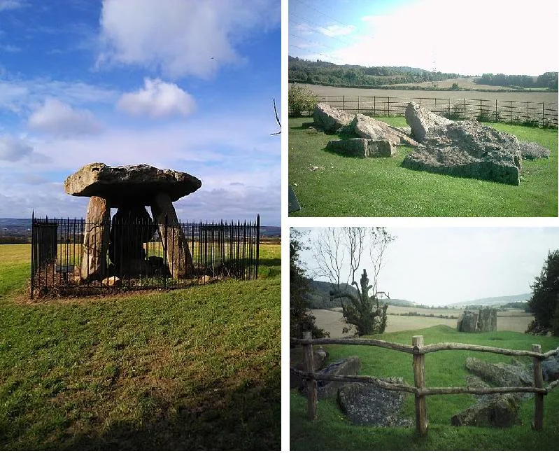
Coldrum Long Barrow
Coldrum Long Barrow — neolithic chambered long barrow near Trottiscliffe, Kent, England, UK.
 📷 5
📷 5Museums · South East England
Guildford House
Guildford House — house in Guildford, Surrey, England, UK.
 📷 5
📷 5Museums · South East England
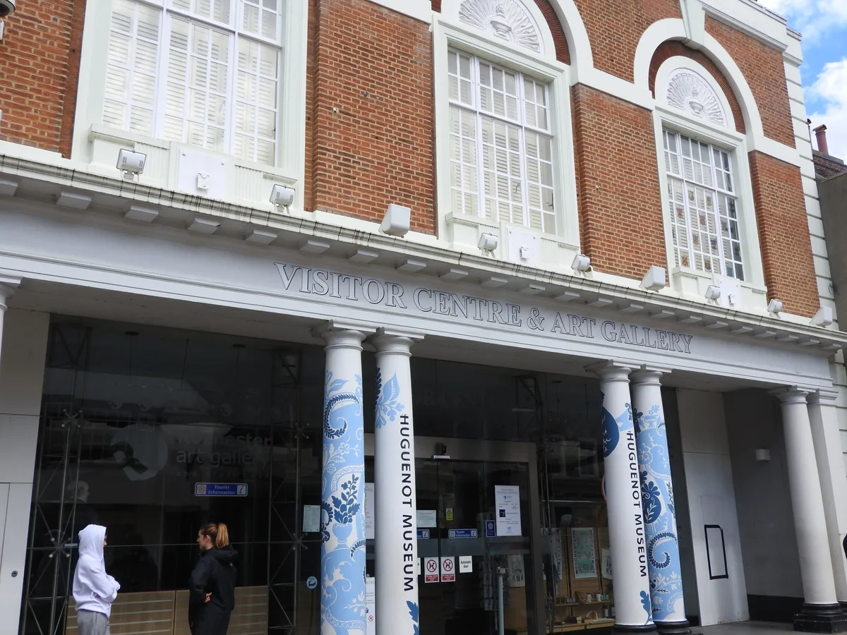
Huguenot Museum
Huguenot Museum — museum in Rochester, England, UK.
 📷 5
📷 5Museums · South East England
Medway megaliths
Medway megaliths — group of long barrows in Kent, England.
Frequently asked questions
- Where is Meopham?
- Meopham is in Kent, London, United Kingdom (postcode DA13 0AT), in the parish of Meopham.
- What is Meopham?
- Meopham is a large linear village and civil parish in the Borough of Gravesham in north-west Kent, England, lying to the south of Gravesend. The parish covers 6.5 square miles (17 km2), and comprise
- How do I get to Meopham?
- The nearest railway station is Sole Street, about 2.5 km away. Drivers can use postcode DA13 0AT.
- Is Meopham a protected site?
- Yes — Meopham is part of the Halling to Trottiscliffe Escarpment SSSI Site of Special Scientific Interest and the NORTH KENT WOODS AND DOWNS National Nature Reserve.
- How do I get to Meopham?
- The nearest railway station is Sole Street, about 2.5 km away. Drivers can navigate to postcode DA13 0AT.