
Museums · South East England
Coldrum Long Barrow
In or near Trottiscliffe.
Coldrum Long Barrow — neolithic chambered long barrow near Trottiscliffe, Kent, England, UK.

Wikimedia Commons contributors — see linked file page for photographer and licence licence

Plan your visit
- Typical visit
- 1.5 h–3 h
- Best time of year
- Year-round
- Nearest railway station
- West Malling · 4.6 km
- Free entry
- Family-friendly
- Wheelchair accessible
Getting there & planning your visit
To visit Coldrum Long Barrow, the nearest railway station is West Malling, located 4.6 km away. Entry is free, and the site is wheelchair accessible. The postcode for sat-nav is ME19 5EG.
About
Coldrum Long Barrow is a museum in the United Kingdom. Heritage designation: scheduled monument. Wikidata describes it as: "neolithic chambered long barrow near Trottiscliffe, Kent, England, UK". Coordinates: 51.3215°, 0.3727°.
Photo gallery
See it from the streetimagery from 2018
Imagery © Mapillary contributors, CC BY-SA 4.0
Heritage listing
The Coldrum Long Barrow, also known as the Coldrum Stones and the Adscombe Stones, is a chambered long barrow located near the village of Trottiscliffe in the south-eastern English county of Kent. Probably constructed in the fourth millennium BCE, during Britain's Early Neolithic period, today it survives only in a state of ruin. Archaeologists have established that the monument was built by pastoralist communities shortly after the introduction of agriculture to Britain from continental Europe. Part of an architectural tradition of long barrow building that was widespread across Neolithic Europe, the Coldrum Stones belong to a localised regional variant of barrows produced in the vicinity of the River Medway, now known as the Medway Megaliths.
From the Historic England List Entry under OGL v3.
Summary from the official site
Coldrum Long Barrow is a well-preserved megalithic chambered tomb located in Kent, dating back over 6,000 years. It is surrounded by sarsen stones and serves as a site for reflection and ritual, including traditional May Day celebrations. The site is managed by the National Trust and invites visitors to explore its historical significance.
Read more on the official property page.
Protected designations
- Site of Special Scientific Interest: Halling to Trottiscliffe Escarpment SSSI
- National Nature Reserve: NORTH KENT WOODS AND DOWNS
- Area of Outstanding Natural Beauty: Kent Downs
Designations sourced from Natural England open data under OGL v3.
From the Wikipedia article
The Coldrum Long Barrow, also known as the Coldrum Stones and the Adscombe Stones, is a chambered long barrow located near the village of Trottiscliffe in the south-eastern English county of Kent. Probably constructed in the fourth millennium BCE, during Britain's Early Neolithic period, today it survives only in a state of ruin. Archaeologists have established that the monument was built by pastoralist communities shortly after the introduction of agriculture to Britain from continental Europe. Part of an architectural tradition of long barrow building that was widespread across Neolithic Europe, the Coldrum Stones belong to a localised regional variant of barrows produced in the vicinity of the River Medway, now known as the Medway Megaliths. Of these, it is in the best surviving condition. It lies near to both Addington Long Barrow and Chestnuts Long Barrow on the western side of the river. Two further surviving long barrows, Kit's Coty House and Little Kit's Coty House, as well as possible survivals such as the Coffin Stone and White Horse Stone, are located on the Medway's eastern side. Built out of earth and around fifty local sarsen-stone megaliths, the long barrow consisted of a sub-rectangular earthen tumulus enclosed by kerb-stones. Within the eastern end of the tumulus was a stone chamber, into which human remains were deposited on at least two separate occasions during the Early Neolithic. Osteoarchaeological analysis of these remains has shown them to be those of at least seventeen individuals, a mixture of men, women, and children. At least one of the bodies had been dismembered before burial, potentially reflecting a funerary tradition of excarnation and secondary burial. As with other barrows, Coldrum has been interpreted as a tomb to house the remains of the dead, perhaps as part of a belief system involving ancestor veneration, although archaeologists have suggested that it may also have had further religious, ritual, and cultural connotations and…
Excerpt from Wikipedia under CC BY-SA 4.0. See the source article linked in Sources below.
Background
Architecture
The Coldrum Long Barrow originally consisted of a sarsen stone chamber, covered by a low earthen mound, which was bounded by prostrate slabs. As such, Ashbee asserted that the monument could be divided into three particular features: the chamber, the barrow, and the sarsen stone surround. It had been built using about 50 stones. The barrow is sub-rectangular in plan, and about 20 metres in length. At its broader, eastern end, where the chamber is located, the monument measures 50 feet, while at the narrower, western end, it is 40 ft in breadth. As such, the barrow is a "truncated wedge-shape". The megalithic builders responsible for the Coldrum Stones positioned it on the top of a small…
Description
The inner chamber measures 13 ft in length, and 5 ft in width, although it was potentially much larger when originally constructed. The chamber's internal height would have been at least 6 ft. In its current state, the northern side of the chamber is made up of two slabs. One is 8 ft long, 7 ft deep, and 1 ft thick; the other is 5 ft long, nearly 6 ft deep, and 2 ft thick. Conversely, the chamber's southern side consists of a single slab, measuring 11 ft in length, 7 ft in depth, and 1 ft in thickness at its eastern end. The western end of the chamber is closed off with a slab measuring about 4 ft wide, with a thickness of 1 ft and a depth of around 8 ft. A collapsed, broken slab lies at…
Sourced from Wikipedia under CC BY-SA 4.0.
- Coordinates
- 51.3215, 0.3727
- County
- Kent
- District
- Tonbridge and Malling
- Parish
- Trottiscliffe
- Postcode
- ME19 5EG
- Parliamentary constituency
- Tonbridge
- Nearest railway station
- West Malling — 4.6 km
- Opening
- Daily Dawn - Dusk
- Official site
- www.nationaltrust.org.uk
Sources
- wikidata: Q5142542 (CC0)
- wikipedia: Coldrum Long Barrow (CC BY-SA 4.0)
- commons: Part of Coldrum Long Barrow - geograph.org.uk - 482591.jpg (CC BY-SA 4.0)
Featured in this guide
Other places nearby

Church of St Peter and St Paul, Trottiscliffe
Historic churches · 0.8 km

Trottiscliffe
Towns & cities · 0.9 km

Trottiscliffe
Villages · 1.5 km

Chestnuts Long Barrow
Burial mounds & barrows · 1.6 km
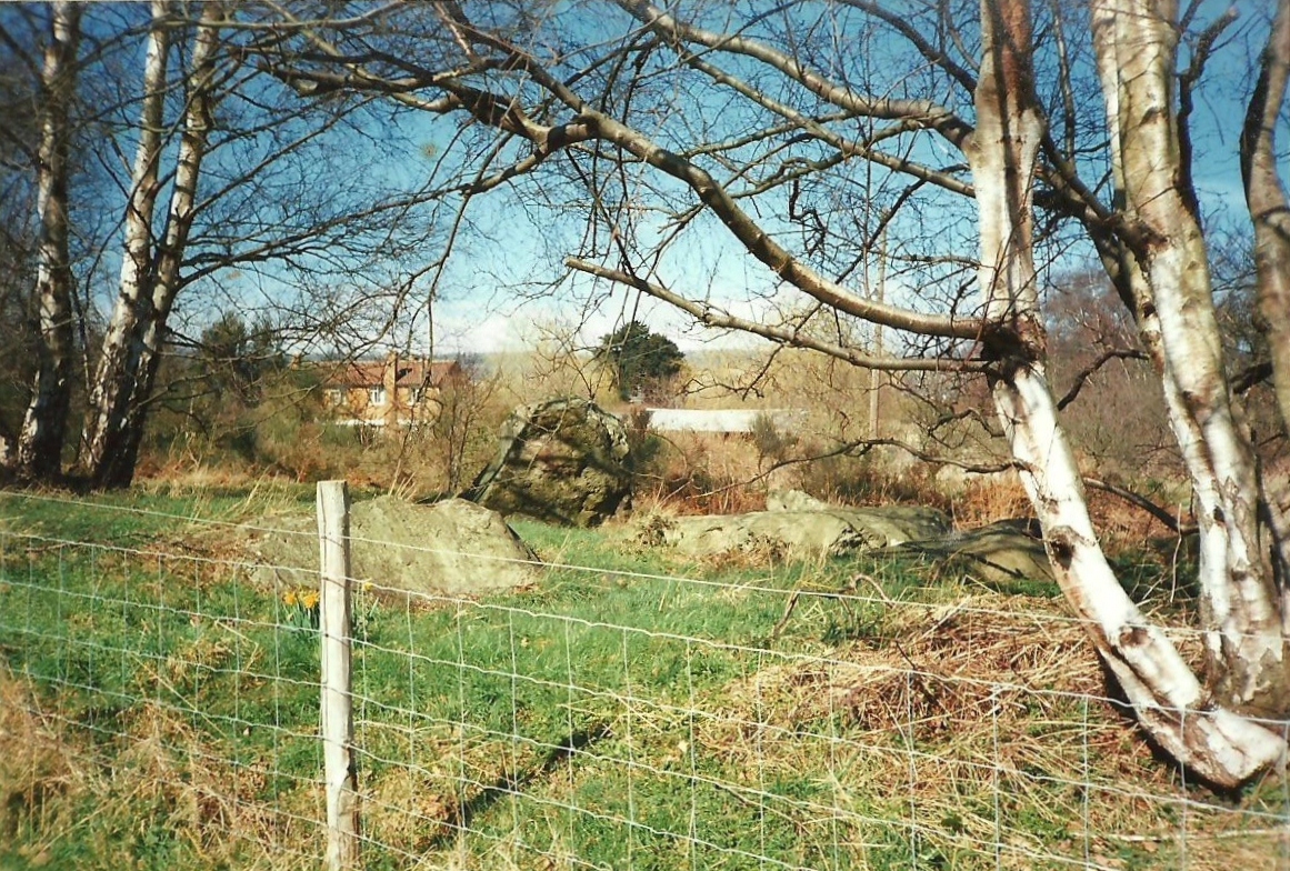
Chestnuts Long Barrow
Archaeological sites · 1.6 km

Badgells Wood Camping
Campsites · 1.6 km

Addington Long Barrow
Burial mounds & barrows · 1.6 km
Addington Long Barrow
Archaeological sites · 1.6 km

Obelisk 20 Yards To East Of Addington Church
Forts · 1.8 km

Vigo Village
Other places · 1.9 km
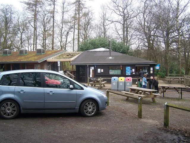
Trosley Country Park
Parks · 2.2 km

Linderwood Manor
Manor houses · 2.2 km
Nearby
📷 5Historic churches · South East England
Church of St Peter and St Paul, Trottiscliffe
Church of St Peter and St Paul, Trottiscliffe — Grade I listed building-listed church in england-london, United Kingdom.
📷 5Towns & cities · South East England
Trottiscliffe
Trottiscliffe — village and civil parish in Kent, United Kingdom.
📷 5📷 5Burial mounds & barrows · South East England
Chestnuts Long Barrow
Chestnuts Long Barrow — a burial mound in england-london, United Kingdom.
📷 5Archaeological sites · South East England
Chestnuts Long Barrow
Chestnuts Long Barrow — archaeological in england london.
📷 5Campsites · South East England
Badgells Wood Camping
Badgells Wood Camping — a campsite in england london.
Where to eat & stay near Coldrum Long Barrow
Places to stay
📷 5Campsites · South East England
Badgells Wood Camping
Badgells Wood Camping — a campsite in england london.
 📷 5
📷 5Campsites · South East England
Gate House Wood Touring Park
Gate House Wood Touring Park — a campsite in england london.
 📷 5
📷 5Campsites · South East England
Hopehill Scout Campsite
Hopehill Scout Campsite — a campsite in england london.
 📷 7
📷 7 📷 5
📷 5Campsites · South East England
Ashmere Farm Certified Campsite
Ashmere Farm Certified Campsite — a campsite in england london.
 📷 5
📷 5Places to eat & drink
 📷 5
📷 5 📷 5
📷 5Restaurants · South East England
Pad Thai Restaurant
Pad Thai Restaurant — a restaurant in england london.
 📷 5
📷 5Historic pubs · South East England
The Joiners Arms Public House
The Joiners Arms Public House in England South East, United Kingdom.
 📷 5
📷 5Historic pubs · South East England
Five Pointed Star Public House
Five Pointed Star Public House in England South East, United Kingdom.
 📷 7
📷 7 📷 7
📷 7Historic pubs · South East England
The King And Queen Public House
The King And Queen Public House in England South East, United Kingdom.
More museums in this region
 📷 5
📷 5Museums · South East England
Guildford House
Guildford House — house in Guildford, Surrey, England, UK.
 📷 5
📷 5Museums · South East England
Huguenot Museum
Huguenot Museum — museum in Rochester, England, UK.
 📷 5
📷 5Museums · South East England
Medway megaliths
Medway megaliths — group of long barrows in Kent, England.
 📷 5
📷 5Museums · South East England
Queen's Own Royal West Kent Regiment Museum
Queen's Own Royal West Kent Regiment Museum — Maidstone, Kent, United Kingdom.
Frequently asked questions
- Where is Coldrum Long Barrow?
- Coldrum Long Barrow is in Kent, London, United Kingdom (postcode ME19 5EG), in the parish of Trottiscliffe.
- What is Coldrum Long Barrow?
- Coldrum Long Barrow — neolithic chambered long barrow near Trottiscliffe, Kent, England, UK.
- How do I get to Coldrum Long Barrow?
- The nearest railway station is West Malling, about 4.6 km away. Drivers can use postcode ME19 5EG.
- Is Coldrum Long Barrow a listed building?
- Coldrum Long Barrow is officially recognised as scheduled monument listed.
- Is Coldrum Long Barrow a protected site?
- Yes — Coldrum Long Barrow is part of the Halling to Trottiscliffe Escarpment SSSI Site of Special Scientific Interest and the NORTH KENT WOODS AND DOWNS National Nature Reserve.
- Is Coldrum Long Barrow free to visit?
- Yes, Coldrum Long Barrow is free to enter.
- How do I get to Coldrum Long Barrow?
- The nearest railway station is West Malling, about 4.6 km away. Drivers can navigate to postcode ME19 5EG.