
Historic houses · North West England
Martholme
In or near Whalley.
Martholme — a Grade I-listed historic house in england-north-west, United Kingdom.

Steve Houldsworth — CC BY-SA 2.0 via Wikimedia Commons licence

Plan your visit
- Typical visit
- 1 h–2 h
- Nearest railway station
- Whalley · 3.6 km
- Family-friendly
- Limited wheelchair access
Getting there & planning your visit
To visit Martholme, the nearest railway station is Whalley, located 3.6 km away. The postcode for sat-nav is BB6 7UJ. Please note that wheelchair accessibility is limited.
About
Martholme is a Grade I-listed building in england-north-west, United Kingdom. Grade I status is conferred by Historic England (or Cadw, Historic Environment Scotland or NIEA equivalents) on buildings of exceptional national interest. See the linked Wikipedia article for full historical and architectural details.
Photo gallery
From the Wikipedia article
Martholme is a Grade I listed medieval manor house standing on the banks of the River Calder 1+1⁄4 miles (2 km) from Great Harwood, Lancashire, England and 5 miles (8 km) north-east of Blackburn.
Excerpt from Wikipedia under CC BY-SA 4.0. See the source article linked in Sources below.
Background
History
In the 13th century, the house belonged to the de Fitton family. After the Civil War the Hesketh family, as Catholics, were heavily fined, losing much of their land at Great Harwood. As a result, Martholme was neglected. It is now a private residence but much of the house has been demolished. It has been designated a Grade I listed building by English Heritage.
Architecture
Martholme is constructed, to a T-shaped floor plan, of sandstone rubble, now rendered, with a slate roof. It was originally surrounded by a moat, of which there are still traces. The 16th-century gatehouse is about 75 ft south of the house. It too is built of sandstone, with slate roofs. It is rectangular and measures approximately 43 ft by 20 ft. The entrance is a round stone archway. The building has three bays and is on two storeys. English Heritage designated the house a Grade I listed building on 11 July 1966. The Grade I designation—the highest of the three grades—is for buildings "of exceptional interest, sometimes considered to be internationally important". The gatehouse has…
Sourced from Wikipedia under CC BY-SA 4.0.
- Coordinates
- 53.8000, -2.3768
- County
- Lancashire
- District
- Hyndburn
- Parish
- Hyndburn, unparished area
- Postcode
- BB6 7UJ
- Parliamentary constituency
- Hyndburn
- Nearest railway station
- Whalley — 3.6 km
Sources
Other places nearby
.jpg?width=1200)
Martholme Viaduct
Historic bridges · 0.1 km

Bridge Heywood Caravan Park
Caravan parks · 0.6 km

Harwood Bar Caravan Park
Caravan parks · 1.1 km

Portfield hillfort
Vineyards · 1.8 km

Portfield
Archaeological sites · 1.9 km

Bowley International Scout Centre
Campsites · 1.9 km

Great Harwood War Memorial
Memorials & monuments · 2.0 km
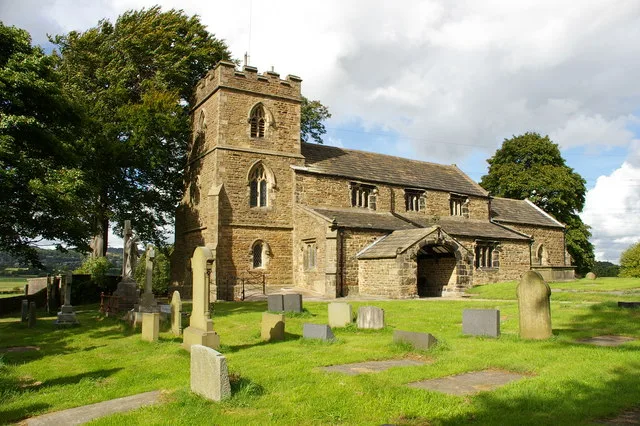
St James' Church, Altham
Historic churches · 2.0 km

Ghousia Masjid mosque
Historic churches · 2.1 km
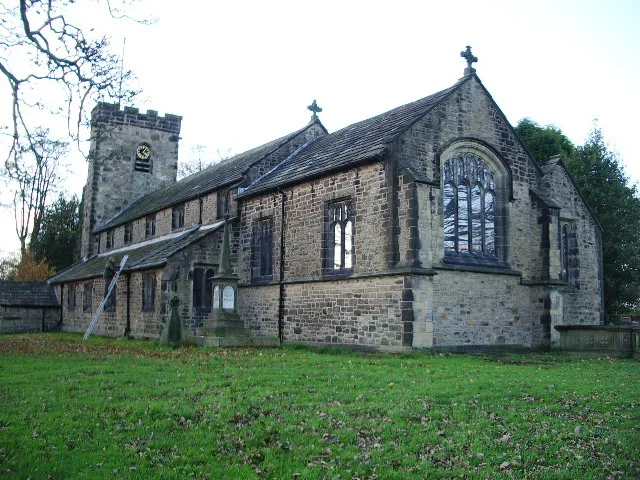
St Bartholomew's Church, Great Harwood
Historic churches · 2.2 km

Turn Hill
Mountains & hills · 2.2 km

Sparth Manor
Manor houses · 2.4 km
Nearby
📷 5Historic bridges · North West England
Martholme Viaduct
Martholme Viaduct is a historic bridge in the United Kingdom.
📷 5Caravan parks · North West England
Bridge Heywood Caravan Park
Bridge Heywood Caravan Park — a caravan park in england north west.
📷 5Caravan parks · North West England
Harwood Bar Caravan Park
Harwood Bar Caravan Park — a caravan park in england north west.
📷 5Vineyards · North West England
Portfield hillfort
Portfield hillfort — a UK vineyard in england north west, producing English or Welsh wine from cool-climate grape varieties.
📷 3Archaeological sites · North West England
Portfield
Portfield — a archaeological in england-north-west, United Kingdom.
📷 5Campsites · North West England
Bowley International Scout Centre
Bowley International Scout Centre — a campsite in england north west.
Where to eat & stay near Martholme
Places to stay
📷 5Caravan parks · North West England
Bridge Heywood Caravan Park
Bridge Heywood Caravan Park — a caravan park in england north west.
📷 5Caravan parks · North West England
Harwood Bar Caravan Park
Harwood Bar Caravan Park — a caravan park in england north west.
📷 5Campsites · North West England
Bowley International Scout Centre
Bowley International Scout Centre — a campsite in england north west.
 📷 5
📷 5Campsites · North West England
Wiswell Shay Farm CC Site
Wiswell Shay Farm CC Site — a campsite in england north west.
 📷 5
📷 5Hotels · North West England
Dunkenhalgh Hotel
Dunkenhalgh Hotel — a hotel in england north west.
 📷 5
📷 5Caravan parks · North West England
Stubbins Vale Caravan Park
Stubbins Vale Caravan Park — a caravan park in england north west.
Places to eat & drink
 📷 5
📷 5 📷 5
📷 5Historic pubs · North West England
Swan with Two Necks
Swan with Two Necks in England North West, United Kingdom.
 📷 5
📷 5 📷 5
📷 5Restaurants · North West England
The Three Fishes
The Three Fishes — a restaurant in england north west.
 📷 5📷 5
Restaurants · North West England
Fence Gate Inn
Fence Gate Inn — a restaurant in england north west.
More historic houses in this region
 📷 3
📷 3Historic houses · North West England
116 Hospital Street, Nantwich
116 Hospital Street, Nantwich — substantial townhouse in Nantwich, Cheshire, England, UK.
 📷 3
📷 3Historic houses · North West England
140–142 Hospital Street, Nantwich
140–142 Hospital Street, Nantwich — grade II listed building in Nantwich, Cheshire East, Cheshire, England, UK.
 📷 3
📷 3Historic houses · North West England
46 High Street, Nantwich
46 High Street, Nantwich — house in Nantwich, Cheshire, England, UK.
 📷 3
📷 3Historic houses · North West England
64, St Ann's Road
64, St Ann's Road — Grade II* listed house in Middlewich, Cheshire East, England, UK.
Frequently asked questions
- Where is Martholme?
- Martholme is in Lancashire, North-West England, United Kingdom (postcode BB6 7UJ), in the parish of Hyndburn, unparished area.
- What is Martholme?
- Martholme — a Grade I-listed historic house in england-north-west, United Kingdom.
- How do I get to Martholme?
- The nearest railway station is Whalley, about 3.6 km away. Drivers can use postcode BB6 7UJ.
- Who owns Martholme?
- Martholme is owned by | designation1 =Grade I Listed Building.
- Is Martholme a listed building?
- Martholme is officially recognised as Grade I listed.
- How do I get to Martholme?
- The nearest railway station is Whalley, about 3.6 km away. Drivers can navigate to postcode BB6 7UJ.