
Historic bridges · North West England
Martholme Viaduct
In or near Whalley.
Martholme Viaduct is a historic bridge in the United Kingdom.
.jpg?width=1200)
Wikimedia Commons contributors — see linked file page for photographer and licence licence
.jpg)
Plan your visit
- Typical visit
- 15 min–30 min
- Nearest railway station
- Whalley · 3.4 km
- Free entry
- Dog-friendly
About
Martholme Viaduct is a named historic bridge in the United Kingdom. Coordinates: 53.8005°, -2.3786°. This entry is part of The Great Britain Guide, a free, ad-free, open-data tourist directory.
Photo gallery
From the Wikipedia article
Martholme Viaduct is a railway bridge near Great Harwood in Lancashire, north-western England. It was built from 1870 and opened in 1877 after construction was beset by landslips. It closed in 1954 and is now a cycle way. It is a Grade II listed building.
Excerpt from Wikipedia under CC BY-SA 4.0. See the source article linked in Sources below.
Background
History
The viaduct was built to carry the Great Harwood Loop (also known as the North Lancashire Loop) of the East Lancashire Line, owned by the Lancashire and Yorkshire Railway (LYR). It crosses the River Ribble between Great Harwood and Read and was designed by Sturges Meek, the LYR's chief engineer. Construction began in 1870 but was beset with problems and the line did not open until. The line required deep cuttings at one end, the spoil from which was to be used to build the embankments needed at the other end, which required it to be transported a distance of around three miles (five kilometres). A large coalfield is located underneath the route and a colliery was located near the site of…
Description
The viaduct is 170 yd on a sharp curve. It is built from snecked gritstone (local sandstone) and faced with rock with brick soffits. It has ten semi-circular arches, each of 40 ft span, and reaches a maximum height of 65 ft above the valley. The arches spring from impost bands. Above them is a solid parapet. The viaduct is now part of a walking and cycling trail. It is a Grade II listed building, a status which provides it with legal protection, first designated in March 1984.
Sourced from Wikipedia under CC BY-SA 4.0.
- Coordinates
- 53.8005, -2.3786
- County
- Lancashire
- District
- Hyndburn
- Parish
- Hyndburn, unparished area
- Postcode
- BB6 7UJ
- Parliamentary constituency
- Hyndburn
- Nearest railway station
- Whalley — 3.4 km
- Opening
- | inaugurated =
Sources
- osm: w543496774 (ODbL)
- wikipedia: Martholme Viaduct (CC BY-SA 4.0)
- commons: Martholme Viaduct (geograph 3695617).jpg (CC BY-SA 4.0)
Other places nearby

Martholme
Historic houses · 0.1 km

Bridge Heywood Caravan Park
Caravan parks · 0.6 km

Harwood Bar Caravan Park
Caravan parks · 1.2 km

Portfield hillfort
Vineyards · 1.7 km

Portfield
Archaeological sites · 1.8 km

Bowley International Scout Centre
Campsites · 1.8 km

Great Harwood War Memorial
Memorials & monuments · 1.9 km

Turn Hill
Mountains & hills · 2.1 km
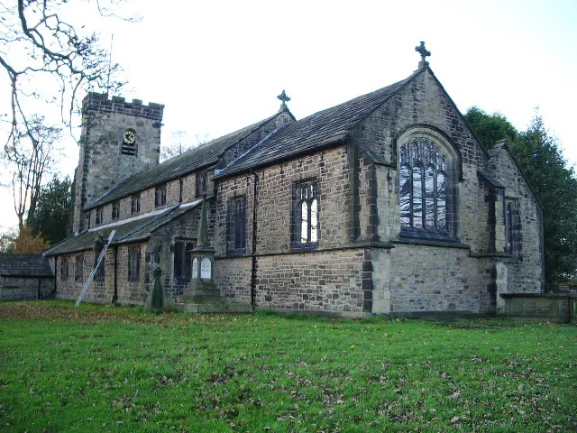
St Bartholomew's Church, Great Harwood
Historic churches · 2.1 km

Ghousia Masjid mosque
Historic churches · 2.1 km
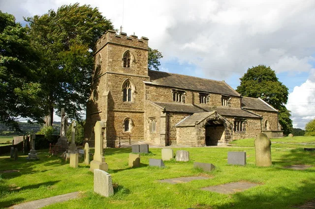
St James' Church, Altham
Historic churches · 2.1 km
Bowley Hill
Mountains & hills · 2.4 km
Nearby
📷 4Historic houses · North West England
Martholme
Martholme — a Grade I-listed historic house in england-north-west, United Kingdom.
📷 5Caravan parks · North West England
Bridge Heywood Caravan Park
Bridge Heywood Caravan Park — a caravan park in england north west.
📷 5Caravan parks · North West England
Harwood Bar Caravan Park
Harwood Bar Caravan Park — a caravan park in england north west.
📷 5Vineyards · North West England
Portfield hillfort
Portfield hillfort — a UK vineyard in england north west, producing English or Welsh wine from cool-climate grape varieties.
📷 3Archaeological sites · North West England
Portfield
Portfield — a archaeological in england-north-west, United Kingdom.
📷 5Campsites · North West England
Bowley International Scout Centre
Bowley International Scout Centre — a campsite in england north west.
Where to eat & stay near Martholme Viaduct
Places to stay
📷 5Caravan parks · North West England
Bridge Heywood Caravan Park
Bridge Heywood Caravan Park — a caravan park in england north west.
📷 5Caravan parks · North West England
Harwood Bar Caravan Park
Harwood Bar Caravan Park — a caravan park in england north west.
📷 5Campsites · North West England
Bowley International Scout Centre
Bowley International Scout Centre — a campsite in england north west.
 📷 5
📷 5Campsites · North West England
Wiswell Shay Farm CC Site
Wiswell Shay Farm CC Site — a campsite in england north west.
 📷 5
📷 5Hotels · North West England
Dunkenhalgh Hotel
Dunkenhalgh Hotel — a hotel in england north west.
 📷 5
📷 5Caravan parks · North West England
Stubbins Vale Caravan Park
Stubbins Vale Caravan Park — a caravan park in england north west.
Places to eat & drink
 📷 5
📷 5 📷 5
📷 5Historic pubs · North West England
Swan with Two Necks
Swan with Two Necks in England North West, United Kingdom.
 📷 5
📷 5 📷 5
📷 5Restaurants · North West England
The Three Fishes
The Three Fishes — a restaurant in england north west.
 📷 5📷 5
Restaurants · North West England
Fence Gate Inn
Fence Gate Inn — a restaurant in england north west.
More bridges in this region
 📷 3
📷 3Historic bridges · North West England
Albert Bridge
Albert Bridge is a historic bridge in the United Kingdom.
 📷 3
📷 3Historic bridges · North West England
Arpley New Bridge
Arpley New Bridge is a historic bridge in the United Kingdom.
 📷 3
📷 3Historic bridges · North West England
Arpley Railway Bridge
Arpley Railway Bridge is a historic bridge in the United Kingdom.
 📷 5
📷 5Historic bridges · North West England
Barton Road Bridge
Barton Road Bridge is a historic bridge in the United Kingdom.
Frequently asked questions
- Where is Martholme Viaduct?
- Martholme Viaduct is in Lancashire, North-West England, United Kingdom (postcode BB6 7UJ), in the parish of Hyndburn, unparished area.
- What is Martholme Viaduct?
- Martholme Viaduct is a historic bridge in the United Kingdom.
- How do I get to Martholme Viaduct?
- The nearest railway station is Whalley, about 3.4 km away. Drivers can use postcode BB6 7UJ.
- Who owns Martholme Viaduct?
- Martholme Viaduct is owned by | maint =.
- Is Martholme Viaduct free to visit?
- Yes, Martholme Viaduct is free to enter.
- How do I get to Martholme Viaduct?
- The nearest railway station is Whalley, about 3.4 km away. Drivers can navigate to postcode BB6 7UJ.