
Hill forts · South East England
Lyneham Longbarrow
In or near Cornwell.
Lyneham Longbarrow — Long barrow in Oxfordshire, England.

Wikimedia Commons contributors — see linked file page for photographer and licence licence

Plan your visit
- Typical visit
- 1 h–2 h
- Nearest railway station
- Ascott-under-Wychwood · 2.2 km
- Free entry
- Dog-friendly
About
Lyneham Longbarrow is a hill fort in the United Kingdom. Wikidata describes it as: "Long barrow in Oxfordshire, England". Coordinates: 51.8872°, -1.5691°.
Photo gallery
See it from the streetimagery from 2020
Imagery © Mapillary contributors, CC BY-SA 4.0
Protected designations
- Area of Outstanding Natural Beauty: Cotswolds
Designations sourced from Natural England open data under OGL v3.
From the Wikipedia article
Lyneham Longbarrow (grid reference SP297210) is a long barrow near Lyneham, Oxfordshire. It is beside the A361 road, between Shipton-under-Wychwood and Chipping Norton. Just nine metres from the barrow mound stands a 1.8-metre-tall (5.9 ft) standing stone.
Excerpt from Wikipedia under CC BY-SA 4.0. See the source article linked in Sources below.
Background
Description
Lyneham barrow stands on a ridge overlooking valleys to the northwest and southeast. The long barrow mound is 52 metres long, 19 metres wide and stands up to 1.75 metres high. Next to it is a weathered sandstone megalith 1.8 metres in height above ground level, 2.0 metres in width and 0.5 metres thick. The stone may have been part of a facade of standing stones.
Sourced from Wikipedia under CC BY-SA 4.0.
- Coordinates
- 51.8872, -1.5691
- County
- Oxfordshire
- District
- West Oxfordshire
- Parish
- Chadlington
- Postcode
- OX7 3NH
- Parliamentary constituency
- Banbury
- Nearest railway station
- Ascott-under-Wychwood — 2.2 km
Sources
- wikidata: Q15243198 (CC0)
- wikipedia: Lyneham Longbarrow (CC BY-SA 4.0)
- commons: Lyneham Longbarrow - geograph.org.uk - 3144.jpg (CC BY-SA 4.0)
Other places nearby

The Roundabout hillfort, 460m west of Barter's Hill Farm
Vineyards · 0.4 km

Pudlicote House
Manor houses · 1.7 km

Bridge At South West End Of Lake Approximately 300 Metres South Of Sarsden House
Historic bridges · 1.7 km

Bridge Over River Evenlode
Historic bridges · 2.0 km

Fragment of Ascott d'Oyley Castle
Castles · 2.0 km
Ascott d'Oyley 12th century motte and bailey castle and associated earthworks
Castles · 2.1 km
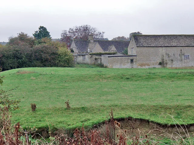
Ascot d'Oilly Castle
Hill forts · 2.1 km

Manor House
Historic houses · 2.1 km

Ascot d'Oilly
Castles · 2.1 km

Ascott Earl Castle
Literary houses · 2.6 km

Ascott Earl motte and bailey castle
Castles · 2.6 km
Ascott Earl
Castles · 2.6 km
Nearby
📷 5Vineyards · South East England
The Roundabout hillfort, 460m west of Barter's Hill Farm
The Roundabout hillfort, 460m west of Barter's Hill Farm — a UK vineyard in england west midlands, producing English or Welsh wine from cool-climate grape varieties.
📷 3Manor houses · South East England
Pudlicote House
Pudlicote House — a manor in South East England, United Kingdom.
📷 3Historic bridges · South East England
Bridge At South West End Of Lake Approximately 300 Metres South Of Sarsden House
Bridge At South West End Of Lake Approximately 300 Metres South Of Sarsden House — Grade II listed building-listed bridge in england-west-midlands, United Kingdom.
📷 3Historic bridges · South East England
Bridge Over River Evenlode
Bridge Over River Evenlode — Grade II listed building-listed bridge in england-west-midlands, United Kingdom.
📷 3Castles · South East England
Fragment of Ascott d'Oyley Castle
Fragment of Ascott d'Oyley Castle — a castle in South East England, United Kingdom.
📷 3Castles · South East England
Ascott d'Oyley 12th century motte and bailey castle and associated earthworks
Ascott d'Oyley 12th century motte and bailey castle and associated earthworks — a castle in South East England, United Kingdom.
Where to eat & stay near Lyneham Longbarrow
Places to stay
 📷 7
📷 7Hotels · South East England
The Shaven Crown
The Shaven Crown — a hotel in england west midlands.
 📷 5
📷 5Campsites · South East England
Chipping Norton Camp Site
Chipping Norton Camp Site — a campsite in england west midlands.
 📷 7
📷 7Hotels · South East England
The Lamb Inn
The Lamb Inn — a hotel in england west midlands.
 📷 4
📷 4Campsites · South East England
Cotswold View
Cotswold View — a campsite in england west midlands.
 📷 5
📷 5 📷 5
📷 5Campsites · South East England
Merryweather Farm Campsite
Merryweather Farm Campsite — a campsite in england west midlands.
Places to eat & drink
 📷 5
📷 5Historic pubs · South East England
Ye Olde Three Horseshoes
Ye Olde Three Horseshoes in England South East, United Kingdom.
 📷 7
📷 7Historic pubs · South East England
The Bunch Of Grapes Public House
The Bunch Of Grapes Public House in England South East, United Kingdom.
 📷 7
📷 7Restaurants · South East England
Spice lounge
Spice lounge — a restaurant in england west midlands.
 📷 5
📷 5Historic pubs · South East England
The Lamb And Flag Public House
The Lamb And Flag Public House in England South East, United Kingdom.
 📷 7
📷 7 📷 5
📷 5Restaurants · South East England
The Kings Arms
The Kings Arms — a restaurant in england west midlands.
More places in this region
 📷 5
📷 5Hill forts · South East England
Ankerwycke Priory
Ankerwycke Priory — Benedictine nunnery with associated moat and fishponds.
 📷 5
📷 5Hill forts · South East England
Shornemead Fort
Shornemead Fort — fort in Shorne, Kent, England, UK.
 📷 5
📷 5Hill forts · South East England
Smythe's Megalith
Smythe's Megalith — neolithic monument in Kent, England.
 📷 5
📷 5Hill forts · South East England
White Horse Stone
White Horse Stone — Two megaliths near Aylesford, Kent, England.
Frequently asked questions
- Where is Lyneham Longbarrow?
- Lyneham Longbarrow is in Oxfordshire, South-East England, United Kingdom (postcode OX7 3NH), in the parish of Chadlington.
- What is Lyneham Longbarrow?
- Lyneham Longbarrow — Long barrow in Oxfordshire, England.
- How do I get to Lyneham Longbarrow?
- The nearest railway station is Ascott-under-Wychwood, about 2.2 km away. The nearest town is Cornwell. Drivers can use postcode OX7 3NH.
- Is Lyneham Longbarrow a protected site?
- Yes — Lyneham Longbarrow is part of the Cotswolds National Landscape (AONB).
- Is Lyneham Longbarrow free to visit?
- Yes, Lyneham Longbarrow is free to enter.
- How do I get to Lyneham Longbarrow?
- The nearest railway station is Ascott-under-Wychwood, about 2.2 km away. Drivers can navigate to postcode OX7 3NH.