
Historic bridges · South East England
Bridge At South West End Of Lake Approximately 300 Metres South Of Sarsden House
In or near Cornwell.
Bridge At South West End Of Lake Approximately 300 Metres South Of Sarsden House — Grade II listed building-listed bridge in england-west-midlands, United Kingdom.

Nick Barber — CC BY-SA 2.0 via Wikimedia Commons licence

Plan your visit
- Typical visit
- 15 min–30 min
- Nearest railway station
- Kingham · 3.3 km
- Free entry
- Dog-friendly
Getting there & planning your visit
The nearest railway station is Kingham, located 3.3 km away. The postcode for the bridge is OX7 6PP, and entry is free.
About
Bridge At South West End Of Lake Approximately 300 Metres South Of Sarsden House is a Grade II listed building-listed bridge in england-west-midlands, United Kingdom, registered on the National Heritage List for England (NHLE entry 1200336). Listed status protects buildings and structures of special architectural or historic interest. See the linked Wikipedia article for further details.
Photo gallery
Heritage listing
Details SARSOEN SP22SE 7/192 Bridge at SW end of lake approx. 300m S of Sarsden House II Bridge. Circa 1796 by Humphry Repton for John Langston. Limestone ashlar with boulder facing to north side and above arch on south side. Single segmental arch. Humphry Repton, who created the lake on which the bridge stands, presented a Red Book for improvements to Sarsden (including the formation of the lake) to John Langston in March 1796. (Nigel Temple, Sarsden, Oxfordshire: Journal of Garden History: Vol.6, No.2 (1986), pp.89-111) [2642] Listing NGR: SP2897422600 Legacy The contents of this record have been generated from a legacy data system. Legacy System number: 254087 Legacy System: LBS
From the Historic England List Entry under OGL v3.
Protected designations
- Area of Outstanding Natural Beauty: Cotswolds
Designations sourced from Natural England open data under OGL v3.
Place summary
The Bridge at the south-west end of the lake, approximately 300 metres south of Sarsden House, is located in Sarsden, Oxfordshire, within the West Midlands. This structure is designated as a Grade II listed building, highlighting its architectural and historical significance.
AI-generated from the structured facts on this page (operator, designation, listing, era). Not a substitute for visiting.
- Coordinates
- 51.9012, -1.5803
- County
- Oxfordshire
- District
- West Oxfordshire
- Parish
- Sarsden
- Postcode
- OX7 6PP
- Parliamentary constituency
- Banbury
- Nearest railway station
- Kingham — 3.3 km
Sources
- wikidata: Q26496145 (CC0)
Other places nearby

The Roundabout hillfort, 460m west of Barter's Hill Farm
Vineyards · 1.5 km

Churchill The Mount
Castles · 1.5 km
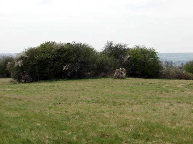
Lyneham Longbarrow
Hill forts · 1.7 km

Churchill
Villages · 1.8 km

William Smith Memorial
Memorials & monuments · 1.8 km
Churchill, Oxfordshire
Museums · 1.9 km

Churchill & Sarsden Heritage Centre
Museums · 2.2 km

The Dower House
Historic houses · 2.4 km

Knollbury
Forts · 2.7 km

Knollbury
Vineyards · 2.7 km

Chipping Norton Camp Site
Campsites · 3.1 km

Pudlicote House
Manor houses · 3.2 km
Nearby
📷 5Vineyards · South East England
The Roundabout hillfort, 460m west of Barter's Hill Farm
The Roundabout hillfort, 460m west of Barter's Hill Farm — a UK vineyard in england west midlands, producing English or Welsh wine from cool-climate grape varieties.
📷 5Castles · South East England
Churchill The Mount
Churchill The Mount — a castle in england west midlands.
📷 3Hill forts · South East England
Lyneham Longbarrow
Lyneham Longbarrow — Long barrow in Oxfordshire, England.
📷 5📷 3Memorials & monuments · South East England
William Smith Memorial
William Smith Memorial — a memorial in england-west-midlands, United Kingdom.
📷 5Museums · South East England
Churchill, Oxfordshire
Churchill, Oxfordshire — a museum in england-west-midlands, United Kingdom.
Where to eat & stay near Bridge At South West End Of Lake Approximately 300 Metres South Of Sarsden House
Places to stay
📷 5Campsites · South East England
Chipping Norton Camp Site
Chipping Norton Camp Site — a campsite in england west midlands.
 📷 7
📷 7Hotels · South East England
The Shaven Crown
The Shaven Crown — a hotel in england west midlands.
 📷 7
📷 7Hotels · South East England
The Lamb Inn
The Lamb Inn — a hotel in england west midlands.
 📷 5
📷 5 📷 5
📷 5Campsites · South East England
Merryweather Farm Campsite
Merryweather Farm Campsite — a campsite in england west midlands.
 📷 4
📷 4Campsites · South East England
Cotswold View
Cotswold View — a campsite in england west midlands.
Places to eat & drink
 📷 7
📷 7Historic pubs · South East England
The Bunch Of Grapes Public House
The Bunch Of Grapes Public House in England South East, United Kingdom.
 📷 5
📷 5Historic pubs · South East England
Ye Olde Three Horseshoes
Ye Olde Three Horseshoes in England South East, United Kingdom.
 📷 5
📷 5Restaurants · South East England
The Kings Arms
The Kings Arms — a restaurant in england west midlands.
 📷 7
📷 7Restaurants · South East England
Spice lounge
Spice lounge — a restaurant in england west midlands.
 📷 7
📷 7 📷 5
📷 5Historic pubs · South East England
The Lamb And Flag Public House
The Lamb And Flag Public House in England South East, United Kingdom.
More bridges in this region
 📷 5
📷 5Historic bridges · South East England
Briary Hill Bridge east
Briary Hill Bridge east is a historic bridge in the United Kingdom.
 📷 5
📷 5Historic bridges · South East England
Briary Hill Bridge west
Briary Hill Bridge west is a historic bridge in the United Kingdom.
 📷 5
📷 5Historic bridges · South East England
Bridge 157 VIR (Bath Hard Road)
Bridge 157 VIR (Bath Hard Road) is a historic bridge in the United Kingdom.
 📷 5
📷 5Historic bridges · South East England
Dorking Arch Bridge
Dorking Arch Bridge is a historic bridge in the United Kingdom.
Frequently asked questions
- Where is Bridge At South West End Of Lake Approximately 300 Metres South Of Sarsden House?
- Bridge At South West End Of Lake Approximately 300 Metres South Of Sarsden House is in Oxfordshire, the West Midlands, United Kingdom (postcode OX7 6PP), in the parish of Sarsden.
- What is Bridge At South West End Of Lake Approximately 300 Metres South Of Sarsden House?
- Bridge At South West End Of Lake Approximately 300 Metres South Of Sarsden House — Grade II listed building-listed bridge in england-west-midlands, United Kingdom.
- How do I get to Bridge At South West End Of Lake Approximately 300 Metres South Of Sarsden House?
- The nearest railway station is Kingham, about 3.3 km away. Drivers can use postcode OX7 6PP.
- Is Bridge At South West End Of Lake Approximately 300 Metres South Of Sarsden House a listed building?
- Bridge At South West End Of Lake Approximately 300 Metres South Of Sarsden House is officially recognised as Grade II listed building listed.
- Is Bridge At South West End Of Lake Approximately 300 Metres South Of Sarsden House a protected site?
- Yes — Bridge At South West End Of Lake Approximately 300 Metres South Of Sarsden House is part of the Cotswolds National Landscape (AONB).
- Is Bridge At South West End Of Lake Approximately 300 Metres South Of Sarsden House free to visit?
- Yes, Bridge At South West End Of Lake Approximately 300 Metres South Of Sarsden House is free to enter.
- How do I get to Bridge At South West End Of Lake Approximately 300 Metres South Of Sarsden House?
- The nearest railway station is Kingham, about 3.3 km away. Drivers can navigate to postcode OX7 6PP.