
Manor houses · South East England
Linderwood Manor
In or near Trottiscliffe.
Linderwood Manor — a manor in South East England, United Kingdom.

Marathon — CC BY-SA 2.0 via Wikimedia Commons licence

Plan your visit
- Typical visit
- 1 h–2 h
- Nearest railway station
- Borough Green & Wrotham · 4.5 km
- Limited wheelchair access
About
Linderwood Manor is a manor located in South East England, United Kingdom. Sourced from OpenStreetMap (ODbL licence); see local listings for visitor information, opening hours and admission details.
Photo gallery
See it from the streetimagery from 2019
Imagery © Mapillary contributors, CC BY-SA 4.0
Protected designations
- Site of Special Scientific Interest: Halling to Trottiscliffe Escarpment SSSI
- National Nature Reserve: NORTH KENT WOODS AND DOWNS
- Area of Outstanding Natural Beauty: Kent Downs
Designations sourced from Natural England open data under OGL v3.
Place summary
Linderwood Manor is a manor located in London. It is notable for its architectural significance and historical context within the region.
AI-generated from the structured facts on this page (operator, designation, listing, era). Not a substitute for visiting.
- Coordinates
- 51.3268, 0.3420
- County
- Kent
- District
- Gravesham
- Parish
- Vigo
- Postcode
- DA13 0SY
- Parliamentary constituency
- Gravesham
- Nearest railway station
- Borough Green & Wrotham — 4.5 km
Sources
- osm: way/693540575 (ODbL)
Other places nearby
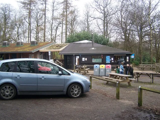
Trosley Country Park
Parks · 0.2 km

Hemsley Conservation Centre
Zoos & aquariums · 0.3 km

Vigo Village
Other places · 0.5 km

Hall Wood
Castles · 0.5 km

Trottiscliffe
Villages · 1.5 km

Trottiscliffe
Towns & cities · 1.5 km

Church of St Peter and St Paul, Trottiscliffe
Historic churches · 1.5 km
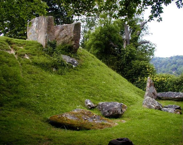
Coldrum Long Barrow
Museums · 2.2 km

Stansted War Memorial
Memorials & monuments · 2.6 km

Stansted
Villages · 2.7 km

Hopehill Scout Campsite
Campsites · 2.9 km

Chestnuts Long Barrow
Burial mounds & barrows · 2.9 km
Nearby
📷 5Parks · South East England
Trosley Country Park
Trosley Country Park — park in United Kingdom.
📷 5Zoos & aquariums · South East England
Hemsley Conservation Centre
Hemsley Conservation Centre — a zoo aquarium in South East England, United Kingdom.
📷 5Other places · South East England
Vigo Village
Vigo Village — a other in england-london, United Kingdom.
📷 5📷 5📷 5Towns & cities · South East England
Trottiscliffe
Trottiscliffe — village and civil parish in Kent, United Kingdom.
Where to eat & stay near Linderwood Manor
Places to stay
📷 5Campsites · South East England
Hopehill Scout Campsite
Hopehill Scout Campsite — a campsite in england london.
 📷 7
 📷 5
Campsites · South East England
Gate House Wood Touring Park
Gate House Wood Touring Park — a campsite in england london.
 📷 5
Campsites · South East England
Badgells Wood Camping
Badgells Wood Camping — a campsite in england london.
 📷 5
 📷 5
Campsites · South East England
Ashmere Farm Certified Campsite
Ashmere Farm Certified Campsite — a campsite in england london.
Places to eat & drink
 📷 5
Restaurants · South East England
Imperial Dynasty
Imperial Dynasty — a restaurant in england london.
 📷 5
Restaurants · South East England
Pad Thai Restaurant
Pad Thai Restaurant — a restaurant in england london.
 📷 5
Historic pubs · South East England
The Joiners Arms Public House
The Joiners Arms Public House in England South East, United Kingdom.
 📷 5
Historic pubs · South East England
Five Pointed Star Public House
Five Pointed Star Public House in England South East, United Kingdom.
 📷 7
 📷 5
More places in this region
 📷 5
Manor houses · South East England
Albury Manor
Albury Manor — a manor in South East England, United Kingdom.
 📷 5
Manor houses · South East England
Weardale Manor
Weardale Manor — a manor in South East England, United Kingdom.
 📷 5
Manor houses · South East England
Rowbarns Manor
Rowbarns Manor — a manor in South East England, United Kingdom.
 📷 5
Manor houses · South East England
Sutton Place
Sutton Place — a manor in South East England, United Kingdom.
Frequently asked questions
- Where is Linderwood Manor?
- Linderwood Manor is in Kent, South-East England, United Kingdom (postcode DA13 0SY), in the parish of Vigo.
- What is Linderwood Manor?
- Linderwood Manor — a manor in South East England, United Kingdom.
- How do I get to Linderwood Manor?
- The nearest railway station is Borough Green & Wrotham, about 4.5 km away. The nearest town is Trottiscliffe. Drivers can use postcode DA13 0SY.
- Is Linderwood Manor a protected site?
- Yes — Linderwood Manor is part of the Halling to Trottiscliffe Escarpment SSSI Site of Special Scientific Interest and the NORTH KENT WOODS AND DOWNS National Nature Reserve.
- How do I get to Linderwood Manor?
- The nearest railway station is Borough Green & Wrotham, about 4.5 km away. Drivers can navigate to postcode DA13 0SY.