
Archaeological sites · North East England
Kirkcarrion
Kirkcarrion in England North East, United Kingdom.

Trevor Littlewood — CC BY-SA 2.0 via Wikimedia Commons licence

Plan your visit
- Typical visit
- 45 min–1.5 h
- Free entry
- Dog-friendly
About
Kirkcarrion is a place of interest in England North East, United Kingdom — drawn from open-data sources for visitor reference. See the linked Wikipedia article for the full description.
Photo gallery
Protected designations
- Site of Special Scientific Interest: Upper Teesdale SSSI
- Area of Outstanding Natural Beauty: North Pennines
Designations sourced from Natural England open data under OGL v3.
From the Wikipedia article
Kirkcarrion is a copse of pine trees, surrounded by a stone wall, on a hilltop near Middleton-in-Teesdale, County Durham, England. The trees, which were planted in Victorian times, cover a tumulus which is reputed to be the burial place of a Bronze Age chieftain, Prince Caryn, who ruled before the days of the Romans. The site is a Bronze Age round barrow on the top of Lunedale Ridge, where it looms over the small town of Middleton-in-Teesdale some 400 feet below. The name Kirkcarrion is conjectured to derive from Carreg Caryn, or "burial mound of Caryn". Kirkcarrion is also sometimes referred to as "Caryn's Castle", a name for which Caer Caryn might be a potential rendering in Brythonic. It has been suggested that Caryn was a Brigantean chief, although this seems unlikely, as the Brigantes were a tribe of the later Iron Age. Excavations in the 19th century are said to have yielded a cist burial and a funerary urn with charred bones inside. The artifacts, the current whereabouts of which is uncertain, are thought to have ended up in the possession of Lord Strathmore, who subsequently built walls around the site and planted the trees within. One legend states that within the circle of trees is a spot where no wind blows, no matter how inclement the weather.
Excerpt from Wikipedia under CC BY-SA 4.0. See the source article linked in Sources below.
- Coordinates
- 54.6094, -2.0958
- District
- County Durham
- Parish
- Lunedale
- Postcode
- DL12 0NT
- Parliamentary constituency
- Bishop Auckland
Sources
- wikidata: Q6415627 (CC0)
- wikipedia: Kirkcarrion (CC BY-SA 4.0)
Featured in these 2 guides
Other places nearby

West Park Meadows
Reservoirs & lochs · 0.9 km

Bowbank
Castles · 1.1 km
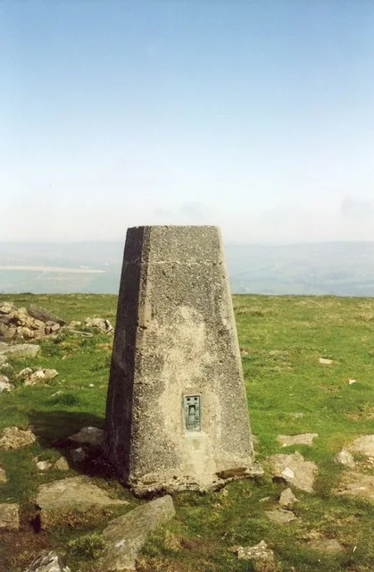
Harter Fell
Mountains & hills · 1.1 km

Middleton Quarry
Quarries · 1.2 km

Thringarth
Other places · 1.2 km

Middleton-in-Teesdale railway station
Castles · 1.3 km

Daleview Holiday Park
Caravan parks · 1.3 km

Rigg Farm and Stake Hill Meadows
Reservoirs & lochs · 1.5 km
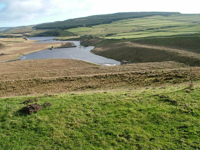
Grassholme Reservoir
Reservoirs & lochs · 1.5 km

Laithkirk
Historic churches · 1.5 km

Middleton-In-Teesdale Auction Mart
Farmers’ markets · 1.5 km

Middleton Bridge
Historic bridges · 1.6 km
Nearby
📷 5Reservoirs & lochs · North East England
West Park Meadows
West Park Meadows in England North East, United Kingdom.
📷 4📷 3Mountains & hills · North East England
Harter Fell
Harter Fell — Named summit at 480.7 m.
📷 3Quarries · North East England
Middleton Quarry
Middleton Quarry in England North East, United Kingdom.
📷 4📷 5Castles · North East England
Middleton-in-Teesdale railway station
Middleton-in-Teesdale railway station in England North East, United Kingdom.
Where to eat & stay near Kirkcarrion
Places to stay
📷 5Caravan parks · North East England
Daleview Holiday Park
Daleview Holiday Park — a caravan park in scotland lowlands.
 📷 5
📷 5Campsites · North East England
Lonton South Farm
Lonton South Farm — a campsite in scotland lowlands.
 📷 5
📷 5Hotels · North East England
The Teesdale Hotel
The Teesdale Hotel — a hotel in scotland lowlands.
 📷 5
📷 5B&Bs · North East England
Brunswick House
Brunswick House — a bed-and-breakfast in scotland lowlands.
 📷 5
📷 5Caravan parks · North East England
Leekworth Caravan and Camping Park
Leekworth Caravan and Camping Park — a caravan park in scotland lowlands.
 📷 5
📷 5Campsites · North East England
Newton Lodge campsite
Newton Lodge campsite — a campsite in scotland lowlands.
Places to eat & drink
 📷 6
📷 6Historic pubs · North East England
Commercial Hotel
Commercial Hotel in England North East, United Kingdom.
 📷 5
📷 5Historic pubs · North East England
The White Swan Public House And Swan Cottage
The White Swan Public House And Swan Cottage in England North East, United Kingdom.
 📷 6
📷 6Historic pubs · North East England
Cricketers' Arms Public House
Cricketers' Arms Public House in England North East, United Kingdom.
 📷 5
📷 5 📷 5
📷 5Historic pubs · North East England
Turk's Head Public House
Turk's Head Public House in England North East, United Kingdom.
 📷 5
📷 5Historic pubs · North East England
Blue Bell Public House
Blue Bell Public House in England North East, United Kingdom.
More archaeological sites in this region
 📷 5
📷 5Archaeological sites · North East England
Medieval Manorial Site of Low Dinsdale
Medieval Manorial Site of Low Dinsdale — archaeological in england yorkshire.
 📷 3
📷 3Archaeological sites · North East England
Old Smelting Mill
Old Smelting Mill — a archaeological in england-north-west, United Kingdom.
 📷 5
📷 5Archaeological sites · North East England
Roper Castle or Round Table (Roman Signal Station)
Roper Castle or Round Table (Roman Signal Station) — archaeological in england north west.
 📷 5
📷 5Archaeological sites · North East England
Nine Standards Rigg
Nine Standards Rigg — archaeological in england north west. Elevation: 662 m.
Frequently asked questions
- Where is Kirkcarrion?
- Kirkcarrion is in North-East England, United Kingdom (postcode DL12 0NT), in the parish of Lunedale.
- What is Kirkcarrion?
- Kirkcarrion in England North East, United Kingdom.
- How do I get to Kirkcarrion?
- Drivers can use postcode DL12 0NT.
- Is Kirkcarrion a protected site?
- Yes — Kirkcarrion is part of the Upper Teesdale SSSI Site of Special Scientific Interest and the North Pennines National Landscape (AONB).
- Is Kirkcarrion free to visit?
- Yes, Kirkcarrion is free to enter.
- How do I get to Kirkcarrion?
- Drivers can navigate to postcode DL12 0NT. It sits within the Bishop Auckland parliamentary constituency.