Mountains & hills · North East England
Harter Fell
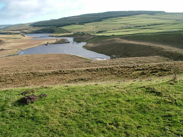
Harter Fell — Named summit at 480.7 m.

Wikimedia Commons contributors — see linked file page for photographer and licence licence
Plan your visit
- Typical visit
- 3 h–8 h
- Best time of year
- Late spring – early autumn (May–Oct)
- Free entry
- Dog-friendly
About
Harter Fell is a named summit in the Scottish Lowlands. The site is within the North Pennines National Landscape (AONB), and is a designated Site of Special Scientific Interest. It sits within the Bishop Auckland parliamentary constituency. Postcode area DL12.
Photo gallery
Official information
Harter Fell is a prominent mountain located in the Lake District, known for its stunning views and challenging hiking trails. Visitors can enjoy the natural beauty of the surrounding landscape and explore various routes to the summit.
Protected designations
- Site of Special Scientific Interest: Lune Forest SSSI
- Site of Special Scientific Interest: Upper Teesdale SSSI
- Area of Outstanding Natural Beauty: North Pennines
Designations sourced from Natural England open data under OGL v3.
Place summary
Harter Fell is a mountain located in the Scottish Lowlands, within the parish of Lunedale. It is designated as a Site of Special Scientific Interest (SSSI) under both Lune Forest and Upper Teesdale, and is part of the North Pennines Area of Outstanding Natural Beauty (AONB).
AI-generated from the structured facts on this page (operator, designation, listing, era). Not a substitute for visiting.
- Coordinates
- 54.6092, -2.1133
- District
- County Durham
- Parish
- Lunedale
- Postcode
- DL12 0NU
- Parliamentary constituency
- Bishop Auckland
- Official site
- trigpointing.uk
Sources
- osm: n29537120 (ODbL)
- commons: Trig Point on Harter Fell - geograph.org.uk - 887429.jpg (CC BY-SA 4.0)
Other places nearby

Thringarth
Other places · 0.9 km

Kirkcarrion
Archaeological sites · 1.1 km

Rigg Farm and Stake Hill Meadows
Reservoirs & lochs · 1.4 km

West Park Meadows
Reservoirs & lochs · 1.5 km

Bowbank
Castles · 1.8 km
Grassholme Reservoir
Reservoirs & lochs · 1.8 km

Middle Crossthwaite
Wildlife reserves · 1.9 km

Middleton-in-Teesdale railway station
Castles · 2.2 km

Middleton Quarry
Quarries · 2.2 km

Daleview Holiday Park
Caravan parks · 2.2 km

Grassholme
Other places · 2.2 km

Park End Wood
Wildlife reserves · 2.3 km
Nearby
📷 4📷 4Archaeological sites · North East England
Kirkcarrion
Kirkcarrion in England North East, United Kingdom.
📷 3Reservoirs & lochs · North East England
Rigg Farm and Stake Hill Meadows
Rigg Farm and Stake Hill Meadows in England North East, United Kingdom.
📷 2Reservoirs & lochs · North East England
West Park Meadows
West Park Meadows in England North East, United Kingdom.
📷 4📷 5Reservoirs & lochs · North East England
Grassholme Reservoir
Grassholme Reservoir — reservoir in County Durham, England, UK.
Where to eat & stay near Harter Fell
Places to stay
📷 5Caravan parks · North East England
Daleview Holiday Park
Daleview Holiday Park — a caravan park in scotland lowlands.
 📷 5
📷 5Hotels · North East England
The Teesdale Hotel
The Teesdale Hotel — a hotel in scotland lowlands.
 📷 5
📷 5B&Bs · North East England
Brunswick House
Brunswick House — a bed-and-breakfast in scotland lowlands.
 📷 5
📷 5Campsites · North East England
Lonton South Farm
Lonton South Farm — a campsite in scotland lowlands.
 📷 5
📷 5Caravan parks · North East England
Leekworth Caravan and Camping Park
Leekworth Caravan and Camping Park — a caravan park in scotland lowlands.
 📷 5
📷 5Campsites · North East England
Low Way Farm Camping Site
Low Way Farm Camping Site — a campsite in scotland lowlands.
Places to eat & drink
 📷 5
📷 5Historic pubs · North East England
The White Swan Public House And Swan Cottage
The White Swan Public House And Swan Cottage in England North East, United Kingdom.
 📷 6
📷 6Historic pubs · North East England
Commercial Hotel
Commercial Hotel in England North East, United Kingdom.
 📷 6
📷 6Historic pubs · North East England
Cricketers' Arms Public House
Cricketers' Arms Public House in England North East, United Kingdom.
 📷 5
📷 5 📷 5
📷 5Historic pubs · North East England
Turk's Head Public House
Turk's Head Public House in England North East, United Kingdom.
 📷 5
📷 5Historic pubs · North East England
Blue Bell Public House
Blue Bell Public House in England North East, United Kingdom.
More mountains in this region
 📷 5
📷 5Mountains & hills · North East England
Danby High Moor
Danby High Moor — a hill or mountain in england yorkshire.
 📷 5
📷 5Mountains & hills · North East England
Arndale Hill
Arndale Hill — mountain in england yorkshire. Elevation: 515.7 m.
 📷 5
📷 5Mountains & hills · North East England
Peat Hill
Peat Hill — mountain in england yorkshire. Elevation: 396 m.
 📷 5
📷 5Mountains & hills · North East England
Cocker Hill
Cocker Hill — mountain in england yorkshire. Elevation: 470 m.
Frequently asked questions
- Where is Harter Fell?
- Harter Fell is in the Scottish Lowlands, United Kingdom (postcode DL12 0NU), in the parish of Lunedale.
- What is Harter Fell?
- Harter Fell — Named summit at 480.7 m.
- How do I get to Harter Fell?
- Drivers can use postcode DL12 0NU.
- Is Harter Fell a protected site?
- Yes — Harter Fell is part of the Lune Forest SSSI Site of Special Scientific Interest and the Upper Teesdale SSSI Site of Special Scientific Interest.
- Is Harter Fell free to visit?
- Yes, Harter Fell is free to enter.
- How do I get to Harter Fell?
- Drivers can navigate to postcode DL12 0NU. It sits within the Bishop Auckland parliamentary constituency.