
Castles · Yorkshire & the Humber
John O'Gaunt's Castle
In or near Askwith.
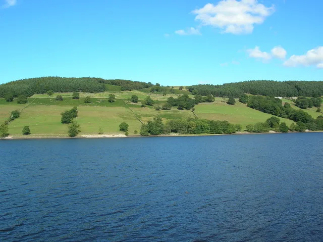
John O'Gaunt's Castle — hunting lodge in North Yorkshire, England, UK.

Wikimedia Commons contributors — see linked file page for photographer and licence licence

Plan your visit
- Typical visit
- 1.5 h–3 h
- Nearest railway station
- Harrogate · 8.5 km
- Family-friendly
- Limited wheelchair access
Getting there & planning your visit
To visit John O'Gaunt's Castle, the nearest railway station is Harrogate, located 8.5 km away. The postcode for sat-nav is HG3 1SJ. Please note that accessibility is limited for wheelchair users.
About
John O'Gaunt's Castle is a castle in the United Kingdom — fortified architecture from the medieval, Tudor, or Victorian-revival period. Heritage designation: scheduled monument. Wikidata describes it as: "hunting lodge in North Yorkshire, England, UK". Coordinates: 53.9864°, -1.6667°.
Photo gallery
Heritage listing
John O'Gaunt's Castle was a royal hunting lodge. It is situated in the civil parish of Haverah Park near Harrogate, now in North Yorkshire (historically in the West Riding of Yorkshire).
From the Historic England List Entry under OGL v3.
Protected designations
- Area of Outstanding Natural Beauty: Nidderdale
Designations sourced from Natural England open data under OGL v3.
From the Wikipedia article
John O'Gaunt's Castle was a royal hunting lodge. It is situated in the civil parish of Haverah Park near Harrogate, now in North Yorkshire (historically in the West Riding of Yorkshire).
Excerpt from Wikipedia under CC BY-SA 4.0. See the source article linked in Sources below.
Background
History
The castle was considered to be the hunting lodge of John O'Gaunt, Duke of Lancaster, who was Lord of the Manor of Knaresborough for twenty-eight years until 1399. Strongly sited on the end of a spur at Haverah Park, is a ditched platform 35 m by 30 m which had a curtain wall and a gatehouse, with a bridge over the moat. Within are buried footings of a central tower, 15 m square, and one wall which probably formed part of a range. It was situated within the royal lordship of Knaresborough. Edward III had building works in progress here in 1334. In 1372 he granted it, along with Knaresborough to his son John of Gaunt. The castle was listed for the first time on 17 December 1929.
Description
The hunting lodge was a stone tower built atop on a square foundation. The lodge also had a chapel. The roof was made out of lead. A 2 m wide ditch surrounded the castle.
Sourced from Wikipedia under CC BY-SA 4.0.
- Coordinates
- 53.9864, -1.6667
- District
- North Yorkshire
- Parish
- Norwood
- Postcode
- HG3 1SJ
- Parliamentary constituency
- Skipton and Ripon
- Nearest railway station
- Harrogate — 8.5 km
- Official site
- www.megalithic.co.uk
Sources
- wikidata: Q6250882 (CC0)
- wikipedia: John O'Gaunt's Castle (CC BY-SA 4.0)
- commons: John O' Gaunt's Castle - geograph.org.uk - 16486.jpg (CC BY-SA 4.0)
Other places nearby

John of Gaunts Castle
Castles · 0.0 km

Haverah Park
Castles · 0.1 km

Bank Slack
Archaeological sites · 0.3 km

Beaver Dyke Reservoirs
Reservoirs & lochs · 0.3 km

Pippin Castle
Castles · 1.6 km

Bland Hill School
Archaeological sites · 2.2 km

Wonderful House
Historic houses · 2.4 km
Ling Cottage
Historic houses · 2.6 km
Swinsty Reservoir
Reservoirs & lochs · 2.6 km

Little Alms Cliff
Viewpoints · 2.6 km

High Moor Farm Park
Caravan parks · 2.7 km

Fewston
Villages · 2.8 km
Nearby
📷 3Castles · Yorkshire & the Humber
John of Gaunts Castle
John of Gaunts Castle — a castle in england-yorkshire, United Kingdom.
📷 5📷 3Archaeological sites · Yorkshire & the Humber
Bank Slack
Bank Slack — a archaeological in england-yorkshire, United Kingdom.
📷 3Reservoirs & lochs · Yorkshire & the Humber
Beaver Dyke Reservoirs
Beaver Dyke Reservoirs — reservoirs in North Yorkshire, England.
📷 3Castles · Yorkshire & the Humber
Pippin Castle
Pippin Castle — a castle in england-yorkshire, United Kingdom.
📷 3Archaeological sites · Yorkshire & the Humber
Bland Hill School
Bland Hill School — a archaeological in england-yorkshire, United Kingdom.
Where to eat & stay near John O'Gaunt's Castle
Places to stay
📷 5Caravan parks · Yorkshire & the Humber
High Moor Farm Park
High Moor Farm Park — a caravan park in england yorkshire.
📷 5Campsites · Yorkshire & the Humber
High Moor Farm Park
High Moor Farm Park — a campsite in england yorkshire.
 📷 5
📷 5Caravan parks · Yorkshire & the Humber
Pinemoor Caravan Park
Pinemoor Caravan Park — a caravan park in england yorkshire.
 📷 5
📷 5Caravan parks · Yorkshire & the Humber
Reynard Crag Park
Reynard Crag Park — a caravan park in england yorkshire.
 📷 5
📷 5Hostels · Yorkshire & the Humber
Scaife Hall Farm
Scaife Hall Farm — a hostel in england yorkshire.
 📷 5
📷 5Caravan parks · Yorkshire & the Humber
Dyke Bottom Farm CAMC Certificated Location
Dyke Bottom Farm CAMC Certificated Location — a caravan park in england yorkshire.
Places to eat & drink
 📷 5
📷 5Historic pubs · Yorkshire & the Humber
Yew Tree Public House
Yew Tree Public House in England Yorkshire, United Kingdom.
 📷 5
📷 5Historic pubs · Yorkshire & the Humber
The Nelson Arms Public House And Attached Outbuilding
The Nelson Arms Public House And Attached Outbuilding in England Yorkshire, United Kingdom.
 📷 5
📷 5Historic pubs · Yorkshire & the Humber
Horse And Farrier
Horse And Farrier in England Yorkshire, United Kingdom.
 📷 5
📷 5Historic pubs · Yorkshire & the Humber
Manor House Public House
Manor House Public House in England Yorkshire, United Kingdom.
 📷 3
📷 3Historic pubs · Yorkshire & the Humber
The Black Bull
The Black Bull — Historic pub — listed building or notable heritage status.
 📷 5
📷 5More castles in this region
 📷 5
📷 5Castles · Yorkshire & the Humber
Ashton-under-Lyne
Ashton-under-Lyne, also known simply as Ashton, is a market town in Tameside, Greater Manchester, United Kingdom. The population was 48,604 at the 2021 census. Historically a part of Lancashire, it is
 📷 5
📷 5Castles · Yorkshire & the Humber
Audenshaw
Audenshaw is a town in Tameside, Greater Manchester, England, 4.9 miles (7.9 km) east of Manchester. Historically part of Lancashire, in 2011 it had a population of 11,419. The name derives from Aldwi
 📷 5
📷 5Castles · Yorkshire & the Humber
Bramhall
Bramhall is a large village in the Metropolitan Borough of Stockport, Greater Manchester, England. It was formerly a civil parish in Cheshire. At the 2021 census, the built-up area, as defined by the
 📷 5
📷 5Castles · Yorkshire & the Humber
Bredbury
Bredbury is a town in the Metropolitan Borough of Stockport, Greater Manchester, England; it lies 8 miles (12.9 km) south-east of Manchester, 2 miles (3.2 km) east of Stockport and 3 miles (4.8 km) so
Frequently asked questions
- Where is John O'Gaunt's Castle?
- John O'Gaunt's Castle is in Yorkshire, United Kingdom (postcode HG3 1SJ), in the parish of Norwood.
- What is John O'Gaunt's Castle?
- John O'Gaunt's Castle — hunting lodge in North Yorkshire, England, UK.
- How do I get to John O'Gaunt's Castle?
- The nearest railway station is Harrogate, about 8.5 km away. Drivers can use postcode HG3 1SJ.
- Is John O'Gaunt's Castle a listed building?
- John O'Gaunt's Castle is officially recognised as scheduled monument listed.
- Is John O'Gaunt's Castle a protected site?
- Yes — John O'Gaunt's Castle is part of the Nidderdale National Landscape (AONB).
- Does John O'Gaunt's Castle charge admission?
- John O'Gaunt's Castle typically charges admission. Check the official site for current ticket prices and opening hours.
- How do I get to John O'Gaunt's Castle?
- Drivers can navigate to postcode HG3 1SJ. It sits within the Skipton and Ripon parliamentary constituency.