
Reservoirs & lochs · Yorkshire & the Humber
Beaver Dyke Reservoirs
In or near Askwith.
Beaver Dyke Reservoirs — reservoirs in North Yorkshire, England.

Wikimedia Commons licence
Plan your visit
- Typical visit
- 1 h–2.5 h
- Nearest railway station
- Harrogate · 8.1 km
- Free entry
- Dog-friendly
Getting there & planning your visit
Beaver Dyke Reservoirs is located in North Yorkshire, postcode HG3 1FG, and the nearest railway station is Harrogate, which is 8.1 km away. Entry to the reservoirs is free.
About
Beaver Dyke Reservoirs is a reservoir in the United Kingdom. Managed by Harrogate Corporation Water Works. Wikidata describes it as: "reservoirs in North Yorkshire, England". Coordinates: 53.9864°, -1.6614°.
Photo gallery
Summary from the official site
Beaver Dyke Reservoirs are significant earthworks of uncertain origin, believed to date back to the Dark Ages or earlier. Visitors can explore the remains of these earthworks, which are situated near a public footpath leading to a medieval hunting lodge.
Protected designations
- Area of Outstanding Natural Beauty: Nidderdale
Designations sourced from Natural England open data under OGL v3.
From the Wikipedia article
Beaver Dyke Reservoirs were two water supply reservoirs (one of which is still extant), 5 miles (8 km) west of Harrogate in North Yorkshire, England. The main reservoir, also known as Lower Beaver Dyke Reservoir, was constructed in 1890 and had a surface area of 9 ha (22 acres). In 2008 the reservoir's owner, Yorkshire Water, decided that it was not economic to maintain its ageing structures. It was decommissioned between 2013 and 2015 by breaching its dam and channelling a stream in the bed of the former reservoir. A residual lake of 0.5 ha (1.2 acres) was retained. The water of the reservoir was relatively nutrient rich, but it was known to suffer from potentially toxic blooms of Cyanobacteria. The smaller reservoir (also called John O'Gaunts Reservoir due to the proximity of John O'Gaunt's Castle) is still filled with water.
Excerpt from Wikipedia under CC BY-SA 4.0. See the source article linked in Sources below.
- Coordinates
- 53.9864, -1.6614
- District
- North Yorkshire
- Parish
- Norwood
- Postcode
- HG3 1FG
- Parliamentary constituency
- Skipton and Ripon
- Established
- 1890
- Nearest railway station
- Harrogate — 8.1 km
Sources
- wikidata: Q4878073 (CC0)
- wikipedia: Beaver Dyke Reservoirs (CC BY-SA 4.0)
Other places nearby

Haverah Park
Castles · 0.3 km

John of Gaunts Castle
Castles · 0.3 km
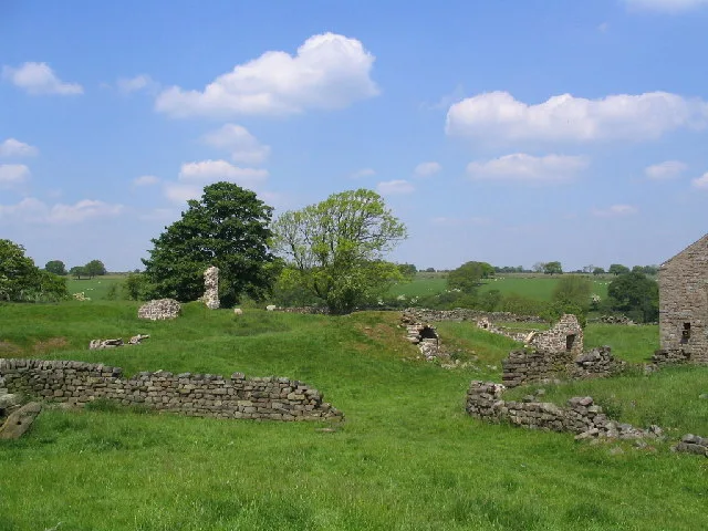
John O'Gaunt's Castle
Castles · 0.3 km

Bank Slack
Archaeological sites · 0.5 km

Pippin Castle
Castles · 1.4 km

Wonderful House
Historic houses · 2.3 km

High Moor Farm Park
Caravan parks · 2.4 km

Bland Hill School
Archaeological sites · 2.5 km

Little Alms Cliff
Viewpoints · 2.5 km
Ling Cottage
Historic houses · 2.5 km
High Moor Farm Park
Campsites · 2.7 km

Haverah Park Lodge
Historic houses · 2.7 km
Nearby
📷 5📷 3Castles · Yorkshire & the Humber
John of Gaunts Castle
John of Gaunts Castle — a castle in Yorkshire & the Humber, United Kingdom.
📷 3Castles · Yorkshire & the Humber
John O'Gaunt's Castle
John O'Gaunt's Castle — hunting lodge in North Yorkshire, England, UK.
📷 3Archaeological sites · Yorkshire & the Humber
Bank Slack
Bank Slack — an archaeological site in Yorkshire & the Humber, United Kingdom.
📷 3Castles · Yorkshire & the Humber
Pippin Castle
Pippin Castle — a castle in Yorkshire & the Humber, United Kingdom.
📷 3Historic houses · Yorkshire & the Humber
Wonderful House
Wonderful House — a historic house in Yorkshire & the Humber, United Kingdom.
Where to eat & stay near Beaver Dyke Reservoirs
Places to stay
📷 5Caravan parks · Yorkshire & the Humber
High Moor Farm Park
High Moor Farm Park — a caravan park in england yorkshire.
📷 5Campsites · Yorkshire & the Humber
High Moor Farm Park
High Moor Farm Park — a campsite in england yorkshire.
 📷 5
📷 5Caravan parks · Yorkshire & the Humber
Pinemoor Caravan Park
Pinemoor Caravan Park — a caravan park in england yorkshire.
 📷 5
📷 5Caravan parks · Yorkshire & the Humber
Reynard Crag Park
Reynard Crag Park — a caravan park in england yorkshire.
 📷 5
📷 5Caravan parks · Yorkshire & the Humber
Dyke Bottom Farm CAMC Certificated Location
Dyke Bottom Farm CAMC Certificated Location — a caravan park in england yorkshire.
 📷 5
📷 5Hostels · Yorkshire & the Humber
Scaife Hall Farm
Scaife Hall Farm — a hostel in england yorkshire.
Places to eat & drink
 📷 5
📷 5Historic pubs · Yorkshire & the Humber
Yew Tree Public House
Yew Tree Public House in England Yorkshire, United Kingdom.
 📷 5
📷 5Historic pubs · Yorkshire & the Humber
The Nelson Arms Public House And Attached Outbuilding
The Nelson Arms Public House And Attached Outbuilding in England Yorkshire, United Kingdom.
 📷 5
📷 5Historic pubs · Yorkshire & the Humber
Horse And Farrier
Horse And Farrier in England Yorkshire, United Kingdom.
 📷 5
📷 5Historic pubs · Yorkshire & the Humber
Manor House Public House
Manor House Public House in England Yorkshire, United Kingdom.
 📷 3
📷 3Historic pubs · Yorkshire & the Humber
The Black Bull
The Black Bull — Historic pub — listed building or notable heritage status.
 📷 5
📷 5More places in this region
 📷 3
📷 3Reservoirs & lochs · Yorkshire & the Humber
Godley Reservoir
Godley Reservoir — reservoir in Greater Manchester, England, UK.
 📷 3
📷 3Reservoirs & lochs · Yorkshire & the Humber
Gorton Lower Reservoir
Gorton Lower Reservoir — reservoir in Greater Manchester, England, UK.
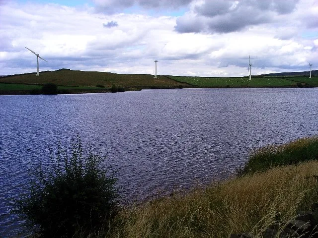 Flagship📷 3
Reservoirs & lochs · Yorkshire & the Humber
Chelker Reservoir
Chelker Reservoir — reservoir in North Yorkshire, England, UK.
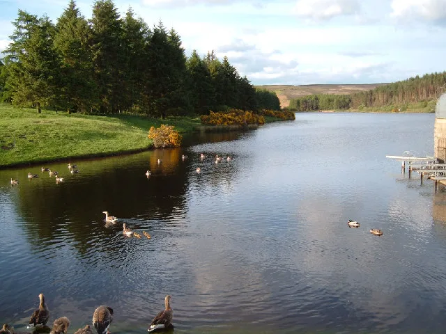 Flagship📷 5
Reservoirs & lochs · Yorkshire & the Humber
Cod Beck Reservoir
Cod Beck Reservoir — reservoir in North Yorkshire, England, UK.
Frequently asked questions
- Where is Beaver Dyke Reservoirs?
- Beaver Dyke Reservoirs is in Yorkshire, United Kingdom (postcode HG3 1FG), in the parish of Norwood.
- What is Beaver Dyke Reservoirs?
- Beaver Dyke Reservoirs — reservoirs in North Yorkshire, England.
- How do I get to Beaver Dyke Reservoirs?
- The nearest railway station is Harrogate, about 8.1 km away. The nearest town is Askwith. Drivers can use postcode HG3 1FG.
- When was Beaver Dyke Reservoirs built?
- Built or established in 1890.
- Who runs Beaver Dyke Reservoirs?
- Beaver Dyke Reservoirs is operated by Harrogate Corporation Water Works.
- Is Beaver Dyke Reservoirs a protected site?
- Yes — Beaver Dyke Reservoirs is part of the Nidderdale National Landscape (AONB).
- Is Beaver Dyke Reservoirs free to visit?
- Yes, Beaver Dyke Reservoirs is free to enter.
- How do I get to Beaver Dyke Reservoirs?
- Drivers can navigate to postcode HG3 1FG. It sits within the Skipton and Ripon parliamentary constituency.