
Castles · Yorkshire & the Humber
Ashton-under-Lyne
In or near Manchester.
Ashton-under-Lyne, also known simply as Ashton, is a market town in Tameside, Greater Manchester, United Kingdom. The population was 48,604 at the 2021 census. Historically a part of Lancashire, it is

Gerald England — CC BY-SA 2.0 via Wikimedia Commons licence

Plan your visit
- Typical visit
- 1.5 h–3 h
- Nearest railway station
- Ashton-under-Lyne · 0.5 km
- Family-friendly
- Limited wheelchair access
Getting there & planning your visit
To visit Ashton-under-Lyne castle, the nearest railway station is Ashton-under-Lyne, located 0.5 km away. The postcode for the site is OL6 7SG. Accessibility is limited for wheelchair users.
About
Ashton-under-Lyne, also known simply as Ashton, is a market town in Tameside, Greater Manchester, United Kingdom. The population was 48,604 at the 2021 census. Historically a part of Lancashire, it is on the north bank of the River Tame, in the foothills of the Pennines, six miles (ten kilometres) east of Manchester. Evidence of Stone Age, Bronze Age, and Viking activity has been discovered in Ashton-under-Lyne. The "Ashton" part of the town's name probably dates from the Anglo-Saxon period, and derives from Old English meaning "settlement by ash trees". The origin of the "under-Lyne" suffix is less clear; it possibly derives from the Brittonic-originating word lemo meaning elm or from Ashton's proximity to the Pennines. In the Middle Ages, Ashton-under-Lyne was a parish and township and Ashton Old Hall was held by the de Asshetons, lords of the manor. The town became a market town from 1414 when the manor was granted a royal charter. The introduction of the cotton trade in 1769 transformed Ashton both economically and geographically, with the town being replanned in a grid. The factory system, and textile manufacture during the Industrial Revolution triggered a process of unplanned urbanisation in the area, and by the mid-19th century Ashton had emerged as an important mill town at a convergence of newly constructed canals and railways. Ashton-under-Lyne's transport network allowed for an economic boom in cotton spinning, weaving, and coal mining, which led to the granting o
Photo gallery
See it from the streetimagery from 2026
Imagery © Mapillary contributors, CC BY-SA 4.0
Protected designations
- Site of Special Scientific Interest: Huddersfield Narrow Canal SSSI
Designations sourced from Natural England open data under OGL v3.
From the Wikipedia article
Ashton-under-Lyne, also known simply as Ashton, is a market town in Tameside, Greater Manchester, United Kingdom. The population was 48,604 at the 2021 census. Historically a part of Lancashire, it is on the north bank of the River Tame, in the foothills of the Pennines, six miles (ten kilometres) east of Manchester. Evidence of Stone Age, Bronze Age, and Viking activity has been discovered in Ashton-under-Lyne. The "Ashton" part of the town's name probably dates from the Anglo-Saxon period, and derives from Old English meaning "settlement by ash trees". The origin of the "under-Lyne" suffix is less clear; it possibly derives from the Brittonic-originating word lemo meaning elm or from Ashton's proximity to the Pennines. In the Middle Ages, Ashton-under-Lyne was a parish and township and Ashton Old Hall was held by the de Asshetons, lords of the manor. The town became a market town from 1414 when the manor was granted a royal charter. The introduction of the cotton trade in 1769 transformed Ashton both economically and geographically, with the town being replanned in a grid. The factory system, and textile manufacture during the Industrial Revolution triggered a process of unplanned urbanisation in the area, and by the mid-19th century Ashton had emerged as an important mill town at a convergence of newly constructed canals and railways. Ashton-under-Lyne's transport network allowed for an economic boom in cotton spinning, weaving, and coal mining, which led to the granting of municipal borough status in 1847. The population grew from 2,859 in 1775 to 34,886 in 1861, two-thirds of its modern-day size, as a direct result of this extensive industrialisation. The town saw significant economic decline in the 1920s, with the majority of its mills closing due to insufficient exports. Nevertheless, the town has continued to thrive as a centre of commerce, and Ashton Market is one of the largest outdoor markets in the United Kingdom. In response to high levels of unemployme
Excerpt from Wikipedia under CC BY-SA 4.0. See the source article linked in Sources below.
Background
History
At about 4.20 pm on Wednesday 13 June 1917, a fire in an ammunition factory producing TNT caused an explosion that demolished much of the west end of the town. Two gasometers exploded and the explosion destroyed the factory and threw heavy objects long distances. At least 41 people died and about 100 were injured. Sylvain Dreyfus, managing director of the works, helped to fight the fire but died in the subsequent explosion. The second of the five victims of the Moors murders, 12-year-old John Kilbride, lived in the town. He was lured away from the town's market on 23 November 1963 by Ian Brady and Myra Hindley before being murdered and buried on Saddleworth Moor. His body was found in…
Sourced from Wikipedia under CC BY-SA 4.0.
- Coordinates
- 53.4872, -2.0975
- District
- Tameside
- Parish
- Tameside, unparished area
- Postcode
- OL6 7SG
- Parliamentary constituency
- Ashton-under-Lyne
- Nearest railway station
- Ashton-under-Lyne — 0.5 km
Sources
- wikipedia: Ashton-under-Lyne (CC BY-SA 4.0)
Other places nearby

Theatre Royal, Ashton-under-Lyne
Open-air theatres · 0.0 km
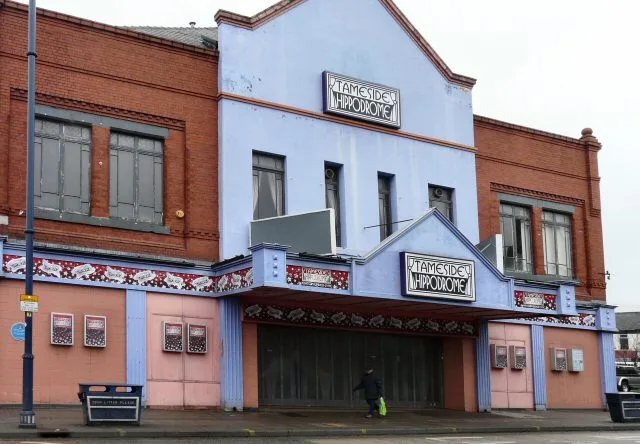
Tameside Hippodrome
Theatres · 0.1 km

Tameside Hippodrome
Open-air theatres · 0.1 km

The Witchwood
Historic pubs · 0.1 km

Metro Cinema
Theatres · 0.2 km

Tameside
Castles · 0.4 km

Ashton Under Lyne Town Hall
Gardens · 0.4 km

Museum of the Manchester Regiment
Museums · 0.4 km

Tudor Mill, Ashton-under-Lyne
Gardens · 0.4 km

Macclesfield Canal
Canals · 0.5 km

Portland Basin Museum
Museums · 0.5 km

Ashton Canal
Canals · 0.5 km
Nearby
📷 5Open-air theatres · Yorkshire & the Humber
Theatre Royal, Ashton-under-Lyne
Theatre Royal, Ashton-under-Lyne — a open-air theatre in england west midlands.
📷 3Theatres · Yorkshire & the Humber
Tameside Hippodrome
Tameside Hippodrome is a theatre in the United Kingdom.
📷 5Open-air theatres · Yorkshire & the Humber
Tameside Hippodrome
Tameside Hippodrome — a open-air theatre in england west midlands.
📷 7📷 3📷 5Castles · Yorkshire & the Humber
Tameside
Tameside — a castle in england-west-midlands, United Kingdom.
Where to eat & stay near Ashton-under-Lyne
Places to stay
 📷 5
📷 5 📷 5
📷 5Campsites · North West England
Well-i-Hole Farm Caravan and Camping
Well-i-Hole Farm Caravan and Camping — a campsite in england north west.
 📷 5
📷 5Caravan parks · Yorkshire & the Humber
Far Benfield Farm Caravan Storage
Far Benfield Farm Caravan Storage — a caravan park in england west midlands.
 📷 5
📷 5Campsites · Yorkshire & the Humber
Boarfold Scout Camp
Boarfold Scout Camp — a campsite in england west midlands.
 📷 5
📷 5Campsites · East Midlands
Crossgate Farm Campsite
Crossgate Farm Campsite — a campsite in england east midlands.
 📷 5
📷 5Places to eat & drink
📷 7 📷 5
📷 5Historic pubs · North West England
Colliers Arms Public House
Colliers Arms Public House in England North West, United Kingdom.
 📷 7
📷 7Historic pubs · North West England
The Plough, Gorton
The Plough, Gorton in England North West, United Kingdom.
 📷 7
📷 7 📷 7
📷 7Cafés · Yorkshire & the Humber
Station South
Station South — a café in england west midlands.
 📷 7
📷 7Historic pubs · North West England
The Rampant Lion
The Rampant Lion in England North West, United Kingdom.
More castles in this region
 📷 5
📷 5Castles · Yorkshire & the Humber
Audenshaw
Audenshaw is a town in Tameside, Greater Manchester, England, 4.9 miles (7.9 km) east of Manchester. Historically part of Lancashire, in 2011 it had a population of 11,419. The name derives from Aldwi
 📷 5
📷 5Castles · Yorkshire & the Humber
Bramhall
Bramhall is a large village in the Metropolitan Borough of Stockport, Greater Manchester, England. It was formerly a civil parish in Cheshire. At the 2021 census, the built-up area, as defined by the
 📷 5
📷 5Castles · Yorkshire & the Humber
Bredbury
Bredbury is a town in the Metropolitan Borough of Stockport, Greater Manchester, England; it lies 8 miles (12.9 km) south-east of Manchester, 2 miles (3.2 km) east of Stockport and 3 miles (4.8 km) so
 📷 5
📷 5Castles · Yorkshire & the Humber
Denton, Greater Manchester
Denton is a town in Tameside, Greater Manchester, England. It lies 5 miles (8 km) east of Manchester city centre. Historically part of Lancashire, it had a population of 36,591 at the 2011 Census.
Frequently asked questions
- Where is Ashton-under-Lyne?
- Ashton-under-Lyne is in Yorkshire, United Kingdom (postcode OL6 7SG), in the parish of Tameside, unparished area.
- What is Ashton-under-Lyne?
- Ashton-under-Lyne, also known simply as Ashton, is a market town in Tameside, Greater Manchester, United Kingdom. The population was 48,604 at the 2021 census. Historically a part of Lancashire, it is
- How do I get to Ashton-under-Lyne?
- The nearest railway station is Ashton-under-Lyne, about 0.5 km away. The nearest town is Manchester. Drivers can use postcode OL6 7SG.
- Is Ashton-under-Lyne a protected site?
- Yes — Ashton-under-Lyne is part of the Huddersfield Narrow Canal SSSI Site of Special Scientific Interest.
- Does Ashton-under-Lyne charge admission?
- Ashton-under-Lyne typically charges admission. Check the official site for current ticket prices and opening hours.
- How do I get to Ashton-under-Lyne?
- The nearest railway station is Ashton-under-Lyne, about 0.5 km away. Drivers can navigate to postcode OL6 7SG.