Mountains & hills · East Midlands
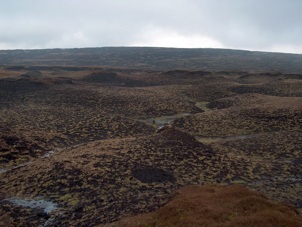
James's Thorn
James's Thorn — mountain in england east midlands. Elevation: 572 m.

Anthony Parkes — CC BY-SA 2.0 via Wikimedia Commons licence
Plan your visit
- Typical visit
- 3 h–8 h
- Best time of year
- Late spring – early autumn (May–Oct)
About
James's Thorn is a mountain located in england east midlands. Elevation: 572 m. A named British peak recorded in OpenStreetMap. Peaks are typically named on Ordnance Survey 1:50k mapping.
Photo gallery
Place summary
James's Thorn is a mountain located in the East Midlands. It is notable for its distinctive elevation and rugged terrain, attracting walkers and outdoor enthusiasts. The area offers various trails, allowing for exploration of the surrounding landscape. Visitors can expect a natural setting conducive to hiking and enjoying panoramic views.
AI-generated from the structured facts on this page (operator, designation, listing, era). Not a substitute for visiting.
- Coordinates
- 53.4507, -1.8802
Sources
- osm: n3649614748 (ODbL)
Other places nearby
Loading nearby places…
Nearby
 📷 3
📷 3Memorials & monuments · East Midlands
Avro Lancaster KB993 and USAAF C-47 Skytrain 42-108982 memorial
Avro Lancaster KB993 and USAAF C-47 Skytrain 42-108982 memorial — a memorial in england-east-midlands, United Kingdom.
 📷 5
📷 5Mountains & hills · East Midlands
Higher Shelf Stones
Higher Shelf Stones — mountain in england east midlands. Elevation: 621.5 m.
 📷 3
📷 3Memorials & monuments · East Midlands
B29 Superfortress memorial
B29 Superfortress memorial — a memorial in england-east-midlands, United Kingdom.
 📷 3
📷 3Natural landmarks · East Midlands
Hern Stones
Hern Stones — a other in england-east-midlands, United Kingdom.
 📷 3
📷 3Natural landmarks · East Midlands
Wain Stones
Wain Stones — a other in england-east-midlands, United Kingdom.
 📷 5
📷 5Natural landmarks · East Midlands
Bleaklow
Bleaklow — mountain in Derbyshire, England, UK.
Where to eat & stay near James's Thorn
Places to stay
 📷 5
📷 5Caravan parks · East Midlands
Windy Harbour Hotel Caravan and Camping Site
Windy Harbour Hotel Caravan and Camping Site — a caravan park in england east midlands.
 📷 5
📷 5Campsites · East Midlands
Crowden Campsite
Crowden Campsite — a campsite in england east midlands.
 📷 5
📷 5Hostels · East Midlands
Crowden Outdoor Education Centre
Crowden Outdoor Education Centre — a hostel in england east midlands.
 📷 5
📷 5Campsites · East Midlands
Crossgate Farm Campsite
Crossgate Farm Campsite — a campsite in england east midlands.
 📷 5
📷 5Campsites · East Midlands
Hayfield Campsite
Hayfield Campsite — a campsite in england east midlands.
 📷 5
📷 5Campsites · East Midlands
Swineshore
Swineshore — a campsite in england east midlands.
Places to eat & drink
 📷 5
📷 5Historic pubs · Yorkshire & the Humber
Bulls Head Public House
Bulls Head Public House in England Yorkshire, United Kingdom.
 📷 5
📷 5Historic pubs · Yorkshire & the Humber
Norfolk Arms Public House
Norfolk Arms Public House in England Yorkshire, United Kingdom.
 📷 5
📷 5Historic pubs · Yorkshire & the Humber
Former Dollars Public House
Former Dollars Public House in England Yorkshire, United Kingdom.
 📷 5
📷 5Historic pubs · Yorkshire & the Humber
The Oakwood and Oakwood Restaurant
The Oakwood and Oakwood Restaurant in England Yorkshire, United Kingdom.
 📷 5
📷 5Historic pubs · Yorkshire & the Humber
The Crown Inn, Glossop
The Crown Inn, Glossop in England Yorkshire, United Kingdom.
 📷 5
📷 5Historic pubs · Yorkshire & the Humber
The Spinners Arms Public House
The Spinners Arms Public House in England Yorkshire, United Kingdom.
More mountains in this region
 📷 3
📷 3Mountains & hills · East Midlands
Axe Edge Moor
Axe Edge Moor — Named summit at 551 m.
Mountains & hills · East Midlands
Beacon Hill
Beacon Hill — Named summit at 244.5 m.
Mountains & hills · East Midlands
Beacon Hill
Beacon Hill — Named summit at 105 m.
 📷 3
📷 3Mountains & hills · East Midlands
Black Edge - Summit
Black Edge - Summit — Named summit at 506.7 m.
Frequently asked questions
- Where is James's Thorn?
- James's Thorn is in the East Midlands, United Kingdom.
- What is James's Thorn?
- James's Thorn — mountain in england east midlands. Elevation: 572 m.
- How do I get to James's Thorn?
- Its coordinates are 53.4507°, -1.8802°.