
Natural landmarks · North West England
Hugh Seat
Hugh Seat — mountain in United Kingdom.

Wikimedia Commons licence
Plan your visit
- Typical visit
- 1 h–2 h
- Nearest railway station
- Garsdale · 7.6 km
- Free entry
- Dog-friendly
Getting there & planning your visit
Hugh Seat is located in North West England, with the nearest railway station being Garsdale, approximately 7.6 km away. Entry to the site is free.
About
Hugh Seat is a named natural landmark in the United Kingdom. Wikidata describes it as: "mountain in United Kingdom". Coordinates: 54.3875°, -2.2939°.
Photo gallery
Protected designations
- Site of Special Scientific Interest: Mallerstang-Swaledale Head SSSI
- Site of Special Scientific Interest: River Eden and Tributaries SSSI
Designations sourced from Natural England open data under OGL v3.
From the Wikipedia article
Hugh Seat is a mountain, or more accurately a fell, in Mallerstang on the eastern edge of Cumbria, England. It lies on the border between Cumbria and North Yorkshire. Hugh Seat is a high point above Black Fell Moss, an extensive area of peat bog drained by Red Gill Beck, which is the source of the River Eden. At this "watershed of England" two other great rivers, the Ure and the Swale, also rise within a kilometre of the Eden. Although it has a relatively small prominence, having several other high points nearby (and is therefore classified as a "sub-Hewitt" or a Nuttall but not a Marilyn), Hugh Seat nevertheless rises conspicuously above the source of the River Eden. The old name for this peak was Hugh Seat Morvill or sometimes Morvil Hill, (and Daniel Defoe confuses it with Wild Boar Fell in his "Tour"). Near the summit there is a column of cut stones, known as "Lady's Pillar", and the inscription AP1664 can just be made out – for Anne Pembroke, Lady Anne Clifford's married name. The pillar was erected in 1664 to commemorate Sir Hugh de Morville, Lady Anne's predecessor as Lord of the Manor of Mallerstang. (Sir Hugh was one of the four knights responsible for the murder of Archbishop St.Thomas Becket in Canterbury Cathedral in 1170). The border between the counties of Cumbria and North Yorkshire is marked near the summit by a fence, which is intended to stop sheep which are "heafed" (trained to stay in a certain area without the need for fences) straying beyond their allotted common land. There are extensive views from the summit – south-east to Cotterdale and Wensleydale, north-west to Gregory Chapel, and west to Mallerstang and Wild Boar Fell. This rugged terrain between Great Shunner Fell and Wild Boar Fell, (part of what David Bellamy has called "the last wilderness in England"), is too inaccessible to be well known by tourists, but it is a favourite route for many walkers.
Excerpt from Wikipedia under CC BY-SA 4.0. See the source article linked in Sources below.
- Coordinates
- 54.3875, -2.2939
- Nearest railway station
- Garsdale — 7.6 km
Sources
Other places nearby

Gregory Chapel
Natural landmarks · 1.2 km

Brockholes Force
Waterfalls · 1.7 km

Long Scar East Cave
Caves · 1.9 km
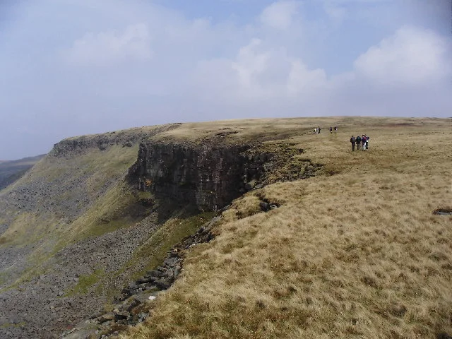
High Seat
Natural landmarks · 2.2 km

Coal Force
Waterfalls · 2.2 km
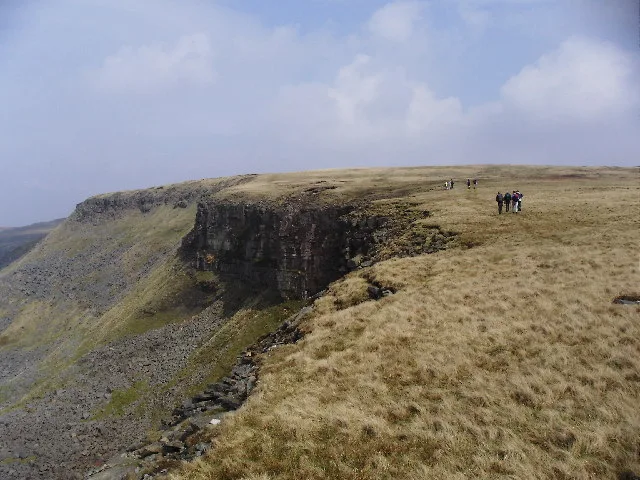
High Seat
Mountains & hills · 2.2 km

Lunds Fell
Mountains & hills · 2.4 km

Water Cut
Heritage railway stations · 2.5 km

Sails
Mountains & hills · 2.6 km

Thrang Force
Waterfalls · 2.6 km

Whitebank Hill
Mountains & hills · 2.8 km

Outhgill
Historic churches · 2.9 km
Nearby
📷 3Natural landmarks · North West England
Gregory Chapel
Gregory Chapel — mountain in United Kingdom.
📷 5📷 5📷 3Natural landmarks · North East England
High Seat
High Seat — mountain in the Yorkshire Dales National Park, England, UK.
📷 5📷 3Where to eat & stay near Hugh Seat
Places to stay
 📷 5
📷 5Campsites · North East England
Hoggarths campsite
Hoggarths campsite — a campsite in england north west.
 📷 5
📷 5Campsites · North East England
Park House Camping & Keld Bunkhouse
Park House Camping & Keld Bunkhouse — a campsite in england north west.
 📷 5
📷 5Campsites · North East England
Rukin's Park Lodge Campsite
Rukin's Park Lodge Campsite — a campsite in england north west.
 📷 5
📷 5Campsites · North West England
Shaw Ghyll caravan and camping
Shaw Ghyll caravan and camping — a campsite in england north west.
 📷 5
📷 5Campsites · North West England
Pennine View Park
Pennine View Park — a campsite in england north west.
 📷 5
📷 5Campsites · Yorkshire & the Humber
Usha Gap Campsite
Usha Gap Campsite — a campsite in england north west.
Places to eat & drink
 📷 7
📷 7Cafés · North West England
The White Hare Cafe
The White Hare Cafe — a café in england north west.
 📷 5
📷 5Cafés · North West England
The Cross Keys Temperance Inn
The Cross Keys Temperance Inn — a café in england north west.
 📷 5
📷 5 📷 5
📷 5Historic pubs · Yorkshire & the Humber
Kings Head Inn
Kings Head Inn in England North West, United Kingdom.
 📷 5
📷 5Cafés · North West England
Gun Dog Coffee Shop
Gun Dog Coffee Shop — a café in england north west.
 📷 5
📷 5More natural landmarks in this region
 📷 3
📷 3Natural landmarks · North West England
Statue of Oliver Cromwell
Statue of Oliver Cromwell — Public artwork (statue).
 📷 3
📷 3Natural landmarks · North West England
Dagfields Craft Centre
Dagfields Craft Centre — a other in england-west-midlands, United Kingdom.
 📷 3
📷 3Natural landmarks · North West England
Weaver Valley Cruises
Weaver Valley Cruises — a other in england-west-midlands, United Kingdom.
 📷 3
📷 3Natural landmarks · North West England
Golden Gates
Golden Gates — a other in england-west-midlands, United Kingdom.
Frequently asked questions
- Where is Hugh Seat?
- Hugh Seat is in North-West England, United Kingdom.
- What is Hugh Seat?
- Hugh Seat — mountain in United Kingdom.
- How do I get to Hugh Seat?
- The nearest railway station is Garsdale, about 7.6 km away. Its coordinates are 54.3875°, -2.2939°.
- Is Hugh Seat a protected site?
- Yes — Hugh Seat is part of the Mallerstang-Swaledale Head SSSI Site of Special Scientific Interest and the River Eden and Tributaries SSSI Site of Special Scientific Interest.
- Is Hugh Seat free to visit?
- Yes, Hugh Seat is free to enter.
- How do I get to Hugh Seat?
- The nearest railway station is Garsdale, about 7.6 km away.