Historic churches · North East England
Outhgill
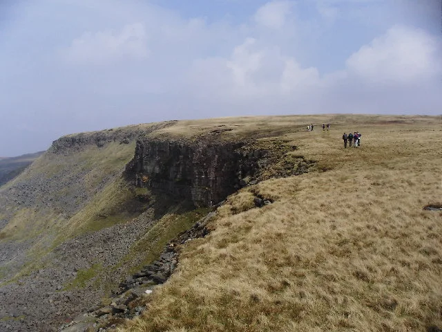
Outhgill in England North East, United Kingdom.

JThomas — CC BY-SA 2.0 via Wikimedia Commons licence
Plan your visit
- Typical visit
- 30 min–1 h
- Nearest railway station
- Kirkby Stephen · 6.5 km
- Free entry
Getting there & planning your visit
To visit Outhgill, the nearest railway station is Kirkby Stephen, which is 6.5 km away. The postcode for Outhgill is CA17 4JU. Entry is free.
About
Outhgill is a place of interest in England North East, United Kingdom — drawn from open-data sources for visitor reference. See the linked Wikipedia article for the full description.
Photo gallery
Protected designations
- Site of Special Scientific Interest: River Eden and Tributaries SSSI
Designations sourced from Natural England open data under OGL v3.
From the Wikipedia article
Outhgill is a hamlet in Mallerstang, Cumbria, England. It lies about 5 miles (8 km) south of Kirkby Stephen. It is the main hamlet in the dale of Mallerstang (a civil parish) which retains the Norse pattern of its original settlement: a series of small hamlets and isolated houses, with no village centre. In the 19th century, as the main hamlet at the centre of the dale, Outhgill had an inn, a post office, a smithy, the parish church and a Methodist chapel. Of these, only the church survives. St Mary's Church was founded by Lady Ideonea de Veteripont in the 14th century (possibly 1311) but was restored, in fact more or less rebuilt, in 1663 by Lady Anne Clifford, as the plaque above the door relates. The simple, dignified interior contains an 18th-century font, a faded coat of arms of Lady Anne from the year she restored the church, a set of shelves that used to hold the loaves of bread distributed weekly under Middleton's Charity, and kneelers embroidered by ladies of the dale. The stained glass windows all date from Victorian times or later. In the churchyard there are the unmarked graves of 25 of the builders of the Mallerstang section of the Settle-Carlisle Railway, and members of their families, who died during the construction of the line. A monument to them, marking the area where they are buried, was dedicated in 1997. Almost opposite the church is the former Wesleyan Chapel, built in 1878. There are about a dozen houses, including one where the father of the great scientist Michael Faraday was the blacksmith in the late 18th century (moving to London in the year Michael was born). The old pinfold contains a sculpture by Andy Goldsworthy. There is a replica of the "Jew Stone" on the village green. The original monument was set up by the rather eccentric William Mounsey in 1850 on Black Fell Moss below Hugh Seat, to mark the source of the River Eden. It got its name from the inscriptions in Greek and Hebrew. Pendragon Castle, reputedly founded by King…
Excerpt from Wikipedia under CC BY-SA 4.0. See the source article linked in Sources below.
- Coordinates
- 54.4000, -2.3333
- District
- Westmorland and Furness
- Parish
- Mallerstang
- Postcode
- CA17 4JU
- Parliamentary constituency
- Westmorland and Lonsdale
- Nearest railway station
- Kirkby Stephen — 6.5 km
Sources
Featured in this guide
Other places nearby

Thrang Force
Waterfalls · 0.4 km

Mallerstang
Mountains & hills · 0.4 km

Outhgill
Villages · 0.8 km

Mallerstang
National parks · 1.0 km

Outhgill Pinfold
Public art & sculpture · 1.0 km

Lock Hill
Mountains & hills · 1.1 km

Jingling Hole
Caves · 1.1 km

Little Fell
Mountains & hills · 1.8 km
High Seat
Mountains & hills · 1.9 km

Whitebank Hill
Mountains & hills · 1.9 km

Gregory Chapel
Natural landmarks · 1.9 km

High Seat
Natural landmarks · 2.0 km
Nearby
📷 5📷 5Mountains & hills · North West England
Mallerstang
Mallerstang — a hill or mountain in england north west.
📷 5📷 4National parks · North East England
Mallerstang
Mallerstang in England North East, United Kingdom.
📷 3Public art & sculpture · North West England
Outhgill Pinfold
Outhgill Pinfold — a public art in england-north-west, United Kingdom.
📷 5Mountains & hills · North West England
Lock Hill
Lock Hill — mountain in england north west. Elevation: 290 m.
Where to eat & stay near Outhgill
Places to stay
 📷 7
📷 7Hotels · North West England
The Black Swan Hotel
The Black Swan Hotel — a hotel in england north west.
 📷 5
📷 5Campsites · North West England
Pennine View Park
Pennine View Park — a campsite in england north west.
 📷 7
📷 7Hotels · North West England
The Kings Head
The Kings Head — a hotel in england north west.
 📷 5
📷 5Campsites · North West England
Low Greenside Farm Campsite
Low Greenside Farm Campsite — a campsite in england north west.
 📷 5
📷 5Hostels · North West England
Kirkby Stephen Hostel
Kirkby Stephen Hostel — a hostel in england north west.
 📷 7
📷 7B&Bs · North West England
Fletcher House
Fletcher House — a bed-and-breakfast in england north west.
Places to eat & drink
 📷 7
📷 7Cafés · North West England
The White Hare Cafe
The White Hare Cafe — a café in england north west.
 📷 5
📷 5Cafés · North West England
The Cross Keys Temperance Inn
The Cross Keys Temperance Inn — a café in england north west.
 📷 5
📷 5 📷 5
📷 5Cafés · North West England
Gun Dog Coffee Shop
Gun Dog Coffee Shop — a café in england north west.
 📷 5
📷 5Historic pubs · Yorkshire & the Humber
Kings Head Inn
Kings Head Inn in England North West, United Kingdom.
 📷 5
📷 5Historic pubs · North East England
1, Scattergate
1, Scattergate in England North East, United Kingdom.
More places in this region
 📷 3
📷 3Historic churches · North East England
Church of St Andrew
Church of St Andrew — Grade I listed church in Winston, County Durham, England, UK.
 📷 3
📷 3Historic churches · North East England
Church of St Andrew
Church of St Andrew — Grade I listed church, County Durham, England, UK.
 📷 3
📷 3Historic churches · North East England
Church of St Mary
Church of St Mary — Grade I listed church in Gainford, County Durham, England, UK.
 📷 3
📷 3Historic churches · North East England
Church of St Mary
Church of St Mary — church in Barnard Castle, County Durham, England, UK.
Frequently asked questions
- Where is Outhgill?
- Outhgill is in North-East England, United Kingdom (postcode CA17 4JU), in the parish of Mallerstang.
- What is Outhgill?
- Outhgill in England North East, United Kingdom.
- How do I get to Outhgill?
- The nearest railway station is Kirkby Stephen, about 6.5 km away. Drivers can use postcode CA17 4JU.
- Is Outhgill a protected site?
- Yes — Outhgill is part of the River Eden and Tributaries SSSI Site of Special Scientific Interest.
- Is Outhgill free to visit?
- Yes, Outhgill is free to enter.
- How do I get to Outhgill?
- The nearest railway station is Kirkby Stephen, about 6.5 km away. Drivers can navigate to postcode CA17 4JU.