
Natural landmarks · North West England
Gregory Chapel
Gregory Chapel — mountain in United Kingdom.

Wikimedia Commons licence
Plan your visit
- Typical visit
- 1 h–2 h
- Nearest railway station
- Kirkby Stephen · 7.7 km
- Free entry
- Dog-friendly
Getting there & planning your visit
To visit Gregory Chapel, the nearest railway station is Kirkby Stephen, located 7.7 km away. Admission is free.
About
Gregory Chapel is a named natural landmark in the United Kingdom. Wikidata describes it as: "mountain in United Kingdom". Coordinates: 54.3969°, -2.3040°.
Photo gallery
Protected designations
- Site of Special Scientific Interest: Mallerstang-Swaledale Head SSSI
- Site of Special Scientific Interest: River Eden and Tributaries SSSI
Designations sourced from Natural England open data under OGL v3.
From the Wikipedia article
Gregory Chapel is one of the high points of the fells on the border between Cumbria and North Yorkshire. The summit is marked by a nearby sheep shelter and an unusual and conspicuous cairn - taller and more rectangular than most others locally. (This may, perhaps, be the origin of the curious name "chapel"?) The main rock in the area is limestone, with Millstone Grit outcrops on the tops. There are fine views over to Wild Boar Fell and Swarth Fell 5 km to the west, across the dale of Mallerstang. Hill walkers seem to prefer to give it the name Archy Styrigg; although Ordnance Survey maps show this name along the small plateau at about 680 m elevation to the southwest of the summit, leading over Mallerstang Edge. (This would fit the Norse name, characteristic of this area: sty = track or path, rigg = ridge: i.e. path along a ridge). It is classified as a Nuttall and sub-Hewitt, but it has a relatively small prominence, having several other high points nearby, and hardly merits being described as a peak. This high, boggy ground is really one great plateau which rarely drops much below 600 m (2000 ft) between Mallerstang Edge and Great Shunner Fell, 5.4 km to the south-east. Gregory Chapel is one of the three high points of Mallerstang Edge, the others being High Seat 1.04 km almost due north, and Hugh Seat 1.26 km SSE. They mark the eastern border of the Parish of Mallerstang, Cumbria - which is also the county border between Cumbria and North Yorkshire.
Excerpt from Wikipedia under CC BY-SA 4.0. See the source article linked in Sources below.
- Coordinates
- 54.3969, -2.3040
- Address
- Mallerstang, Cumbria, England
- Nearest railway station
- Kirkby Stephen — 7.7 km
Sources
- wikidata: Q5606848 (CC0)
- wikipedia: Gregory Chapel (CC BY-SA 4.0)
Other places nearby
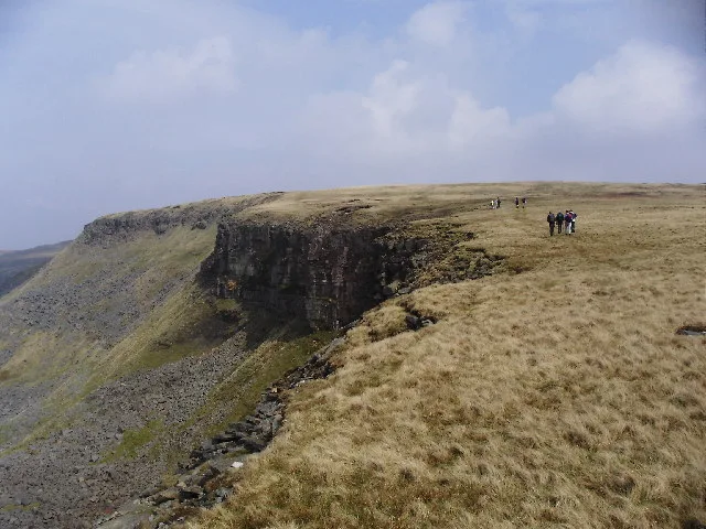
High Seat
Natural landmarks · 1.0 km
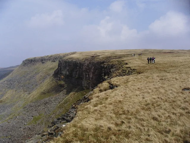
High Seat
Mountains & hills · 1.1 km

Hugh Seat
Natural landmarks · 1.2 km

Brockholes Force
Waterfalls · 1.3 km

Whitebank Hill
Mountains & hills · 1.6 km

Thrang Force
Waterfalls · 1.7 km

Outhgill
Historic churches · 1.9 km

Mallerstang
Mountains & hills · 2.3 km

Outhgill Pinfold
Public art & sculpture · 2.4 km

Lock Hill
Mountains & hills · 2.4 km

Outhgill
Villages · 2.5 km

Water Cut
Heritage railway stations · 2.5 km
Nearby
📷 3Natural landmarks · North East England
High Seat
High Seat — mountain in the Yorkshire Dales National Park, England, UK.
📷 3📷 3📷 5📷 5Mountains & hills · North West England
Whitebank Hill
Whitebank Hill — mountain in england north west. Elevation: 673 m.
📷 5Where to eat & stay near Gregory Chapel
Places to stay
 📷 5
📷 5Campsites · North East England
Hoggarths campsite
Hoggarths campsite — a campsite in england north west.
 📷 5
📷 5Campsites · North West England
Pennine View Park
Pennine View Park — a campsite in england north west.
 📷 5
📷 5Campsites · North East England
Park House Camping & Keld Bunkhouse
Park House Camping & Keld Bunkhouse — a campsite in england north west.
 📷 5
📷 5Hostels · North West England
Kirkby Stephen Hostel
Kirkby Stephen Hostel — a hostel in england north west.
 📷 7
📷 7B&Bs · North West England
Fletcher House
Fletcher House — a bed-and-breakfast in england north west.
 📷 7
📷 7Hotels · North West England
The Black Swan Hotel
The Black Swan Hotel — a hotel in england north west.
Places to eat & drink
 📷 7
📷 7Cafés · North West England
The White Hare Cafe
The White Hare Cafe — a café in england north west.
 📷 5
📷 5Cafés · North West England
The Cross Keys Temperance Inn
The Cross Keys Temperance Inn — a café in england north west.
 📷 5
📷 5 📷 5
📷 5Historic pubs · Yorkshire & the Humber
Kings Head Inn
Kings Head Inn in England North West, United Kingdom.
 📷 5
📷 5Cafés · North West England
Gun Dog Coffee Shop
Gun Dog Coffee Shop — a café in england north west.
 📷 5
📷 5More natural landmarks in this region
 📷 3
📷 3Natural landmarks · North West England
Statue of Oliver Cromwell
Statue of Oliver Cromwell — Public artwork (statue).
 📷 3
📷 3Natural landmarks · North West England
Dagfields Craft Centre
Dagfields Craft Centre — a other in england-west-midlands, United Kingdom.
 📷 3
📷 3Natural landmarks · North West England
Weaver Valley Cruises
Weaver Valley Cruises — a other in england-west-midlands, United Kingdom.
 📷 3
📷 3Natural landmarks · North West England
Golden Gates
Golden Gates — a other in england-west-midlands, United Kingdom.
Frequently asked questions
- Where is Gregory Chapel?
- Gregory Chapel is in North-West England, United Kingdom.
- What is Gregory Chapel?
- Gregory Chapel — mountain in United Kingdom.
- How do I get to Gregory Chapel?
- The nearest railway station is Kirkby Stephen, about 7.7 km away. Its coordinates are 54.3969°, -2.3040°.
- Is Gregory Chapel a protected site?
- Yes — Gregory Chapel is part of the Mallerstang-Swaledale Head SSSI Site of Special Scientific Interest and the River Eden and Tributaries SSSI Site of Special Scientific Interest.
- Is Gregory Chapel free to visit?
- Yes, Gregory Chapel is free to enter.
- How do I get to Gregory Chapel?
- The nearest railway station is Kirkby Stephen, about 7.7 km away.