Forts · East Midlands
Howe Plantation Obelisk, 70 Metres North East Of Woodland Grange
In or near Linby.
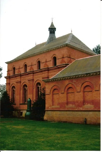
Howe Plantation Obelisk, 70 Metres North East Of Woodland Grange — a martello broad in england-east-midlands, United Kingdom.

David Lally — CC BY-SA 2.0 via Wikimedia Commons licence
Plan your visit
- Typical visit
- 45 min–1.5 h
- Nearest railway station
- Hucknall · 4.2 km
About
Howe Plantation Obelisk, 70 Metres North East Of Woodland Grange is a martello broad located in england-east-midlands, United Kingdom. Catalogued from Wikidata's UK heritage register; see the linked Wikipedia article for further details on its history, architecture and visiting information.
Photo gallery
Place summary
Howe Plantation Obelisk is a fort located 70 metres north-east of Woodland Grange in the East Midlands. It is a notable structure, although specific historical details or architectural significance are not provided.
AI-generated from the structured facts on this page (operator, designation, listing, era). Not a substitute for visiting.
- Coordinates
- 53.0654, -1.1529
- County
- Nottinghamshire
- District
- Gedling
- Parish
- Papplewick
- Postcode
- NG15 8FL
- Parliamentary constituency
- Sherwood Forest
- Nearest railway station
- Hucknall — 4.2 km
Sources
- wikidata: Q26554752 (CC0)
Other places nearby

Obelisk 20 Metres North West Of Vincent Lodge
Forts · 1.4 km
Papplewick Pumping Station
Museums · 1.5 km

Mortons Farm Tea Rooms
Cafés · 2.2 km

Papplewick
Museums · 2.3 km

The Hutt Inn
Historic pubs · 2.4 km

Notts Sun Club
Campsites · 2.5 km

Rose Garden, Newstead Abbey
Botanic gardens · 2.8 km

Male Satyr Statue
Public art & sculpture · 2.9 km
.jpg?width=1200)
Female Satyr Statue
Public art & sculpture · 2.9 km

Byron's Oak
Natural landmarks · 3.0 km

Boatswain's Grave
Memorials & monuments · 3.0 km
Boatswain's Monument 30 Metres North East Of Newstead Abbey
Memorials & monuments · 3.0 km
Nearby
📷 5Forts · East Midlands
Obelisk 20 Metres North West Of Vincent Lodge
Obelisk 20 Metres North West Of Vincent Lodge — a martello broad in england-east-midlands, United Kingdom.
📷 5Museums · East Midlands
Papplewick Pumping Station
Papplewick Pumping Station — architectural structure and museum in Papplewick, Gedling, England, United Kingdom.
📷 7Cafés · East Midlands
Mortons Farm Tea Rooms
Mortons Farm Tea Rooms — a café in england east midlands.
📷 5Museums · East Midlands
Papplewick
Papplewick — a museum in england-east-midlands, United Kingdom.
📷 7📷 5Campsites · East Midlands
Notts Sun Club
Notts Sun Club — a campsite in england east midlands.
Where to eat & stay near Howe Plantation Obelisk, 70 Metres North East Of Woodland Grange
Places to stay
📷 5Campsites · East Midlands
Notts Sun Club
Notts Sun Club — a campsite in england east midlands.
 📷 5
📷 5Campsites · East Midlands
Fairview Farm Holiday Accomodation
Fairview Farm Holiday Accomodation — a campsite in england east midlands.
 📷 5
📷 5Campsites · East Midlands
Sherbrooke Scout Camp
Sherbrooke Scout Camp — a campsite in england east midlands.
 📷 5
📷 5Hotels · East Midlands
Bestwood Lodge Hotel
Bestwood Lodge Hotel — a hotel in england east midlands.
 📷 5
📷 5Campsites · East Midlands
Lurcher Farm Cottage Camping & Caravanning Site
Lurcher Farm Cottage Camping & Caravanning Site — a campsite in england east midlands.
 📷 5
📷 5Places to eat & drink
📷 7Cafés · East Midlands
Mortons Farm Tea Rooms
Mortons Farm Tea Rooms — a café in england east midlands.
📷 7 📷 7
📷 7Historic pubs · East Midlands
The Five Ways Public House
The Five Ways Public House in England East Midlands, United Kingdom.
 📷 5
📷 5Historic pubs · East Midlands
Old Pear Tree Public House And Attached Garden Wall
Old Pear Tree Public House And Attached Garden Wall in England East Midlands, United Kingdom.
 📷 5
📷 5Historic pubs · East Midlands
Portland Arms Public House
Portland Arms Public House in England East Midlands, United Kingdom.
 📷 5
📷 5Historic pubs · East Midlands
The Old Ram Public House
The Old Ram Public House in England East Midlands, United Kingdom.
More forts in this region
 📷 5
📷 5Forts · East Midlands
Obelisk To Captain Shultz In The Churchyard To South West Of St Peter And St Paul
Obelisk To Captain Shultz In The Churchyard To South West Of St Peter And St Paul — a martello broad in england-london, United Kingdom.
 📷 3
📷 3Forts · East Midlands
Bailey's Tump
Bailey's Tump is a fort in the United Kingdom.
.jpg?width=1200) 📷 3
📷 3 📷 3
📷 3Forts · East Midlands
Battle of Stoke Field 1487
Battle of Stoke Field 1487 is a fort in the United Kingdom.
Frequently asked questions
- Where is Howe Plantation Obelisk, 70 Metres North East Of Woodland Grange?
- Howe Plantation Obelisk, 70 Metres North East Of Woodland Grange is in Nottinghamshire, the East Midlands, United Kingdom (postcode NG15 8FL), in the parish of Papplewick.
- What is Howe Plantation Obelisk, 70 Metres North East Of Woodland Grange?
- Howe Plantation Obelisk, 70 Metres North East Of Woodland Grange — a martello broad in england-east-midlands, United Kingdom.
- How do I get to Howe Plantation Obelisk, 70 Metres North East Of Woodland Grange?
- The nearest railway station is Hucknall, about 4.2 km away. Drivers can use postcode NG15 8FL.
- How do I get to Howe Plantation Obelisk, 70 Metres North East Of Woodland Grange?
- The nearest railway station is Hucknall, about 4.2 km away. Drivers can navigate to postcode NG15 8FL.