
Forts · East Midlands
Battle of Stoke Field
Also known as: Brwydr Maes Stoke
In or near Thoroton.
Battle of Stoke Field is a fort in the United Kingdom.
.jpg?width=1200)
Wikimedia Commons contributors — see linked file page for photographer and licence licence
.jpg)
Plan your visit
- Typical visit
- 45 min–1.5 h
- Nearest railway station
- Fiskerton · 3.3 km
Getting there & planning your visit
To visit the Battle of Stoke Field, the nearest railway station is Fiskerton, located 3.3 km away. The postcode for navigation is NG23 5PG. Entry details are not specified, so please check in advance.
About
Battle of Stoke Field is a historic fort or fortified site in the United Kingdom. OpenStreetMap heritage rating: 2/5. Coordinates: 53.0332°, -0.8938°.
Photo gallery
From the Wikipedia article
The Battle of Stoke Field, which took place at East Stoke, Nottinghamshire, on 16 June 1487, may be considered the last battle of the Wars of the Roses, since it was the last major engagement between contenders for the throne whose claims derived from descent from the houses of Lancaster and York. The Battle of Bosworth Field, two years previously, had established Henry VII on the throne, ending the last period of Yorkist rule and initiating that of the Tudors. The Battle of Stoke Field was the decisive engagement in an attempt by leading Ricardian Yorkists to unseat the King in favour of the pretender Lambert Simnel. Though it is often portrayed as almost a footnote to the major battles between York and Lancaster, it may have been slightly larger than Bosworth, with much heavier casualties, possibly because of the terrain which forced the two sides into close, attritional combat. In the end, though, Henry's victory was crushing. Almost all the leading Yorkists were killed in the battle.
Excerpt from Wikipedia under CC BY-SA 4.0. See the source article linked in Sources below.
- Coordinates
- 53.0332, -0.8938
- County
- Nottinghamshire
- District
- Newark and Sherwood
- Parish
- Elston
- Postcode
- NG23 5PG
- Parliamentary constituency
- Newark
- Nearest railway station
- Fiskerton — 3.3 km
Sources
- osm: w371237374 (ODbL)
- wikipedia: Battle of Stoke Field (CC BY-SA 4.0)
- commons: Henry Marriott Paget - The last stand of Schwarz and his Germans (c. 191̥0).jpg (CC BY-SA 4.0)
Other places nearby

Battle of Stoke Field 1487
Forts · 0.4 km

Digger
Public art & sculpture · 0.6 km

East Stoke
Villages · 0.7 km
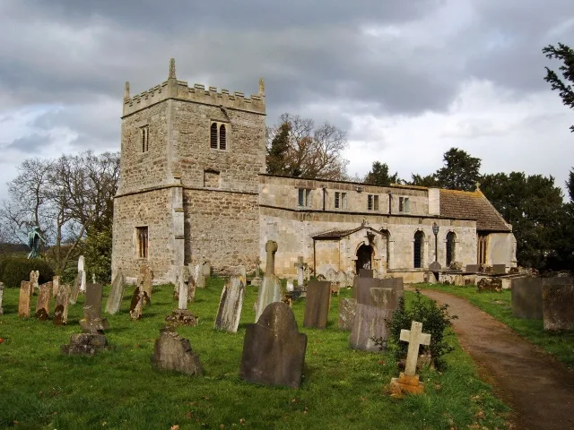
St Oswald's Church, East Stoke
Historic churches · 1.1 km

Medieval settlement and remains of open fields immediately west of East Stoke village
Vineyards · 1.1 km

Stoke Hall
Historic houses · 1.3 km
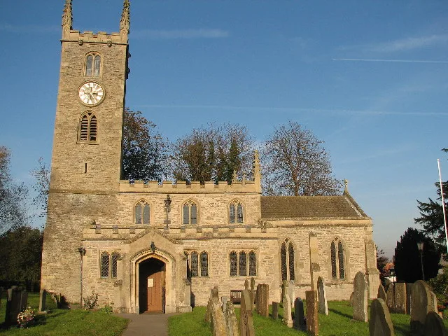
All Saints' Church, Elston
Historic churches · 1.9 km

Elston
Villages · 1.9 km

Flintham
Villages · 1.9 km

Ad Pontem
Archaeological sites · 2.1 km

Ad Pontem
Archaeological sites · 2.1 km
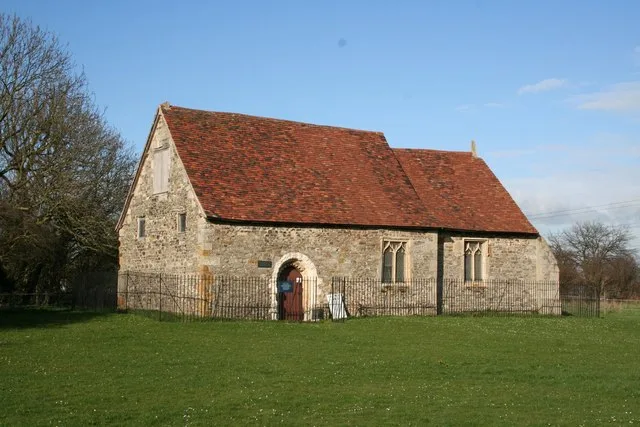
Elston Chapel
Historic churches · 2.1 km
Nearby
📷 3Forts · East Midlands
Battle of Stoke Field 1487
Battle of Stoke Field 1487 is a fort in the United Kingdom.
📷 3Public art & sculpture · East Midlands
Digger
Digger — a public art in england-east-midlands, United Kingdom.
📷 5📷 3Historic churches · East Midlands
St Oswald's Church, East Stoke
St Oswald's Church, East Stoke — church in Newark and Sherwood, Nottinghamshire, England, UK.
📷 5Vineyards · East Midlands
Medieval settlement and remains of open fields immediately west of East Stoke village
human settlement in East Stoke, Newark and Sherwood, Nottinghamshire, England, UK
📷 4Historic houses · East Midlands
Stoke Hall
Stoke Hall — a Grade II-listed historic house in england-east-midlands, United Kingdom.
Where to eat & stay near Battle of Stoke Field
Places to stay
 📷 5
📷 5Hotels · East Midlands
Saracen's Head
Saracen's Head — a hotel in england east midlands.
 📷 5
📷 5 📷 5
📷 5Campsites · East Midlands
Gunthorpe Camping
Gunthorpe Camping — a campsite in england east midlands.
 📷 5
📷 5Campsites · East Midlands
Maythorne caravan site & fishing lakes
Maythorne caravan site & fishing lakes — a campsite in england east midlands.
 📷 5
📷 5B&Bs · East Midlands
East Bridgford Hill
East Bridgford Hill — a bed-and-breakfast in england east midlands.
 📷 5
📷 5Caravan parks · East Midlands
Riverdale Caravan Park
Riverdale Caravan Park — a caravan park in england east midlands.
Places to eat & drink
 📷 5
📷 5 📷 7
📷 7Historic pubs · East Midlands
The Spring House Public House
The Spring House Public House in England East Midlands, United Kingdom.
 📷 5
📷 5Restaurants · East Midlands
Victoria Fish Bar
Victoria Fish Bar — a restaurant in england east midlands. Cuisine: fish and chips.
 📷 5
📷 5Historic pubs · East Midlands
The Watermill Public House
The Watermill Public House in England East Midlands, United Kingdom.
 📷 7
📷 7Historic pubs · East Midlands
The Horse And Gears Public House
The Horse And Gears Public House in England East Midlands, United Kingdom.
 📷 7
📷 7Historic pubs · East Midlands
Castle And Falcon Public House And Attached Outbuildings
Castle And Falcon Public House And Attached Outbuildings in England East Midlands, United Kingdom.
More forts in this region
 📷 5
📷 5Forts · East Midlands
Obelisk To Captain Shultz In The Churchyard To South West Of St Peter And St Paul
Obelisk To Captain Shultz In The Churchyard To South West Of St Peter And St Paul — a martello broad in england-london, United Kingdom.
 📷 3
📷 3Forts · East Midlands
Bailey's Tump
Bailey's Tump is a fort in the United Kingdom.
📷 3Forts · East Midlands
Battle of Stoke Field 1487
Battle of Stoke Field 1487 is a fort in the United Kingdom.
 📷 3
📷 3Frequently asked questions
- Where is Battle of Stoke Field?
- Battle of Stoke Field is in Nottinghamshire, the East Midlands, United Kingdom (postcode NG23 5PG), in the parish of Elston.
- What is Battle of Stoke Field?
- Battle of Stoke Field is a fort in the United Kingdom.
- How do I get to Battle of Stoke Field?
- The nearest railway station is Fiskerton, about 3.3 km away. The nearest town is Thoroton. Drivers can use postcode NG23 5PG.
- How do I get to Battle of Stoke Field?
- The nearest railway station is Fiskerton, about 3.3 km away. Drivers can navigate to postcode NG23 5PG.